

Weekly Weather Watch: Sunday, October 1st, 2023
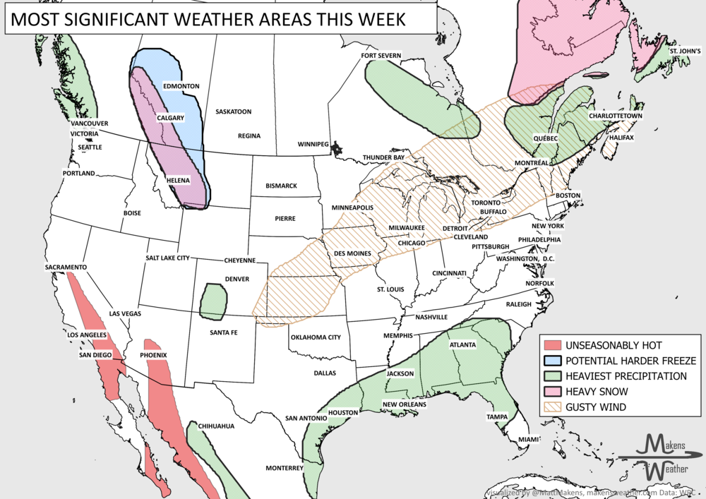
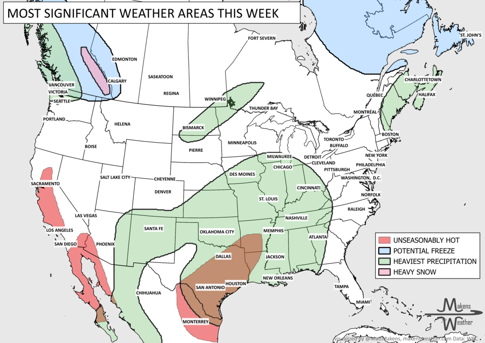
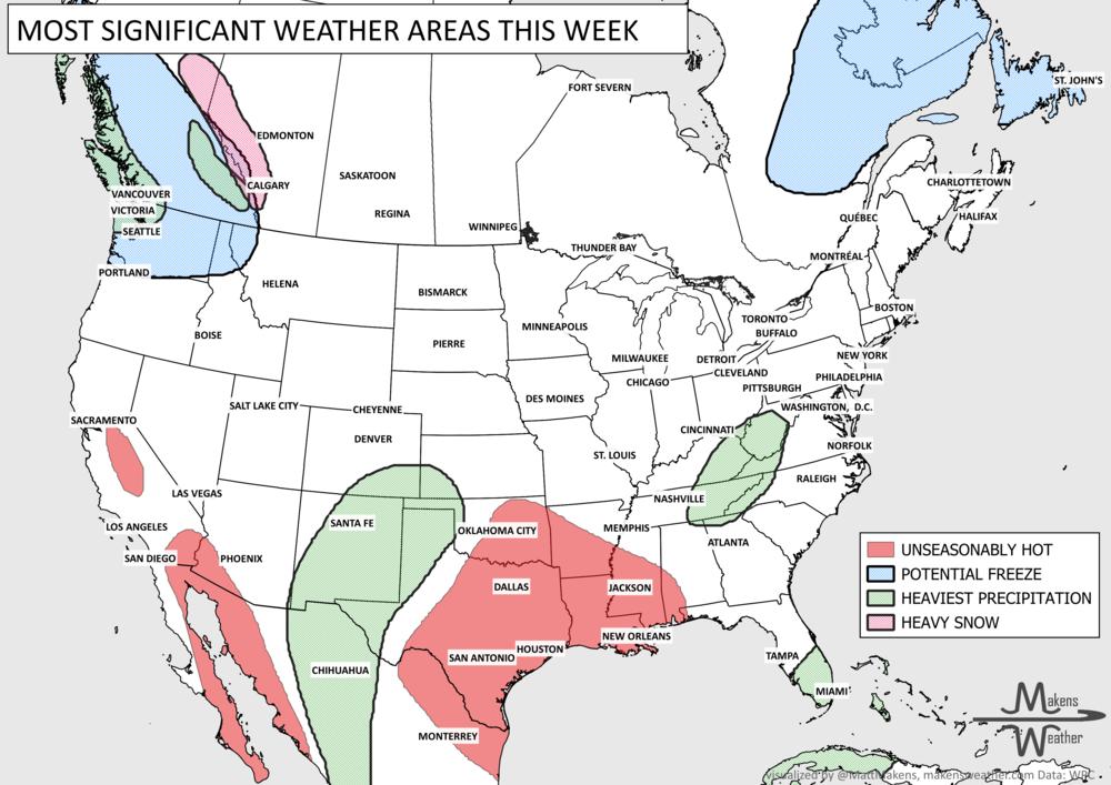
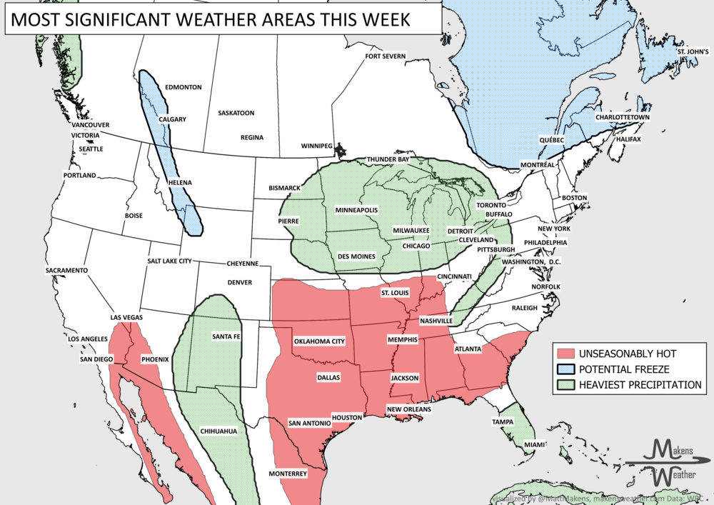
A change in the wind says I: We’ve seen snow in Nevada, first frosts in the West, and a strong system that will spread cooler changes across the country this week. This will contribute to the pattern change across the U.S., which calls for record heat to spread toward New England, heavy rainfall in parts of the Southern Plains, and the first frost for some more of the West and Northern Plains/Upper Midwest in the days ahead.
Frosty: We haven’t seen a widespread frost yet this season, but for parts of the Rockies and nearby High Plains, toward the northern states into the Great Lakes region, we may see that first frost on the way. Then we may see frost form in parts of New England after a warm start to the week.

Heat relief: There have been some very warm temperatures across the nation’s midsection since September, but the cooler temperatures arriving this week will shove some of that heat to the East before that area cools off too. Record-setting temperatures this week will focus on the Midwest and South first, then head toward New England.

How does this cool down for the East impacts the outlook for October in terms of not just those temperatures but also precipitation? Well, glad you asked - the October Weather Outlook was posted for members this morning. Check it out by clicking here.
Rainy-daze: We do have quite a bit of water coming to parts of the country this week, although in some cases perhaps a bit much to handle. Drought parched Texas will have rainfall later this week, which is great but heavy rainfall on solid soil doesn’t penetrate quite as well as we’d like. It’s rain, though!


There will be additional snow in the mountain ranges for the West, but overall, it will be confined to the higher ski resorts and peaks. It won’t be long before the heavy snow flies, and we’ll chat about those associated travel impacts. That’s the weather brief for this week; make it a good one! -Matt. PS- if you haven’t signed up for these free weekly weather briefs, please do so with the form below.
The weather pattern is about to make a pretty sharp turn across the country. California starts the week with unusual October heat, including highs well into the 90s and even lower 100s in the Central Valley. Meanwhile, much cooler fall air has reached the Great Lakes and Northeast. The Gulf Coast and Southeast stay unsettled, and there’s that record to watch: a tropical depression is likely to develop over the Gulf this week and could strengthen as it moves northeast. If it becomes a hurricane after the 8th, 2026 will have the latest-first hurricane in the Atlantic Basin record.