Weekly Weather Watch: Monday, October 9th, 2023
Phew, we escaped a freeze at my spot this past week, but many folks surrounding me did not. The first frost and freeze of the season for many growing areas has spread from west to east across the country, and that threat is now the highest for the Upper Midwest tonight. In addition to the seasonal change in temperatures, we may also be looking at the season’s first snowfall across parts of the Northern U.S.. Let’s chat about that, heavy rainfall areas, and problems on the horizon for next week in this Weekly Weather Watch.
FROSTY: An overall view of the temperature outlook includes the coldest anomalies for the Eastern U.S. Meanwhile, the Western U.S. has mostly warmer-than-average temperatures on track this week. From an impact standpoint, here are two areas to be mindful of colder temperatures through the next ten days.
I like to view weather and risk in terms of probability. So, regarding the probability of hitting a frost or colder temperatures, here are the probabilities for the next ten days with that in mind. Widespread frost and freeze are possible across the mountainous west, High Plains, Upper Midwest, and the Appalachians to New England states.
FROSTY THE SNOWMAN? In addition to the cooler temperatures will be areas of moisture. In total, quite a bit of moisture is headed to much of the country this week. So, let’s start there and then turn to the odds of snow…the first snow in most cases. Total precipitation is shown first regarding threat level, then totals for the week, followed by the odds of receiving at least a trace of snowfall.
Snow lovers may be a bit too excited to see their first snow, but matched with fall colors, parts of Colorado, and Wyoming will have a beautiful scene for the snow folks. From a travel standpoint, we aren’t quite to the winter weather advisory criteria just yet.
TEXAS, BE WATCHFUL: For parts of Texas and the Gulf Coast States, let’s watch an area of disturbed weather over the Gulf that should be watched for possible tropical development. Considering the warmth of the Gulf, intensification is likely.
So, for the week we have quite the variety of elements to be watching. Weather headlines will be coming from winter-type weather, to heavy rains, to possible tropical weather. Have a Blessed week - Matt.

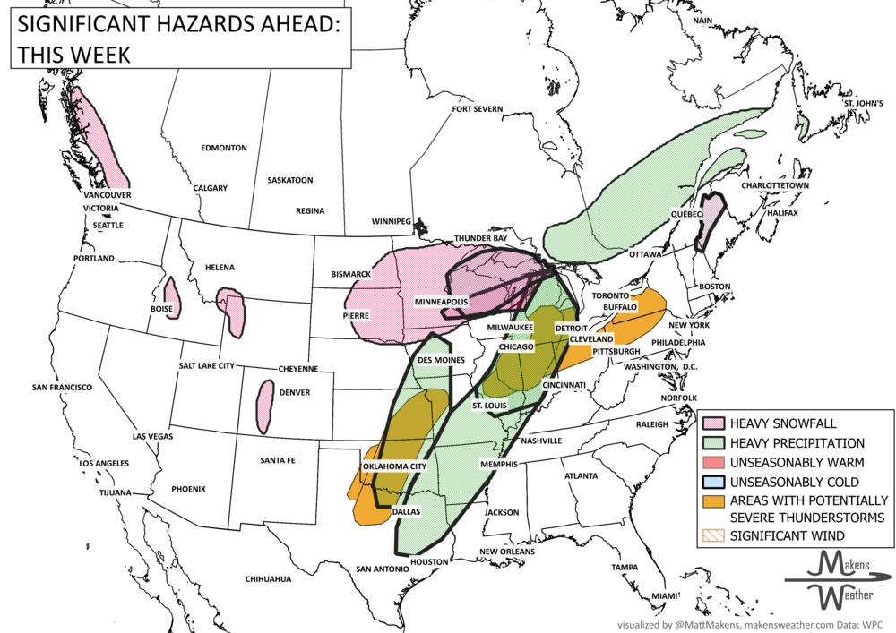
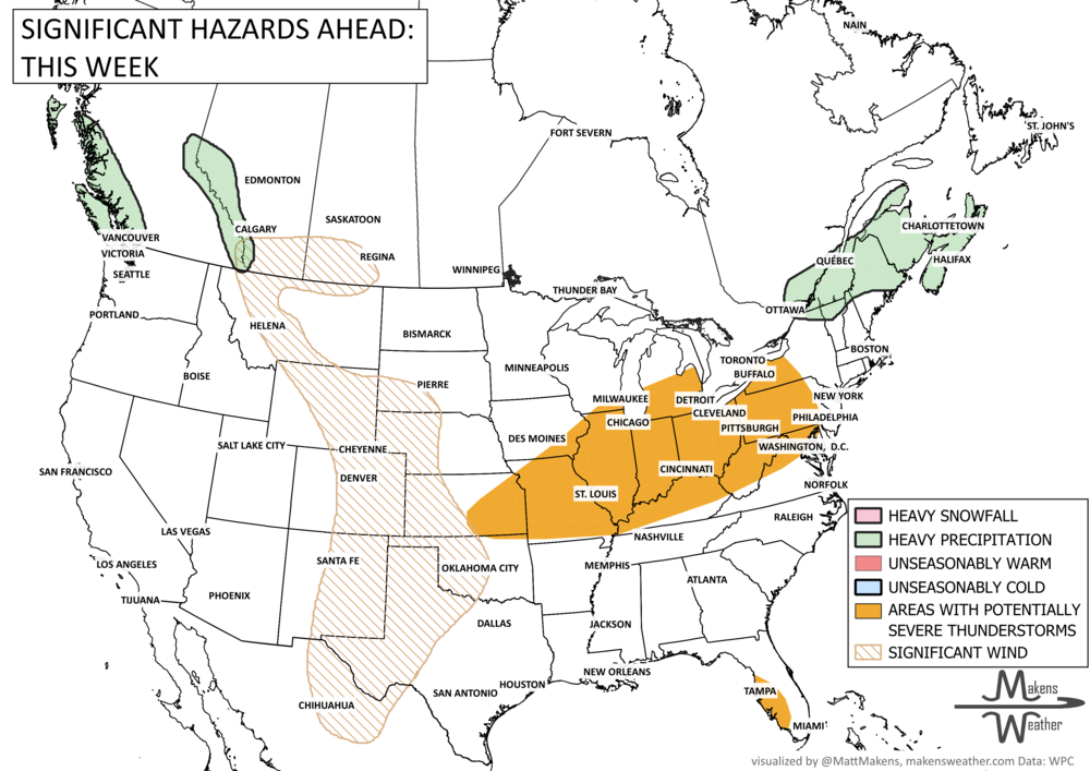
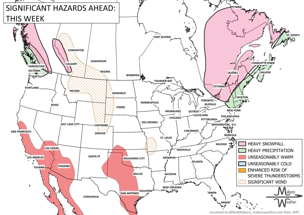
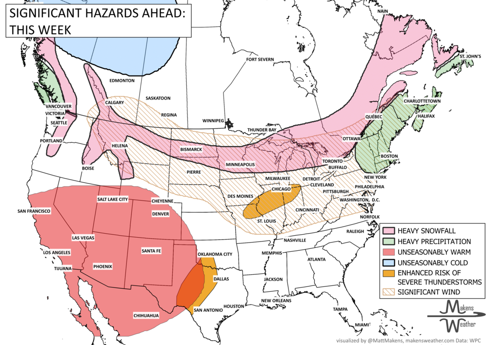
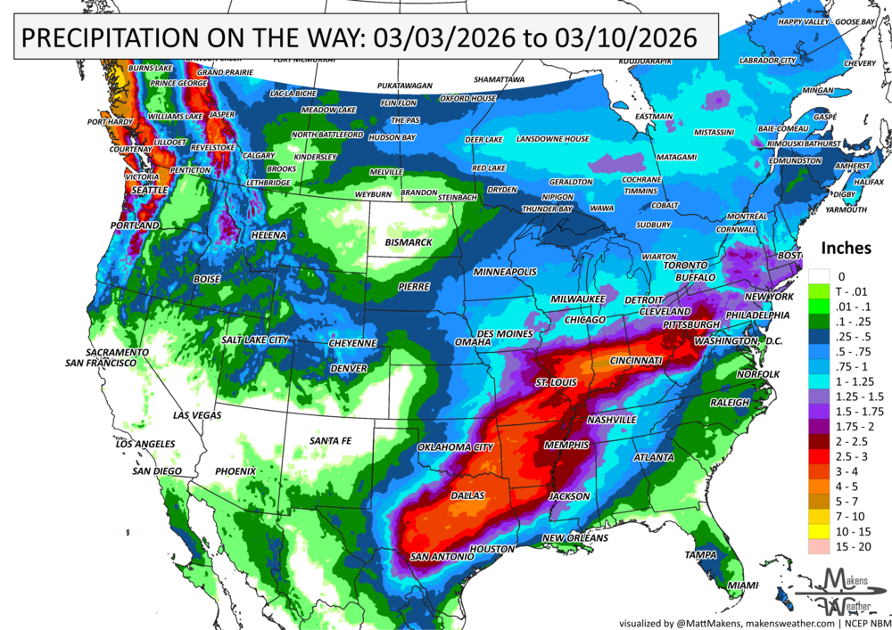


A drawn-out storm pattern will keep much of the country active through the first week of April. A slow-moving front stretching from the Great Lakes into the Plains will separate late-season snow and ice to the north from heavy rain and severe thunderstorms to the south. The setup brings the greatest impacts to parts of the Midwest, Ohio Valley, Southern Plains, Mississippi Valley, and eventually the East Coast, while the West sees mountain snow and then a warming trend heading into the weekend.