


Weekly Weather Watch: Tuesday, January 27th, 2026
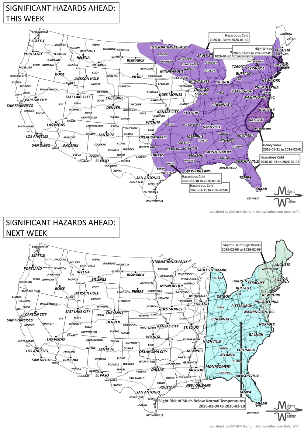
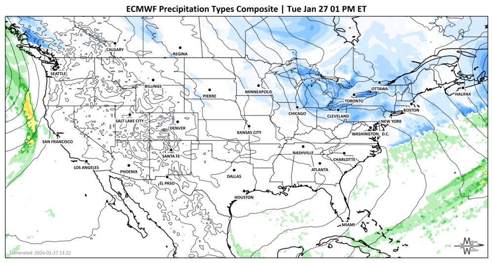
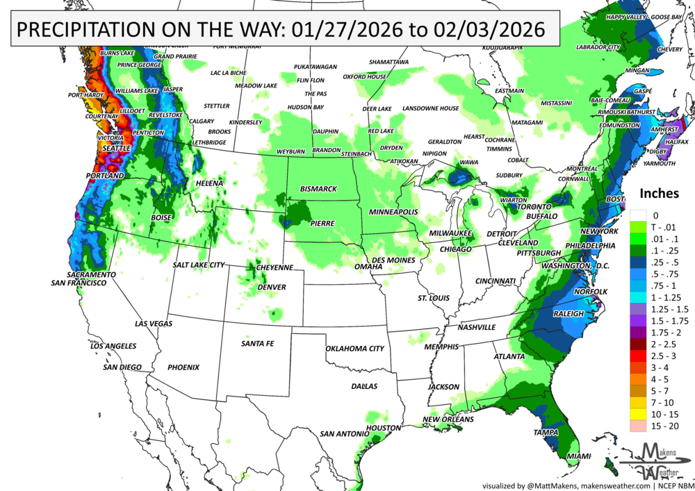
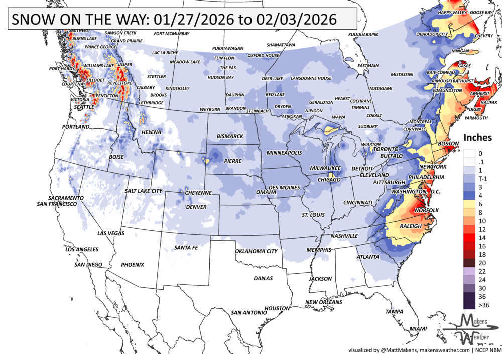
January is closing out with no shortage of winter weather. Frigid temperatures will dominate the eastern U.S. for the rest of the week as another round of arctic air spills southward starting Friday. The cold could break more records as far south as Florida. Meanwhile, closely tracking a potentially significant East Coast winter storm this weekend that could bring heavy snow, strong winds, and coastal flooding from the Carolinas to New England and Maritimes. That system has time to stay offshore…stay posted. Out West, a soggy pattern continues in the Pacific Northwest, with rounds of rain and mountain snow. For video updates on any pending ice and snowstorms, Brian and I have launched @realsnowbros on YouTube.
Unlock the Makens Weather Advantage ☀️📊
Your membership includes:
✔️ Real-time dashboard with the latest weather observations and long-range projections
✔️ Monthly-lead forecasts to plan weeks ahead
✔️ Discounts on personalized consultations for ag, energy, or risk planning
All built for decision-makers who need weather insight, not just data.
🎯 Join now and put the forecast to work for you.
📈 The latest outlooks and conditions - track it 👉 Join Now to Access the Dashboard
HEADLINERS:
Weekly Timeline Snapshot
Tuesday–Wednesday:
Pacific Northwest sees heavy rain and mountain snow as a new system arrives.
Great Lakes & Northeast into the Maritimes: Lake effect snow continues through early Wednesday. Snow squall warnings for parts of Ontario and Quebec.
Thursday–Friday:
Another arctic surge pushes into the Plains and Midwest, moving east.
Dangerous wind chills are possible in the Upper Ohio Valley.
Friday–Saturday:
Arctic cold spreads across the East Coast and Southeast, including Florida.
Potential for wintry mix or snow in parts of the Gulf Coast States.
Saturday–Sunday:
Watching for a significant East Coast winter storm, likely to develop and intensify offshore.
Heavy snow possible for eastern Carolinas, Mid-Atlantic, and southern New England.
High winds and coastal flooding are possible along the Eastern Seaboard.
Next Week:
Cold lingers across the central and eastern U.S.
Continued snow chances for the Great Lakes and interior Northeast.
Ongoing wet pattern in the Pacific Northwest.
IN THE GAUGES, precipitation through the 3rd:
GRAB A RULER, snowfall through the 3rd:
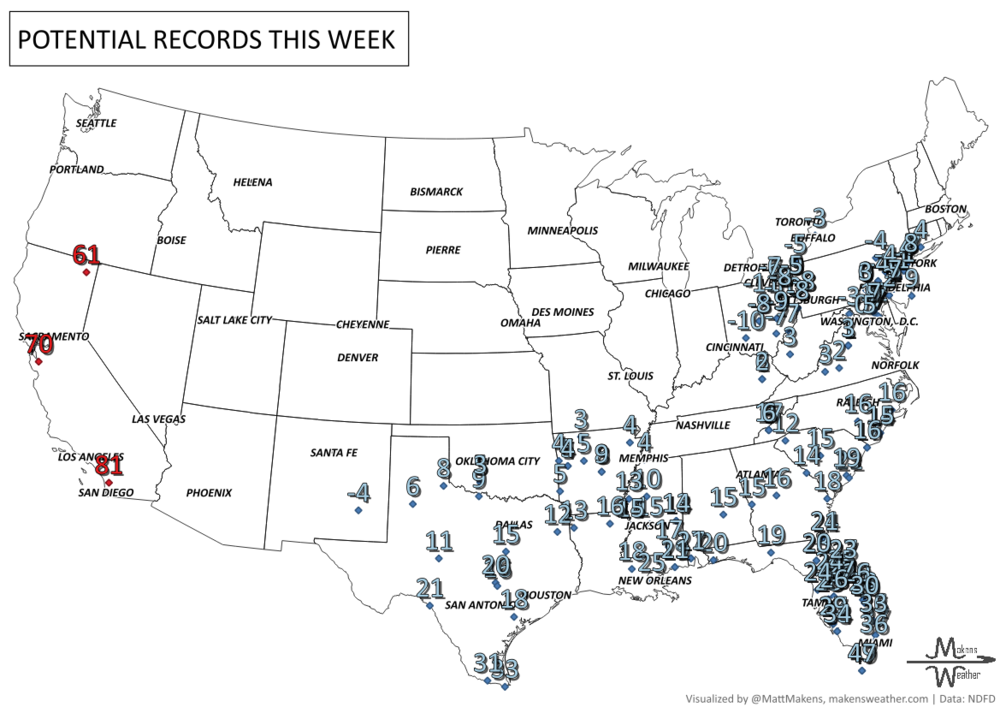
RECORDS MADE TO BE BROKEN, daily highs and lows:
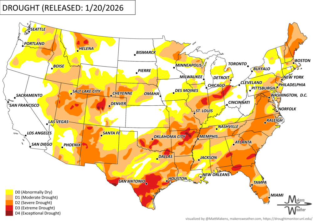
UN-DROUGHTABLY DRY:
This drought update does NOT include the weekend’s storm event - that new drought information is released later this week. This week, weather quieted across the Lower 48, but growing concerns remain about Western water supply as snowpack continues to lag. Here's the key takeaway:
West: Despite a wet start to winter, snowpack is below normal in many areas.
California reservoirs are in good shape with 123% of average storage.
Colorado River Basin remains critically low at 53% of average, reflecting long-term drought impacts.
Plains: Stayed mostly dry, with some snow and elevated wildfire risk in spots.
Midwest & East: Cold and occasionally snowy. Recent drought changes paused as the pattern turned colder and drier, effectively "freezing" drought conditions in place.
Overall, short-term drought movement has slowed, but long-term water concerns remain, especially in the Southwest. -U.S. Department of Agriculture
ARE YOU CIRRUS?!
Today in weather history:
1922: On this date through the 29th, a significant snowstorm struck the East Coast from South Carolina to southeastern Massachusetts. Washington, DC, reported 28 inches of snow. The heavy snow on the Knickerbocker Theater's flat roof put a significant strain on the structure. On the evening of the 28th, during a showing of the silent comedy "Get-Rich-Quick Wallingford," the building collapsed, killing 98 people and injuring 130 others.
1967: Residents of Chicago, Illinois, began to dig out from the storm of the 26th and 27th, which produced 23 inches of snow in 29 hours.
1989: Bitter cold air gripped most of Alaska during January 1989. Tanana, near Fairbanks, saw a low temperature of 76 degrees below zero on this day. The high for the day was 60 degrees below zero. With an average temperature of 68 degrees below zero, Tanana saw an average temperature of nearly sixty degrees below normal. McGrath, Alaska, recorded a wind chill of -100°F.
A drawn-out storm pattern will keep much of the country active through the first week of April. A slow-moving front stretching from the Great Lakes into the Plains will separate late-season snow and ice to the north from heavy rain and severe thunderstorms to the south. The setup brings the greatest impacts to parts of the Midwest, Ohio Valley, Southern Plains, Mississippi Valley, and eventually the East Coast, while the West sees mountain snow and then a warming trend heading into the weekend.