


Weekly Weather Watch: Tuesday, February 3rd, 2026
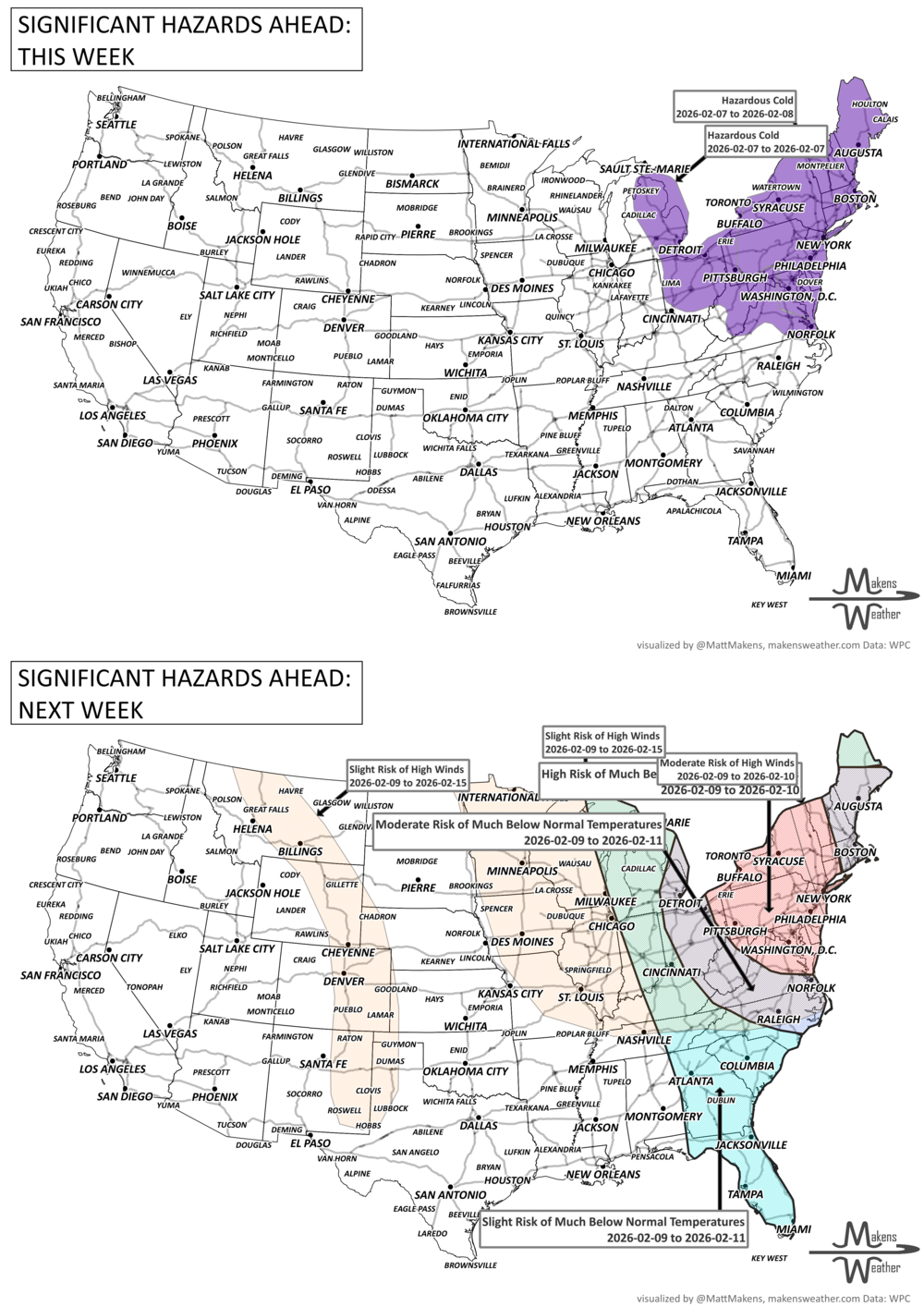
A rare winter pattern is unfolding this week as arctic air plunges deep into the Southeast, leading to freeze warnings in Florida and snow squalls across the Northern Tier. Meanwhile, Alberta clippers will zip through the Great Lakes and Plains, bringing light snow and reinforcing the chill. After a brief midweek break, another surge of arctic cold is expected to dive into the East Coast by the weekend. Warmth continues, for now, for the Western U.S. and Canada.
The February outlook released Sunday has been sent to members, here is the link to save you from fishing through emails: February Outlook.
Unlock the Makens Weather Advantage ☀️📊
Your membership includes:
✔️ Real-time dashboard with the latest weather observations and long-range projections
✔️ Monthly-lead forecasts to plan weeks ahead
✔️ Discounts on personalized consultations for ag, energy, or risk planning
All built for decision-makers who need weather insight, not just data.
🎯 Join now and put the forecast to work for you.
📈 The latest outlooks and conditions - track it 👉 Join Now to Access the Dashboard
HEADLINERS:
Weekly Timeline Snapshot
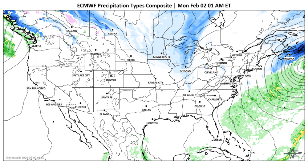
Tuesday: Series of Alberta clippers spread light snow across the Great Lakes and Northern Plains. Heavy snowfall departs the Maritimes.
Tuesday - Wednesday: Rain and embedded storms push through the South, changing to light snow across the Ohio Valley and Mid-Atlantic.
Thursday: Most of the country quiets down except for lingering snow across the Appalachians. Heavy snowfall from Saskatchewan to Manitoba.
Friday - Saturday: Another arctic front brings snow squalls and renewed cold to the Northeast and Mid-Atlantic including Ontario, Quebec and the Maritimes.
Weekend: Frigid lows 15–25°F below normal for I-95 corridor cities, including Washington D.C., Philadelphia, and Boston.
Out West: Mild and dry for most, though rain/snow returns to the Pacific Northwest Saturday into Sunday.
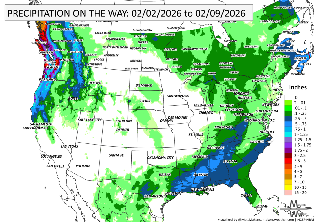
IN THE GAUGES, precipitation through the 3rd:
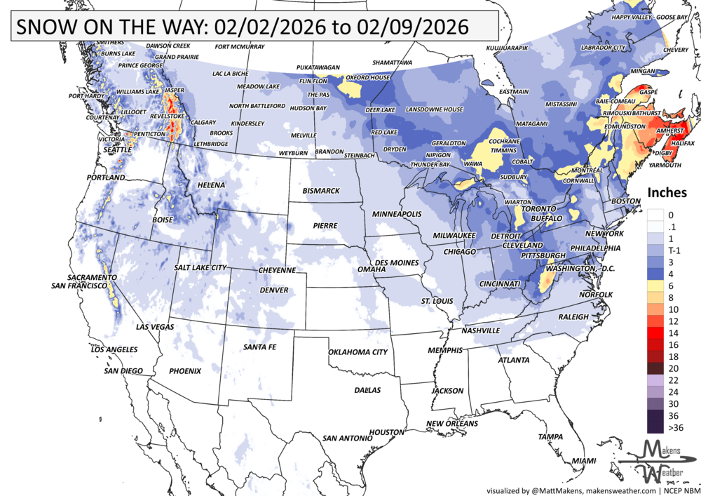
GRAB A RULER, snowfall through the 3rd:
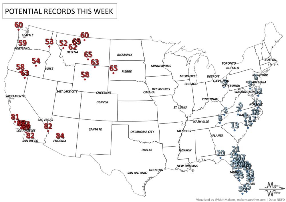
RECORDS MADE TO BE BROKEN, daily highs and lows:
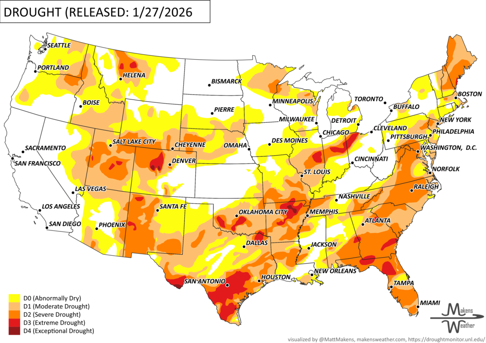
UN-DROUGHTABLY DRY:
A massive coast-to-coast winter storm brought heavy precipitation to much of the southern and eastern U.S., stretching from the Southern Rockies to the East Coast. At its peak, winter storm warnings covered nearly 1 million square miles.
Heavy snow of 1 - 2 feet fell across Pennsylvania, New York, New England, with notable totals in Ohio, West Virginia, Oklahoma, and Arkansas.
Sleet was extreme in the South, reaching up to 7 inches in Arkansas, Louisiana, and North Carolina.
Freezing rain led to widespread tree damage and power outages, with ice accumulations exceeding 1 inch in parts of Oklahoma, Mississippi, and Alabama.
Rainfall totals topped 3 inches in areas of Texas, Louisiana, Mississippi, and Alabama; some spots saw up to 10 inches in southwest Louisiana.
Despite the high totals, drought relief has been limited since much of the water remains frozen. Thawing in the South may help soon, but colder regions will see slower improvement.
Outside of the main storm zone, minimal precipitation fell across the rest of the country, making this single storm responsible for nearly all of the week’s measurable precipitation. -U.S. Department of Agriculture
ARE YOU CIRRUS?!
Today in weather history:
1898: In the Southern Hemisphere near Australia, tropical cyclones were once called Willy-Willies. An Australian Meteorologist, Clement Wragge, is credited for giving girls names to tropical cyclones by the end of the 19th Century. On this date, Wragge's weather journal showed a Willy Willy named "Eline."
1952: An area of low pressure moved out of the Gulf and across southern Florida during the evening and late-night hours on February 2, 1952. It produced 60 mph winds and two to four inches of rain on February 2 and 3. The low pressure remains the only tropical storm to impact the United States in February.
1996: An Arctic outbreak that lasted from late January through early February produced nearly 400 hundred record lows, 15 all-time low readings, and over 50 new record lows. Four states recorded their all-time record low temperatures, including Tower, Minnesota, on this date with a reading of 60 degrees below zero, canceling Tower's annual Icebox Days festival because it is too cold. Locations that reported their all-time record low or tied included: Cresco, IA: -36°, Osage, IA: -34°, Charles City, IA tied their record low with -32° and Lancaster, WI tied their all-time record low with -31°. International Falls, MN, and Glasgow, MT set records for February with -45° and -38°, respectively. The temperature at Embarrass, MN, plummeted to -53°. Rochester, MN, dipped to -34° for its coldest temperature in 45 years. Green Bay, WI only reached -16° for the high temperature for the day, their coldest high temperature on record in February. The place to be this day was in Orlando, FL, where it was a balmy 85 degrees.
A drawn-out storm pattern will keep much of the country active through the first week of April. A slow-moving front stretching from the Great Lakes into the Plains will separate late-season snow and ice to the north from heavy rain and severe thunderstorms to the south. The setup brings the greatest impacts to parts of the Midwest, Ohio Valley, Southern Plains, Mississippi Valley, and eventually the East Coast, while the West sees mountain snow and then a warming trend heading into the weekend.