

Weekly Weather Watch: Monday, November 13th, 2023
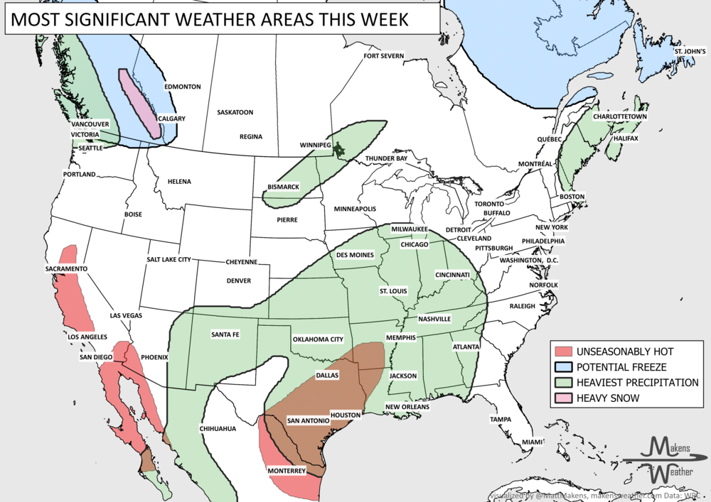
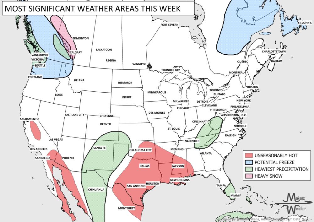
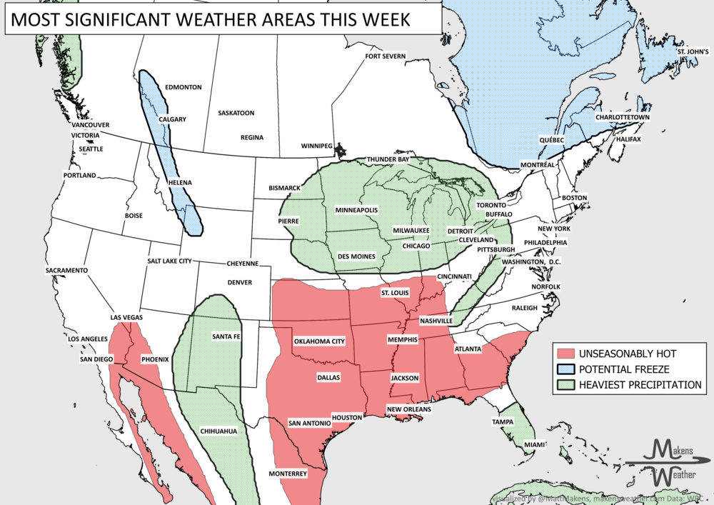
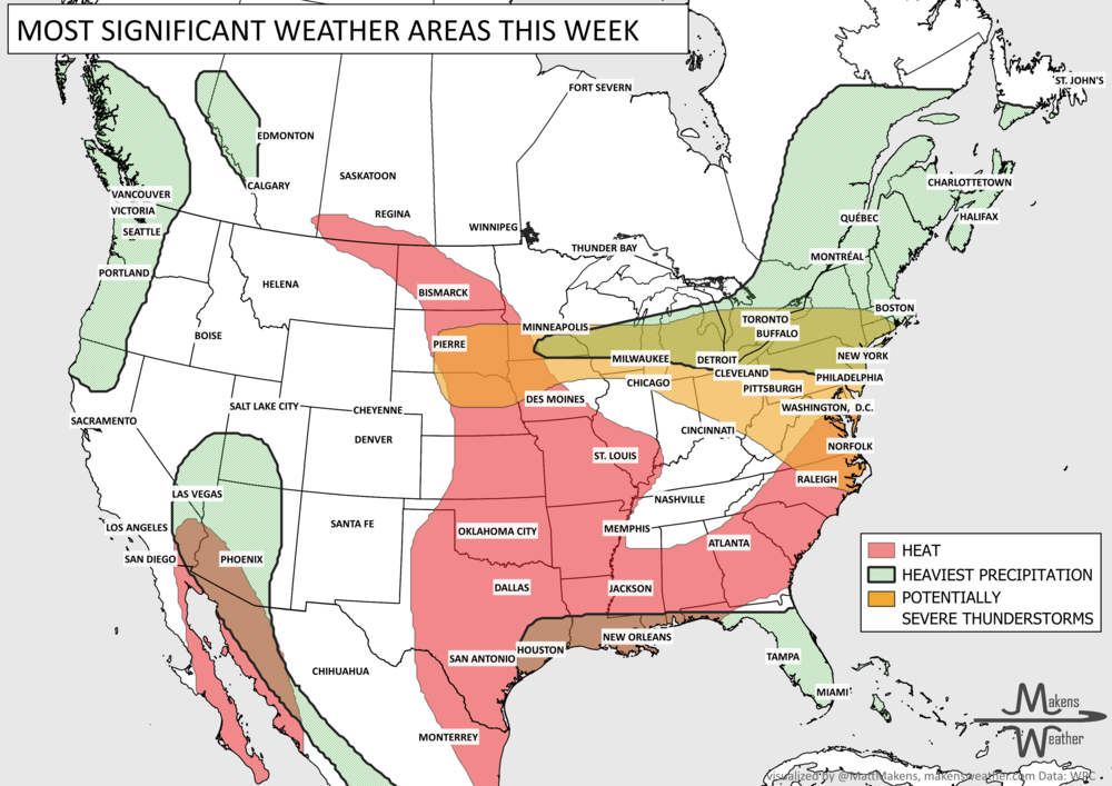
Nearing the holidays with an increasingly active weather pattern ahead. Weather headlines this week will cover an area of low pressure to be watched for tropical development as it passes over Florida and onto the Atlantic Ocean, heavy areas of rainfall (some snow, too) for the West, heavy rain along the Gulf Coast and toward New England, and some significant cold is increasingly likely into Thanksgiving week across the Northwest and Northern to Central Plains. Here’s your weekly brief on the weather ahead.
Storm systems: Here’s an animation to show you the progression of storm systems this week. This is the forecast radar product showing areas of precipitation.
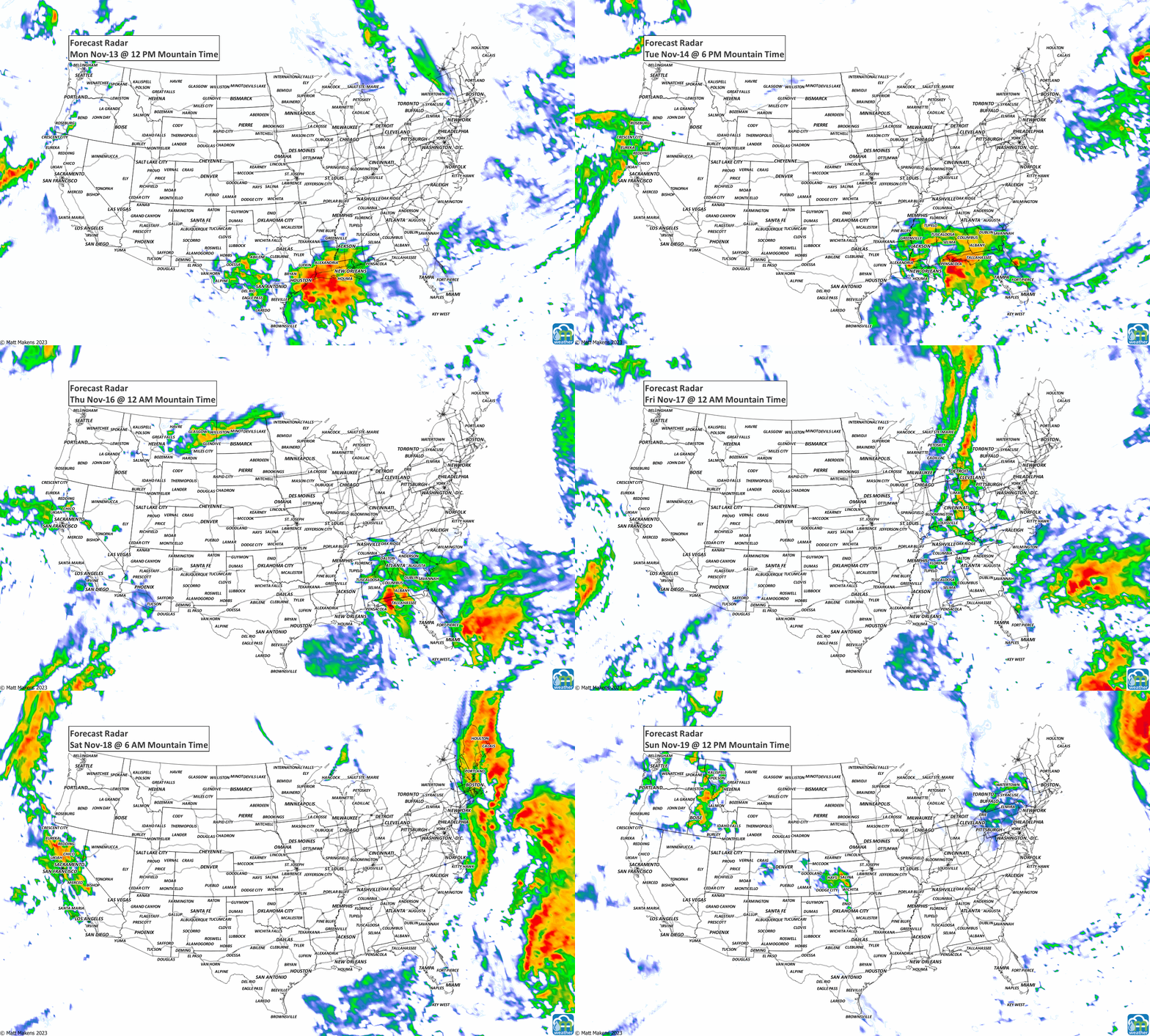
The precipitation for the week focuses on the Gulf Coast, but significant totals are coming to the West and into New England, too. For the Gulf Coast, 3+” will accumulate. Those totals may be too low depending on the ultimate strength of this developing low-pressure area.

For snow lovers, some heavier totals begin to show up during the week. Thanksgiving week will be more favorable for higher totals, but for this week we have the following snowfall totals. Yet, other than perhaps some high mountain passes, the impact on travel from snowfall appears low at this time.

We may be nearing the end of the Hurricane Season, but there may be some development this week. We need to watch the Gulf of Mexico, Florida, and the Atlantic offshore of Florida for possible impacts this week. For local impacts, Brian Shields has great tropical coverage, especially for Floridians.

So, plenty to watch this week but next week gets busier with potential travel impacts and increasing wintry conditions. More on that in next week’s Weekly Weather Watch. Stay well! -Matt
Pacific tropical moisture will drive one of the bigger weather stories this week as it gets pulled north into a slow-moving storm over the Southwest. New Mexico and western Texas face the greatest flash-flood threat early in the week, before heavy rain expands across the Southern Plains, Central Plains and Midwest. Some areas could pick up 3 to 6 inches of rain, with locally higher totals. The wet pattern won’t end quickly either, with the threat gradually shifting east toward the Mississippi and Tennessee Valleys later this week and into the weekend. Meanwhile, the Nor’easter affecting New England is winding down, while late-season heat hangs on across southern Texas and eventually builds across parts of the West.