


Weekly Weather Watch: Wednesday, October 16th, 2024
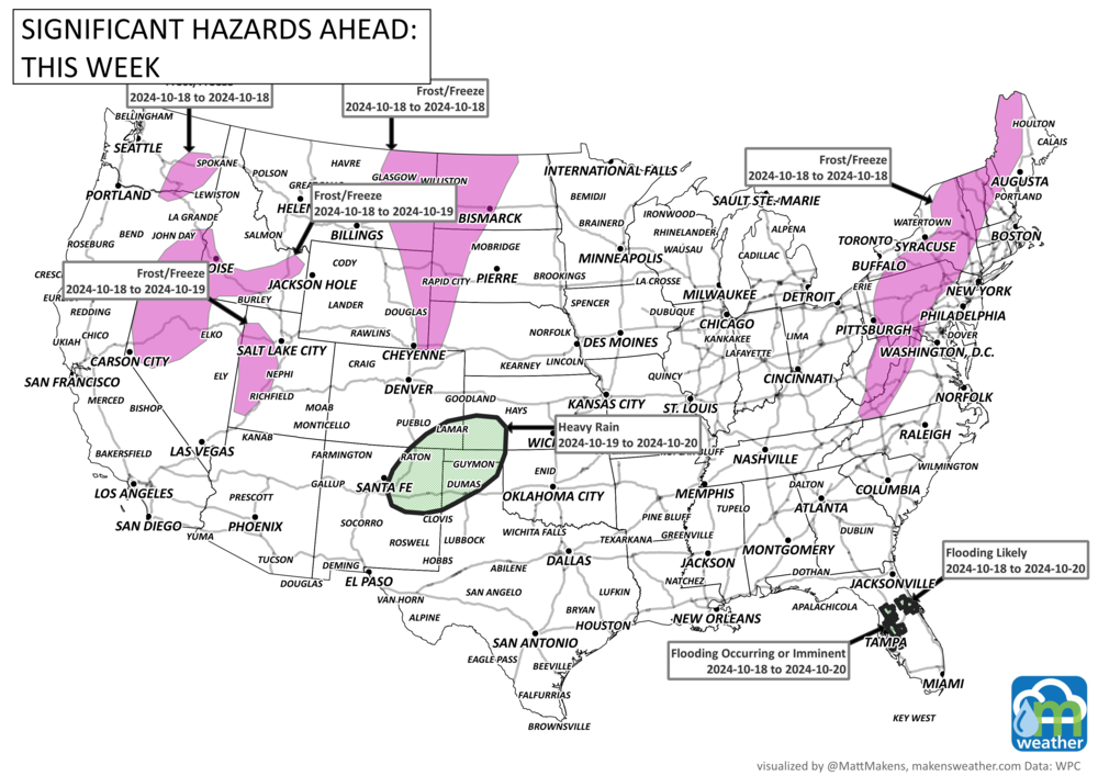
The season’s first snow will hit much of the Rockies, along with frost or freeze for many areas, as the same system passes over the West and heads across the northern states this week.
HEADLINERS:
A Four Corners upper low will bring the first snow of the season to parts of the central/southern Rockies and heavy rain/flooding concerns to the south-central High Plains this weekend.
A frost/freeze is possible for many areas Friday and Saturday.
A slight risk of high winds for portions of western Mainland Alaska, Wed-Thu, Oct 23-24.
Possible flooding for the northern and central Florida Peninsula.
Risk of Rapid Onset Drought (ROD) across portions of eastern Texas, northern Louisiana, and southern Arkansas.
Snowfall for parts of Canada and the risk of a growing season-ending frost/freeze for Ontario and Quebec.
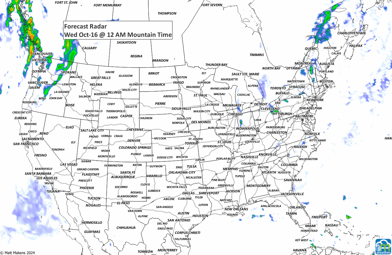
ON THE RADAR:
IN THE GAUGES:
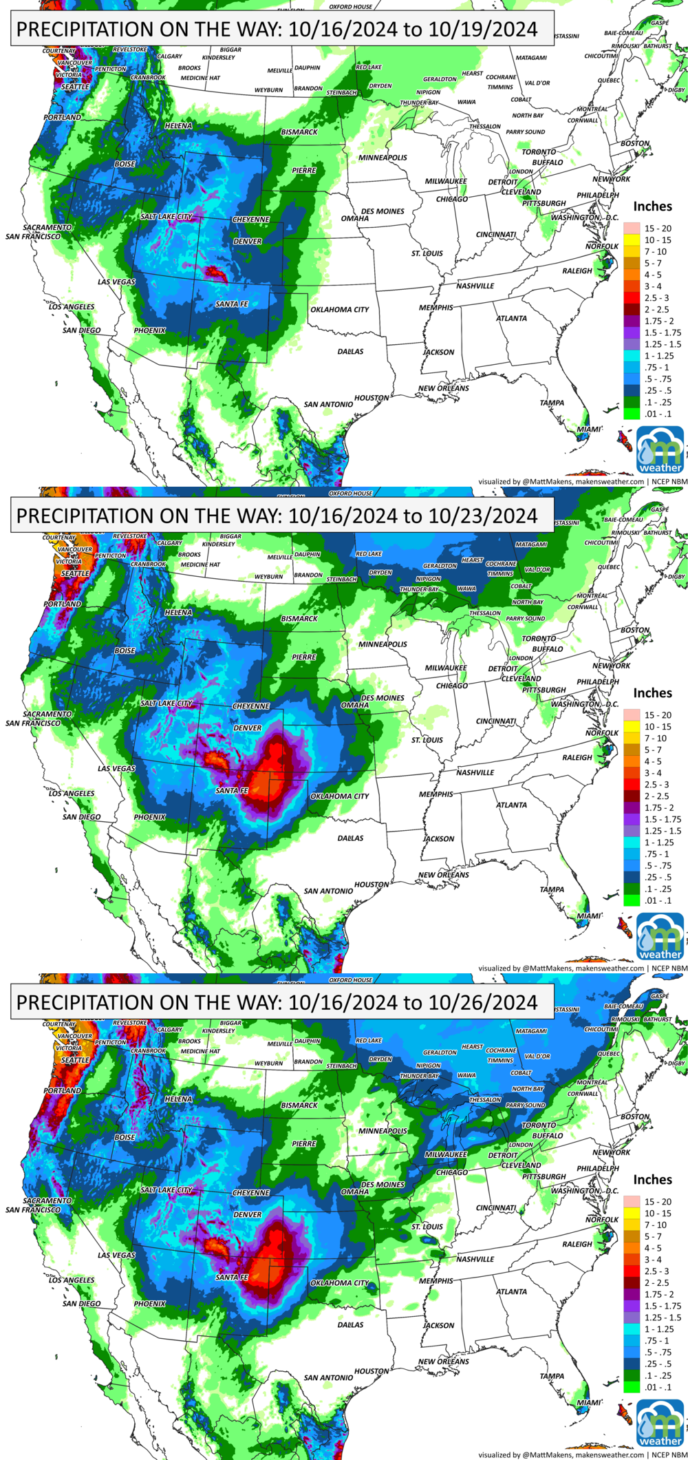
GRAB A RULER:

Colorado folks, your snowfall forecast is provided at WEATHER5280.
RECORDS MADE TO BE BROKEN:
Record highs shown in red, record lows shown in blue. Record lows will outnumber highs this time.

TROPICAL TIDINGS:
At this moment, yes there are areas of active thunderstorms in the tropics that should be monitored for potential development into an organized tropical cyclone, but there is not an imminent risk as of now.
ARE YOU CIRRUS?!
On this day in weather history:
2004 A chain-reaction accident caused on I-95 near White Marsh, Maryland that injured 49 people was caused by the glare of sudden hail.
1780 The most deadly Western Hemisphere hurricane on record raged across the Caribbean. It killed 22,000 people on the islands of Martinique, St. Eustatius, and Barbados. Thousands more died at sea.
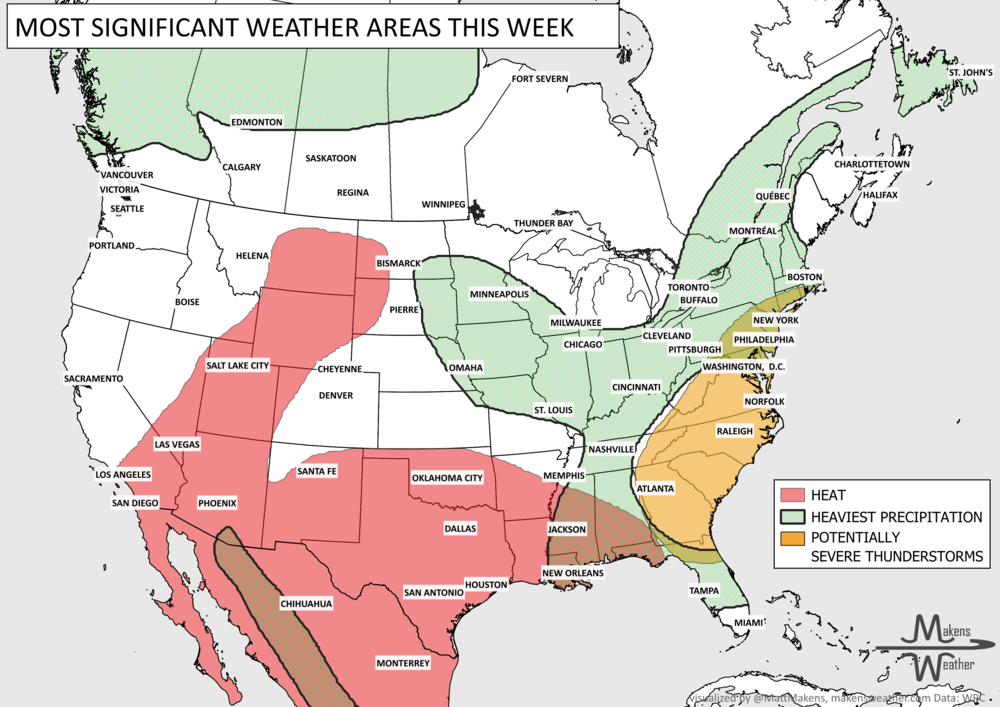
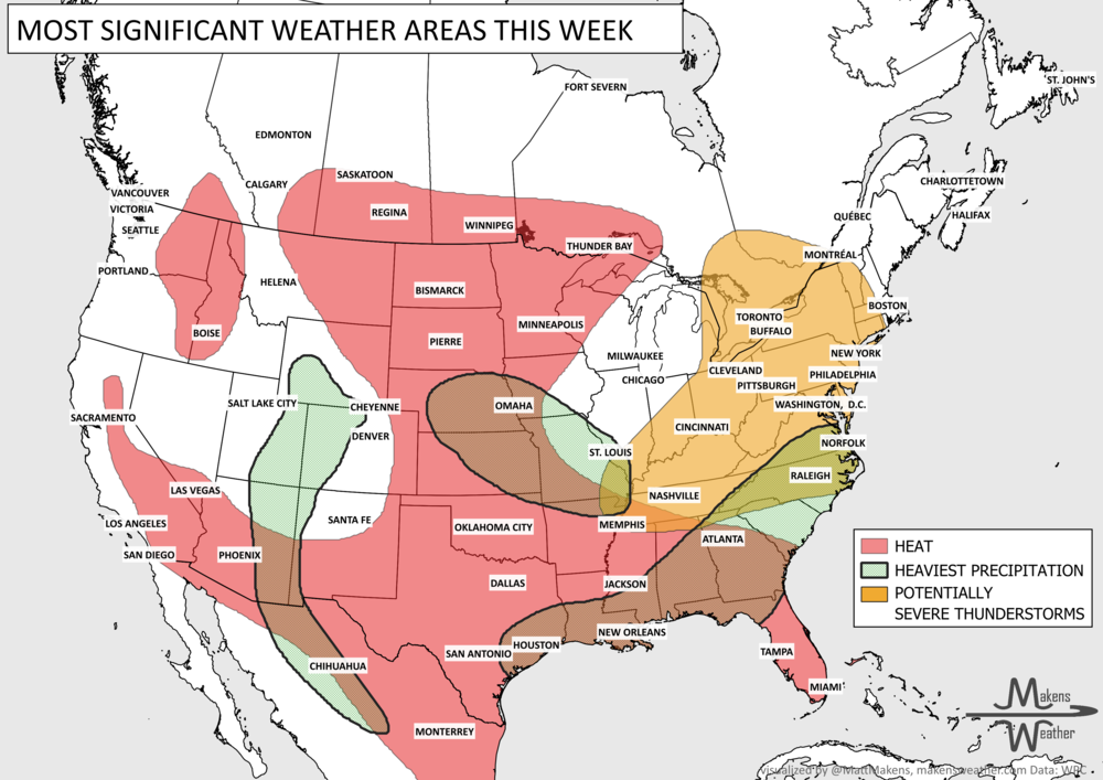
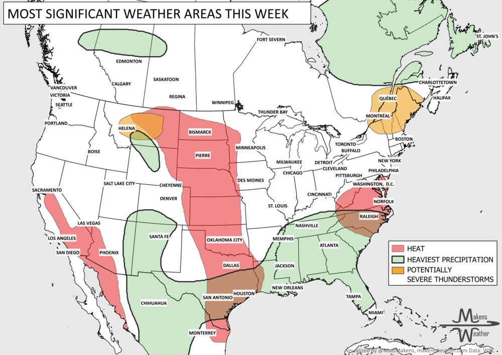
The weather pattern across the United States and Canada remains highly active this week, with two major stories dominating the forecast. Dangerous, long-lasting heat continues across much of the South before expanding into the western United States by the weekend. At the same time, repeated rounds of thunderstorms will bring the threat of flash flooding and severe weather from the Mid-Atlantic and Northeast to parts of the Midwest and Gulf Coast. Residents across these regions should stay weather-aware as heavy rain, damaging winds, and dangerous heat create multiple hazards over the coming week.