


Weekly Weather Watch: Tuesday, October 8th, 2024
Hurricane Milton has set some staggering records already as the cyclone continues churning in the Gulf of Mexico, headed toward Florida. That is the leading headline of the week. Otherwise, unseasonal warmth continues for most of us along with dry conditions.
HEADLINERS:
Milton has intensified into a major hurricane and is expected to make landfall along the West Coast of the Florida Peninsula early Thursday morning.
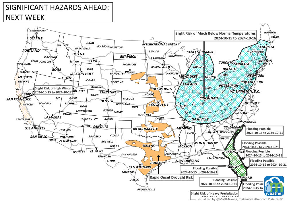
Frost hits parts of New England, Quebec, and New Brunswick. Next week, another frost may cover much of the Northern U.S.
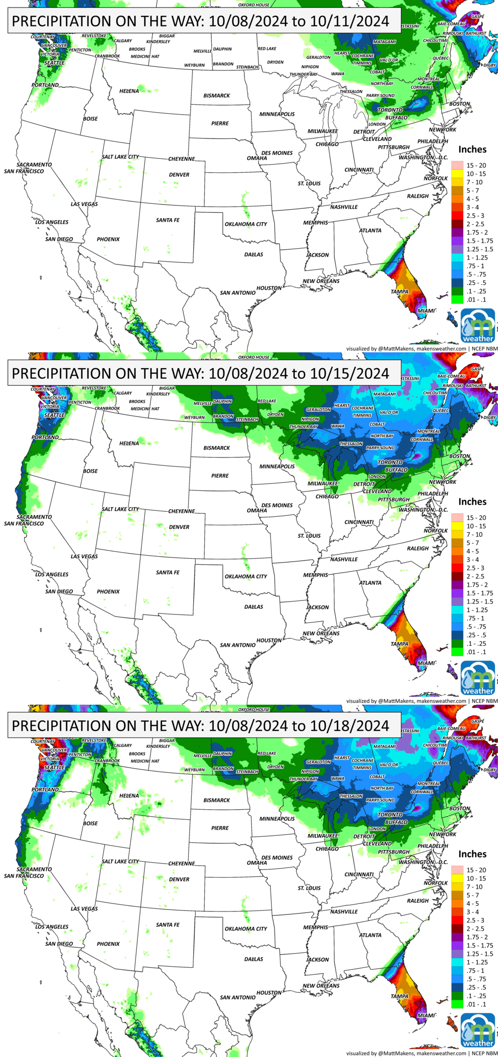
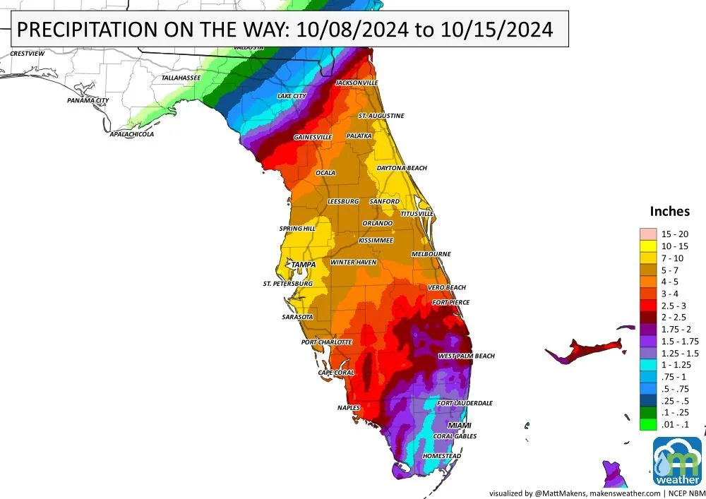
Heavy precipitation for Florida, parts of Quebec and Coastal B.C.
Rapidly expanding drought this week into next for the Central U.S.

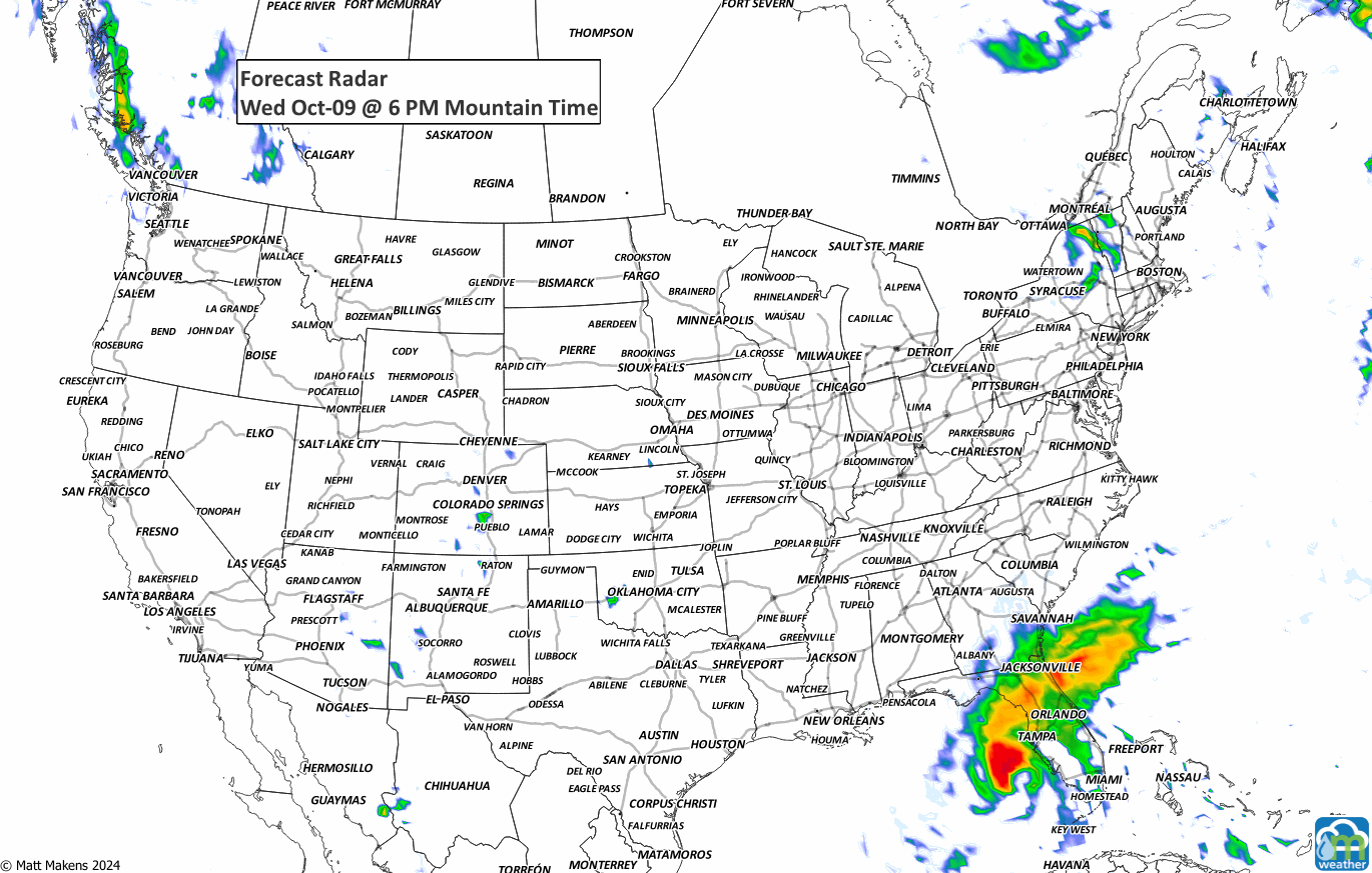
ON THE RADAR:
IN THE GAUGES:
TROPICAL TIDINGS:
Key Messages:
1. Damaging hurricane-force winds and a life-threatening storm surge with destructive waves are expected across portions of the northern coast of the Yucatan Peninsula today.
2. A large area of destructive storm surge, with highest inundations of 10 ft or greater, is expected along a portion of the west-central coast of the Florida Peninsula. If you are in the Storm Surge Warning area, this is an extremely life-threatening situation, and you should evacuate today if ordered by local officials. There will likely not be enough time to wait to leave on Wednesday.
3. Devastating hurricane-force winds are expected along portions of the west coast of Florida, where a Hurricane Warning is in effect. Milton is forecast to remain a hurricane as it crosses the FloridaPeninsula and life-threatening hurricane-force winds, especially in gusts, are expected to spread inland across the peninsula. Preparations to protect life and property, and to be ready for long-duration power outages, should be complete by tonight.
4. Heavy rainfall across the Florida Peninsula through Thursday brings the risk of life-threatening flash and urban flooding along with moderate to major river flooding, especially in areas where coastal and inland flooding combine to increase the overall flood threat.

ARE YOU CIRRUS?!
“Milton became the seventh storm in the last 20 years to gain at least 75 mph in wind speed in just 24 hours and none did so between 1950 and 2000.” Phil Klotzbach. CSU.
A busy stretch of summer weather is underway. The greatest concern through midweek will be severe thunderstorms capable of damaging winds, large hail, isolated tornadoes, and flash flooding from the Dakotas into Minnesota and later the Upper Midwest. At the same time, dangerous heat continues across the Southeast, while a strengthening ridge will send temperatures soaring across the Northern Plains and Central U.S. heading into the weekend. Meanwhile, the Southwest monsoon will gradually become more active, bringing increasing rounds of afternoon and evening thunderstorms. In British Columbia and Quebec, smoke is causing or expected to cause poor air quality and reduced visibility.