

Weekly Weather Watch: Monday, February 19th, 2024
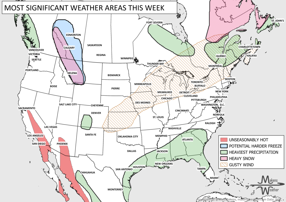
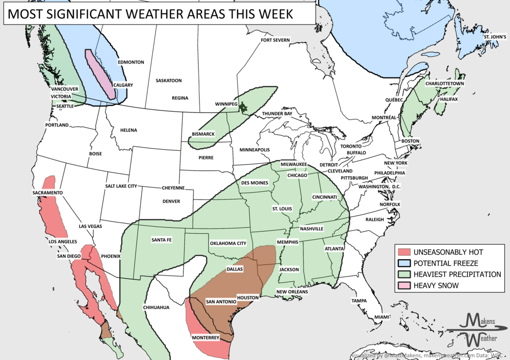
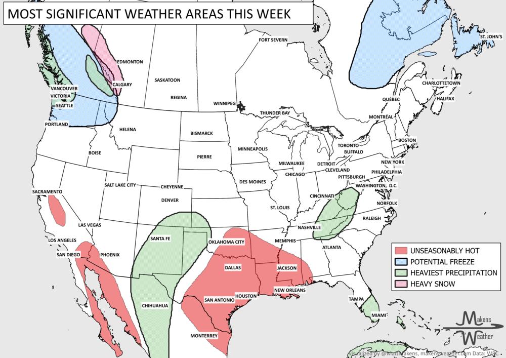
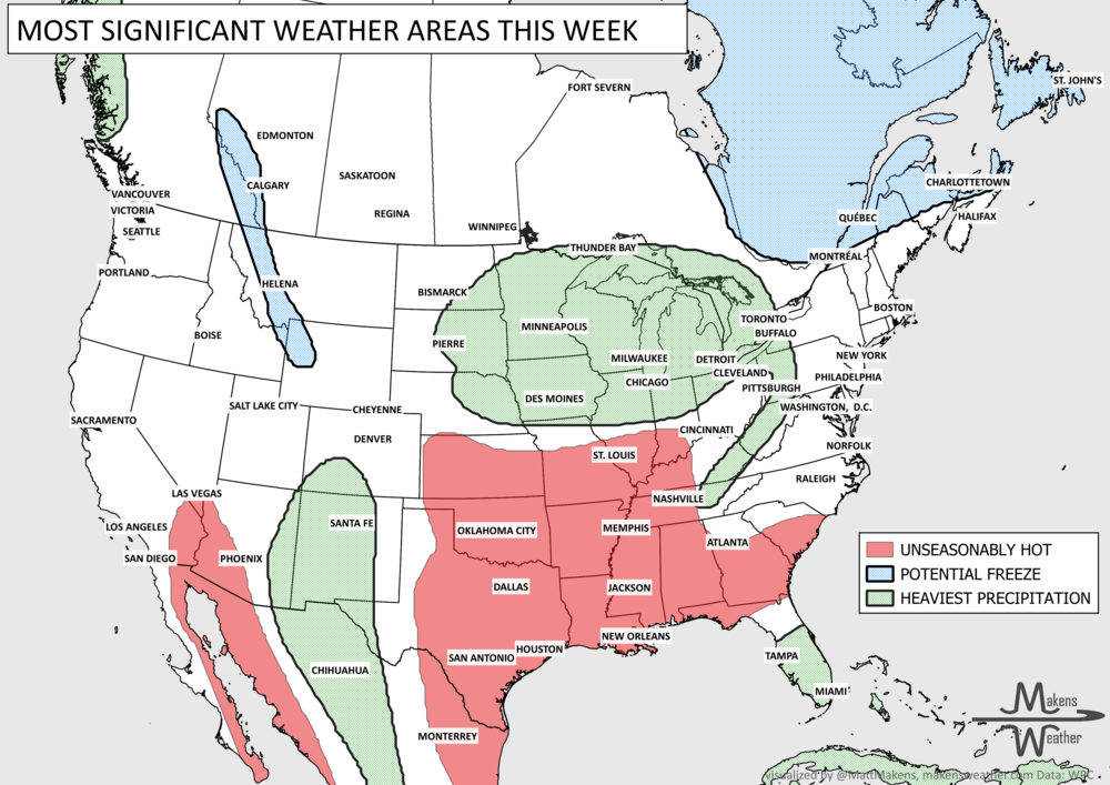
I’ve been on a speaking tour for the past month and gone frequently which is a factor, but does anyone else feel like 2024 has been speeding by uncannily fast?!?! Gracious, it’s late February…and, with that, I suppose we would be looking for cold weather and lots of snow for someone. In today’s Weekly Weather Watch, here are the weather events making headlines you’ll see this week.
Steady moisture continues to inundate the West, flooding is possible here. Today we could hear of severe weather reports from California (increased risks of tornadoes, wind, and hail).
Flooding is possible in parts of the Southeast.
Risks of heavy snowfall for the Northeast this weekend, and an increased risk of heavy snow for the last several days of February into early March across the West.
Risks from wind will increase this weekend into early next week from coast to coast.
Mild temperatures will expand across the Plains - quite warmer than average for many.
For Alaska, heavy precipitation continues across coastal areas along the south from a steady flow of moisture coming in from Asia and the West Pacific.
Canada has some substantial cold around Hudson Bay and South of, where the chances for snowfall this week will be highest. (due to multiple requests, several maps below have been expanded to show Canadian Provinces - thank you for your feedback.)
Hawaii will see the Trades increase later this week with a possible increase in moisture and precipitation across the state, particularly the west.
Coloradans, I posted your weekly update to weather5280 yesterday.
Here are those highlight items mapped, with a technical summary to follow.


With the highlights out of the way, let’s get to more specifics. First, a timeline of storminess for the next week+.

You can anticipate the precipitation map to show the heaviest moisture to the West where I pointed out the risk of flooding. Here is that map:

Not to discount the moisture headed toward the South and East with that area of 2”+ over the Ohio Valley, but there are considerable amounts of water expected for the Sierras and Cascades and coastal California to Washington and British Columbia. Totals in many of those areas exceed 5” (12cm) of total precipitation. Yes, those mountain ranges will see this water in the form of snow, so here’s the snowfall projection.

For the Central, Northern, and Canadian Rockies, we have several ranges to receive more than two feet (60cm) of snow this week. There’s also a healthy swath of snow from northern Alberta toward Ontario and most of Quebec.
Phew, that’s quite a bit of water, but not for the Central U.S. Texas, Oklahoma, and New Mexico; I’m trying to get you more moisture to help keep fighting that drought. We will check that progress in next week’s Weather Watch. Until then, Blessings to you all. - Matt.
The weather pattern is about to make a pretty sharp turn across the country. California starts the week with unusual October heat, including highs well into the 90s and even lower 100s in the Central Valley. Meanwhile, much cooler fall air has reached the Great Lakes and Northeast. The Gulf Coast and Southeast stay unsettled, and there’s that record to watch: a tropical depression is likely to develop over the Gulf this week and could strengthen as it moves northeast. If it becomes a hurricane after the 8th, 2026 will have the latest-first hurricane in the Atlantic Basin record.