

Weekly Weather Watch: Monday, February 12th, 2024
Good afternoon; we are nearing the second half of February, and with it will come increased chances for cold across the country. Here are the headlines that’ll be coming your way this week:
Severe Weather for the Southeastern U.S.
Nor’easter hits Tuesday
Another deluge for the Pacific Coast.
Snowfall for the Dakotas and Upper Midwest.
For Alaska, unusually warm but a Low will come your way next weekend.
For Canada, the nor’easter will hit parts of the Maritimes Tuesday into Wednesday. The mountains and the East will have some snow this week. Be watching the forecast for potential cold impacts in AB and SK next week.
Hawaii, relatively easy wind until later this week when a front will increase wind and chances for moisture.
The first significant storm system is happening now. Severe weather and potential flooding are risks to the Southeast tonight, and then the storm heads to New England as a nor’easter. Tuesday. Following this system is a new one for the Northwest by midweek. Let’s sort these out with this animation first.
With this storm duo, there’s a lot of water to fall on either coast. Here is the total precipitation for the week, and check out California! That’s over a foot of water in many cases there. The Southeast and East have upwards of two or more inches of total water.
Of that total precipitation, we do have quite a bit of the frozen variety. So, here are the snowfall totals and some zoomed in maps to see the higher totals across the West and in New England.
The latest guidance suggests heavy snowfall occurring from southern New England down into southern Pennsylvania/New Jersey. Generally, between 6-12 inches are probable for portions of the aforementioned areas. The nor'easter will bring strong winds to the region on Tuesday which coupled with the heavy snowfall could damage trees and power lines. The strong winds will also bring a threat for coastal flooding. - WPC


You’ve guessed it, there will be travel issues along with power problems, etc. focusing on that storm in New England. Here’s a way to categorize the winter weather by severity.
Wind will be a factor around the Rocky Mountain region, in addition to more moisture and that snow I showed above. For Colorado information, we’ve got you covered over on Weather5280.com.
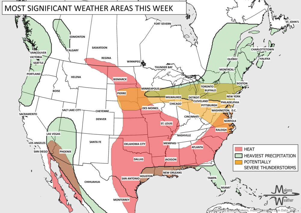
So, in the short-term, we are worried most about the system tonight in the Southeast with severe weather, and then it turns into a significant nor’easter tomorrow. Beyond, here is a summary of the hazards this week into next.
I haven’t mentioned temperatures yet. We aren’t setting many records this week but look for a cooler trend as we go through February into March. There is some potential for significant cold ahead, which I’ll discuss more next week. I want to thank those with AgCountry FCS for inviting me to speak last week at their annual meeting, which brought hundreds together from across the Upper Midwest; we had great discussions on how La Niña will impact their grains/futures for the next couple of years. With that, and for now, those are the headlines that’ll hit your feeds this week. Blessings, Matt.
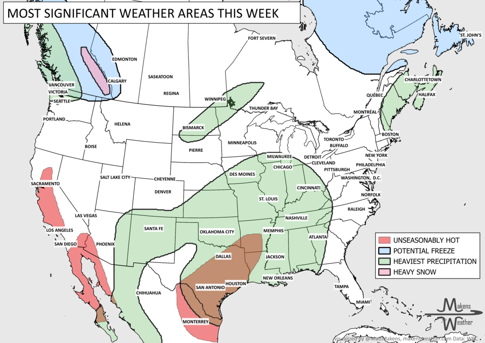
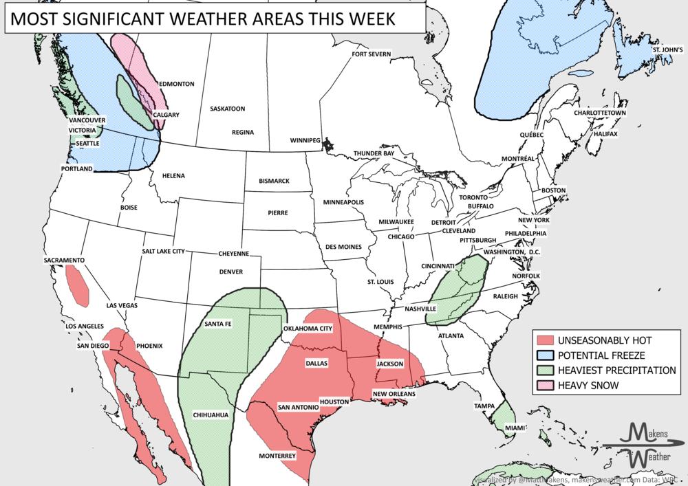
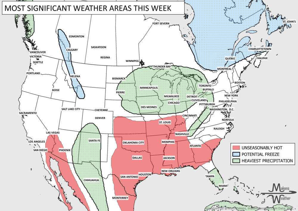
Pacific tropical moisture will drive one of the bigger weather stories this week as it gets pulled north into a slow-moving storm over the Southwest. New Mexico and western Texas face the greatest flash-flood threat early in the week, before heavy rain expands across the Southern Plains, Central Plains and Midwest. Some areas could pick up 3 to 6 inches of rain, with locally higher totals. The wet pattern won’t end quickly either, with the threat gradually shifting east toward the Mississippi and Tennessee Valleys later this week and into the weekend. Meanwhile, the Nor’easter affecting New England is winding down, while late-season heat hangs on across southern Texas and eventually builds across parts of the West.