


Weekly Weather Watch: Sunday, March 24th, 2024
Good Sunday to you. This week’s weather watch has some love for snow lovers. Part of this snowfall will attack drought conditions in the Upper Midwest. Now, a lot is going on beyond snowfall, so here are the highlights for this week’s weather:
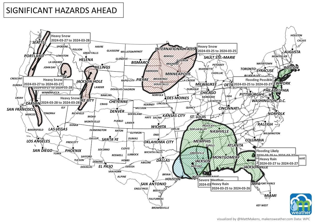
Heavy snow targets the mountain ranges of the West and the Northern Plains through the Upper Midwest. (Colorado, blizzard warnings in place for parts of the metro areas - weather5280.com has the latest).
High Wind will accompany that winter pattern hitting the central states.
A significant chill will hit the Plains during the next few days.
Severe thunderstorms are possible across the South.
Heavy rain for the South and Southeast.
For Alaska and Western Canada, there is growing potential for a major Bering Sea storm for later in the week/weekend.
For Eastern Canada, heavy snow and wind from Ontario to the Maritimes.
For Hawaii, “typical” trade wind activity this week.
Here is a graphic to outline many of those threats.
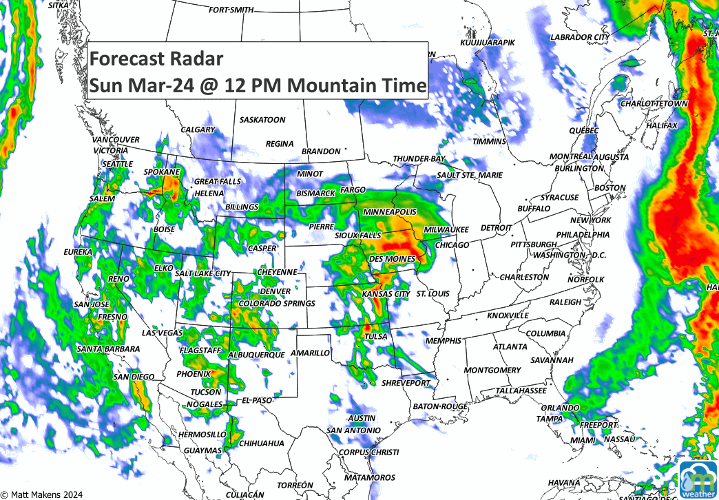
Let’s watch the animation, which shows storm motion this week.
With that storm flow in mind, it makes sense to see the orientation of precipitation as follows. Note the reds on the map are for at least 2.5”, and there are a lot of areas on the map to hit this mark, including Minnesota and Wisconsin.


From that total precipitation mapping above, let us look at snowfall. I mentioned a lot of water coming to the Upper Midwest, and snowfall totals during the next ten days can climb to more than two feet in many areas.


Okay, let’s turn to temperatures for a moment. Considering the time of year, I will call it significantly cold from the Texas Panhandle to the Central Plains. For one example, here are the lows for Tuesday morning.

I think you’ve been sufficiently briefed on the highlights this week. Snow and a chill will be big stories, along with potential severe weather and rain for the South. Until next time, Blessings. -Matt.
A prolonged and dangerous heat wave will dominate the weather story this week as much of the central and eastern United States experiences some of the hottest weather of the year. Heat index values above 100 degrees will become widespread, with some communities seeing readings between 105 and 115 degrees and little relief at night. At the same time, several rounds of severe thunderstorms are expected from the High Plains through the Upper Midwest and Northeast, bringing the threat of damaging winds, large hail, and localized flash flooding. Out West, cooler-than-normal temperatures will continue while dry conditions keep wildfire concerns elevated across parts of the Four Corners and Great Basin. Air quality is an issue across Alberta to Quebec due to wildfire smoke. Heavy precipitation is possible from far eastern Saskatchewan to far western Manitoba.