Weekly Weather Watch: Monday, March 11th, 2024
A doozy of a storm system is trying to set up over the Western and Southwestern United States this week, near a spot that can produce a lot of snowfall in Colorado. Colorado folks, the latest is posted to Weather5280.com for you. Here are the weather headlines you’ll see/hear this week:
Monday brings heavy wet snow to the Great Lakes region toward New England and parts of Canada’s Maritimes.
Multiple rounds of rain and heavy snow to hit the West into the Central Rockies. Fire danger increases across the Central and Southern Plains from wind, warmth, and dry conditions ahead of the system mentioned to hit the West.
Severe weather will start of lots of rainfall from the Southern Plains into the Southeastern U.S. Heavy precipitation will hit the Southeastern U.S. later this week, followed by the potential for impactful cold from here toward the Midwest next week. Windy weather will hit the eastern third of the U.S. from the weekend through next week, too.
Across Canada, the next week to ten days brings chances for snow for the mountains and additional snowfall for Eastern MB and ON to the Maritimes without too much snow for the prairies of AB or SK. A strong shot of cold air may move in from Alaska, across the Northwest toward central and eastern Provinces next week.
For Hawaii, strong trades and increased moisture will mean increased chances for moisture through mid-week.
Let’s get to the storm animation for the next ten days:
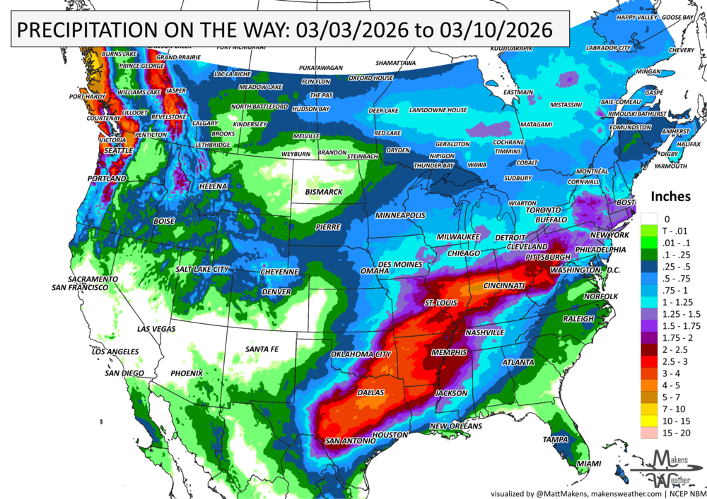
With that storm flow in mind, how much total water is expected? Here is the estimated total through the next ten days (inches).
And, of that how much is snow? Here is that estimate in inches. Notice the focus on Colorado and New England to the Maritimes.
We will need to watch for some potential cold in the next two weeks, too. Here are weekly snippets showing that trend as cold air over Alaska moves east and south from this week into next:
Okay, that wraps up the biggest weather stories for the next week to ten days. I hope it is a good week. Blessings, Matt.

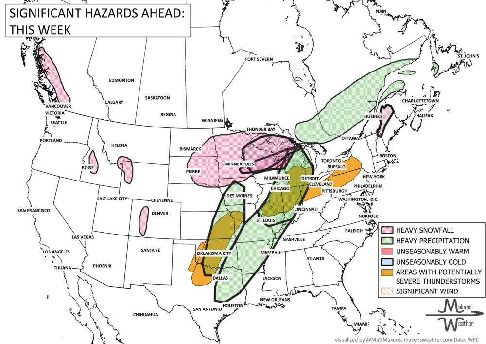
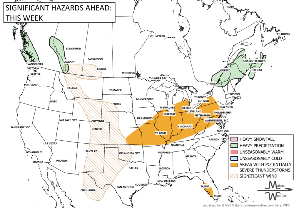
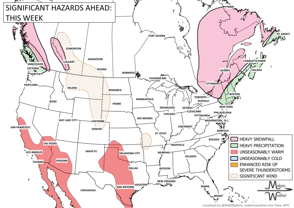
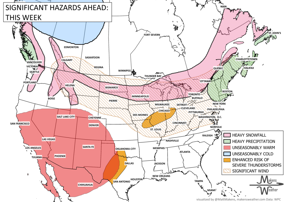


A drawn-out storm pattern will keep much of the country active through the first week of April. A slow-moving front stretching from the Great Lakes into the Plains will separate late-season snow and ice to the north from heavy rain and severe thunderstorms to the south. The setup brings the greatest impacts to parts of the Midwest, Ohio Valley, Southern Plains, Mississippi Valley, and eventually the East Coast, while the West sees mountain snow and then a warming trend heading into the weekend.