

Weekly Weather Watch: Tuesday, March 5th, 2024
If you haven’t heard the headlines about the amount of snow in the Sierra Nevadas, it’s worth a “Google” of the Mammoth area to see some pictures of the deep snow they’ve received. In other headlines, we have tremendously bad grassfire news out of Texas and Oklahoma during the past week.
For this week, here are the items that have my attention and perhaps yours.
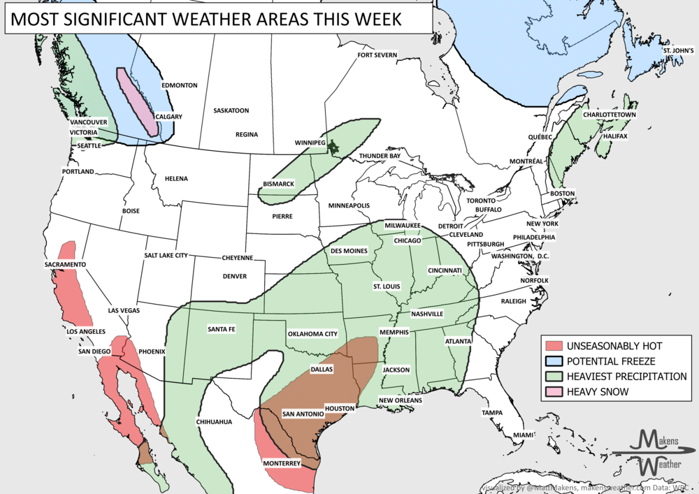
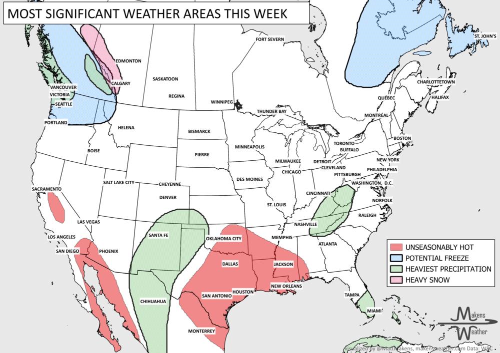
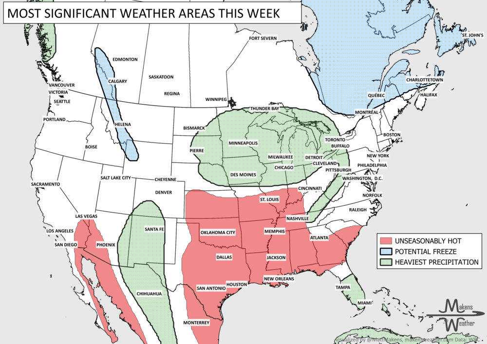
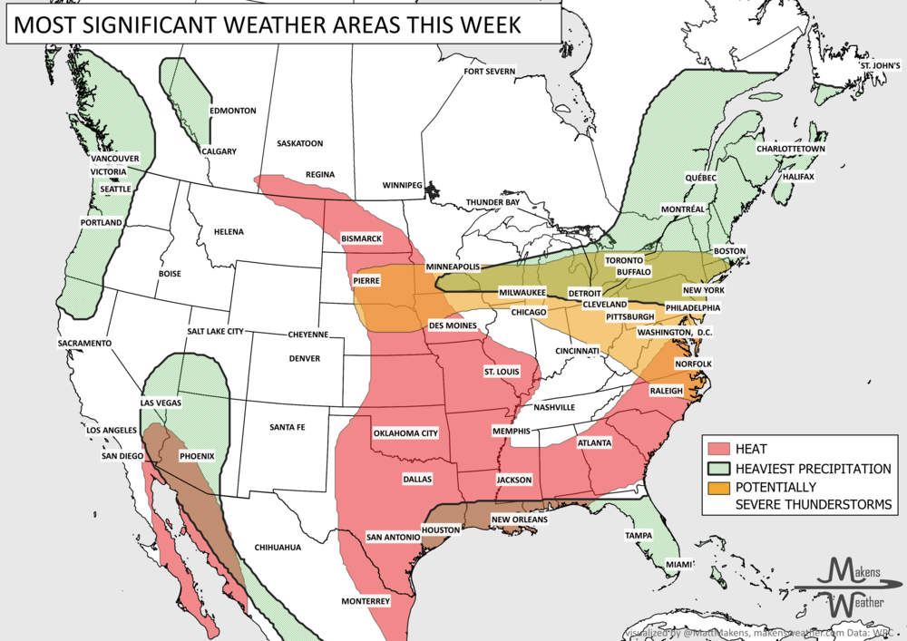
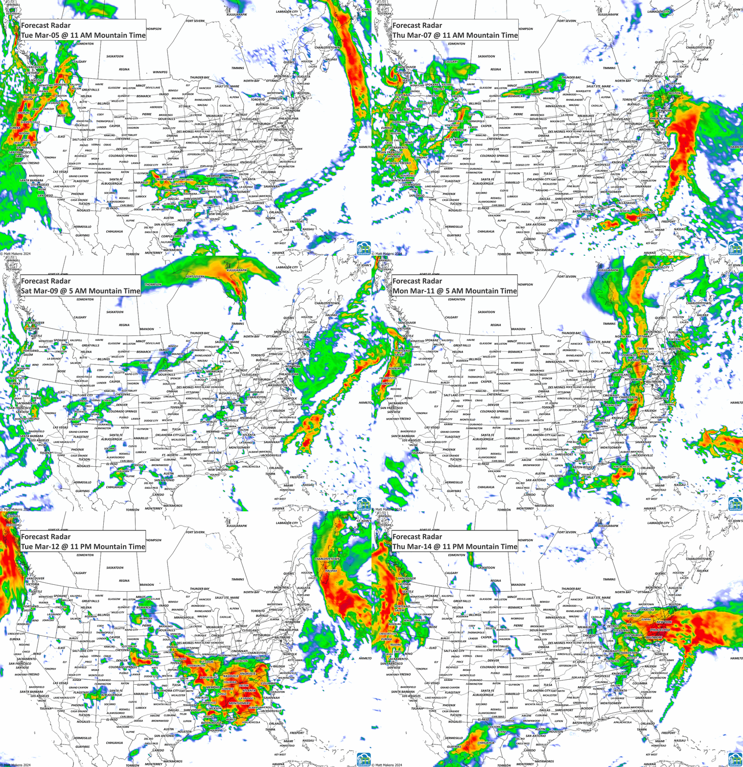
For the States, heavy precipitation hits the West Coast from the 9th to 11th, heavy snowfall for the Central Rockies (mostly Colorado) the 7th and 8th, severe thunderstorms are possible across the South the 7th and 8th before that system drenches the South and East with heavy precipitation through the 10th. (image follows)
For Canada, extreme cold warnings are in the near term for AB and BC; cold temperatures will persist. Moisture will spread across the Prairies later this week, then the East for the weekend and early next week.
For Alaska, troughing will keep the cold coming, and moisture will favor the south and southeast.
For Hawaii, strong trades will keep moisture on the mountains and the windward side of the islands.

Let’s get to the animation showing the storm flow for the next ten days:
From that storm flow, let’s look at the precipitation totals first and then the snowfall totals.

The driest areas are those along the lee side of the Rockies from Alberta to Montana. The Pacific Coast to catch more than half-a-foot of water, the southeast to pick up several inches, and some needed water to fall on the Corn Belt. In terms of snowfall, how much?

The mountains, eastern Canadian Prairies, New England, and the Maritimes have some notable snow on the way.
In terms of temperatures, I mentioned the extreme cold warnings for parts of Canada where the cold has a firm grip on the west - the colder temperatures are covering much of the Western U.S. this week with milder conditions for the eastern half of the States and Canada.

That’s the brief for this week. I need to thank several folks including Beef Farmers of Ontario, the Alberta Beef Industry Conference, and Compeer Financial for having me speak recently about the year’s weather patterns and changes ahead with loss of our current El Niño turning into La Niña. If you are a member/attendee of any of those entities your private web links given you will have the seasonal and monthly outlooks through the year (lasting about one more month before I’ll need to take those pages over for future speaking engagements). Blessings! -Matt.
Pacific tropical moisture will drive one of the bigger weather stories this week as it gets pulled north into a slow-moving storm over the Southwest. New Mexico and western Texas face the greatest flash-flood threat early in the week, before heavy rain expands across the Southern Plains, Central Plains and Midwest. Some areas could pick up 3 to 6 inches of rain, with locally higher totals. The wet pattern won’t end quickly either, with the threat gradually shifting east toward the Mississippi and Tennessee Valleys later this week and into the weekend. Meanwhile, the Nor’easter affecting New England is winding down, while late-season heat hangs on across southern Texas and eventually builds across parts of the West.