


Weekly Weather Watch: Tuesday, April 30th, 2024
In this week’s guide to the headlines that will be made from weather events, we again will focus on severe weather across the Central U.S., along with very heavy rainfall in the same regions. First, a look at the most significant weather ahead, and then a bulleted list of the headlines for the U.S. and Canada.
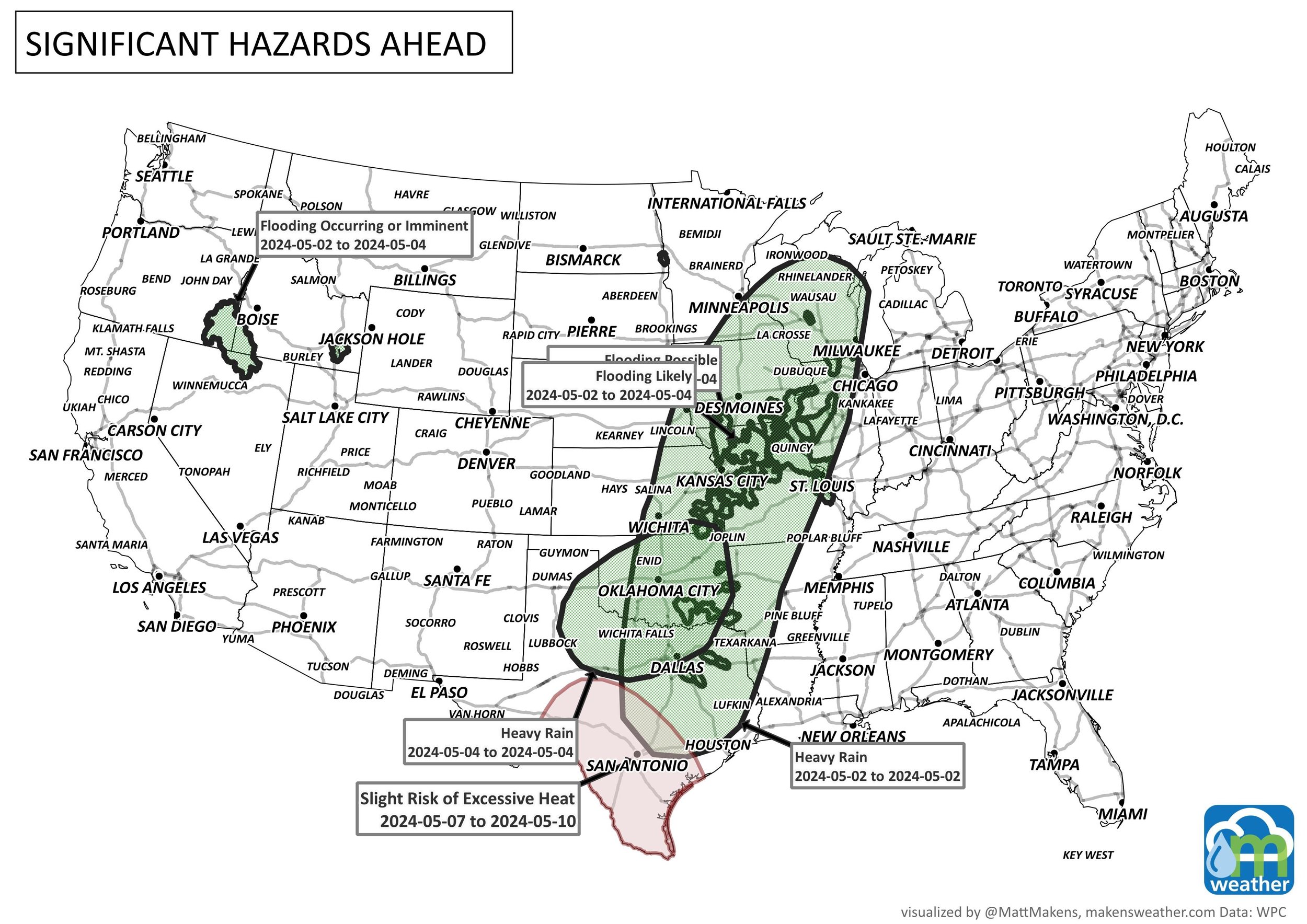
Severe/damaging thunderstorms and flooding concerns for parts of the Upper/Middle Mississippi Valley and Great Plains.
Critical Fire Weather for the Southern High Plains on Wednesday
Cool and snowy in the Northwest
Heavy snowfall in the Canadian Rockies.
For Alaska, heavy precipitation for the southern coastal region.
There is a slight risk of excessive heat for portions of the Southern Plains from May 7 to 10.
There is a slight risk for heavy precipitation for portions of the Northern Plains and Upper Mississippi Valley, May 7-8.
There is a slight risk for high winds for the Great Basin, Central and Southern Rockies, Desert Southwest, and the Central and Southern Plains, May 7-10.
Risk for rapid onset drought for portions of Central Florida.
Here’s the timeline for the next week:

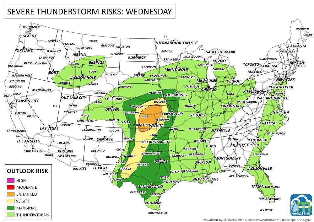
Severe Weather Outlook areas:

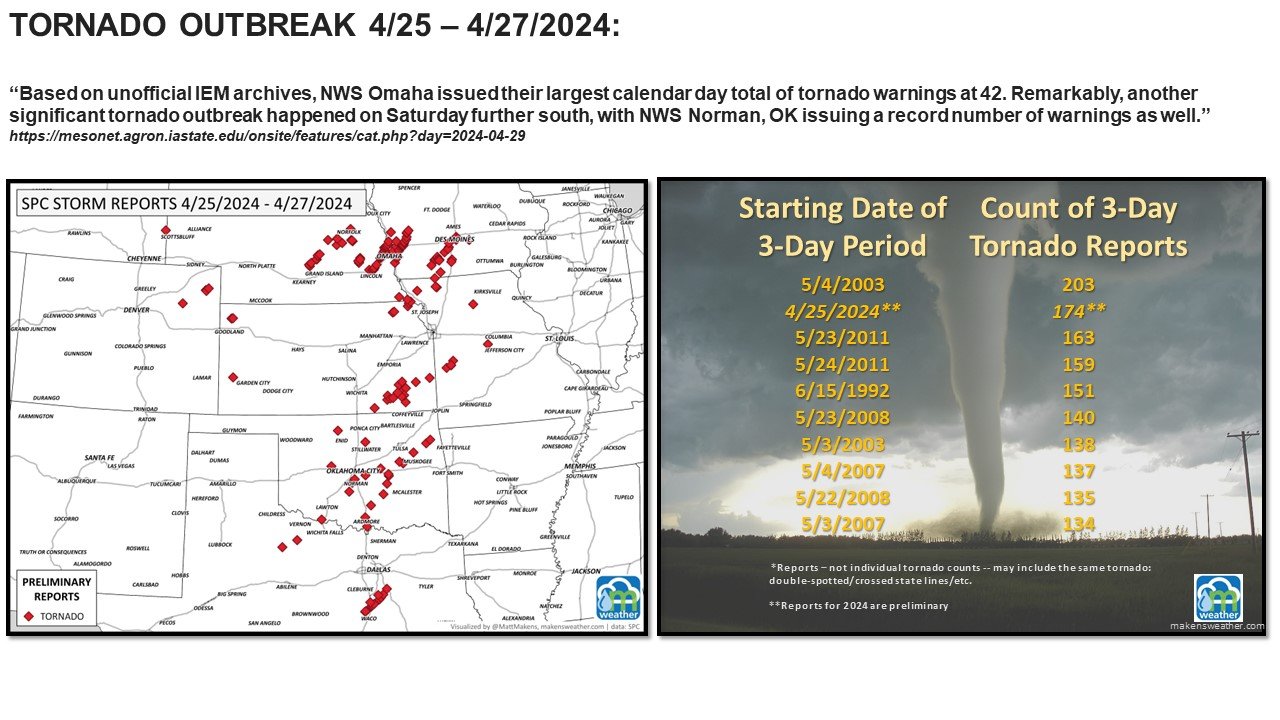
perspective on the recent severe weather outbreak
Based on preliminary numbers, it may be one of the most active three-day stretches for tornadoes since 1950. I did a quick and dirty data analysis of 3-day tornado outbreaks, and 2024 is currently ranked 2nd. This is very preliminary as the data hasn't been verified yet by the NOAA NWS Storm Prediction Center.
Here is a list of tornado reports, not individual tornadoes, as some have been "double-counted" since 1950. These include any strength of a tornado, also.
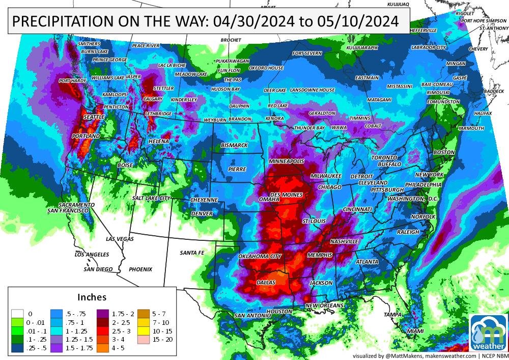
Total Precipitation expected the next 10 days


This briefing is meant to guide you to the weather headlines that will be made during the week ahead. I keep them brief to save your busy schedules, but please don’t hesitate to contact us if you need anything specific: click here to email.
A prolonged and dangerous heat wave will dominate the weather story this week as much of the central and eastern United States experiences some of the hottest weather of the year. Heat index values above 100 degrees will become widespread, with some communities seeing readings between 105 and 115 degrees and little relief at night. At the same time, several rounds of severe thunderstorms are expected from the High Plains through the Upper Midwest and Northeast, bringing the threat of damaging winds, large hail, and localized flash flooding. Out West, cooler-than-normal temperatures will continue while dry conditions keep wildfire concerns elevated across parts of the Four Corners and Great Basin. Air quality is an issue across Alberta to Quebec due to wildfire smoke. Heavy precipitation is possible from far eastern Saskatchewan to far western Manitoba.