


Weekly Weather Watch: Monday, May 6th, 2024
Welcome to May’s first weather briefing. The Members received their May outlook on the 1st, which included heavy precipitation areas. To expand that, here is a specific look at this week's significant weather areas (image 1). Many places will be hit with heavy rainfall and may flood (image 8), and others with heat, drought, and wind (image 11).

IMAGE 1
Besides the heaviness of the rain, another serious threat this week will be a substantial risk of damage from thunderstorms across the Central Plains today, which will spread eastward later this week. Severe weather outlooks are shown below (Images 2, 3, 4, 5). Here are the weather items that will make headlines this week:
There is a Moderate to High Risk of severe thunderstorms over parts of the Central/Southern Plains on Monday and a Slight Risk across the Ohio Valley on Tuesday. (Images 2, 3, 4)
There is a Slight Risk of excessive rainfall over the Northern High Plains and Central Plains/Middle Mississippi Valley on Monday. (Images 7, 8)
Heavy snow over the higher elevations from the Pacific Northwest to the Northern/Central Rockies. (Image 9)
Central Gulf Coast States to Appalachians/Southeast U.S. Heavy Rainfall Threat into Thursday/Friday. (Images 7, 8)
Rapid onset drought is possible for portions of Central Florida. (Images 10, 11)
For Canada, the highest threat comes from Alberta, where heavy rain is expected tonight and Tuesday. Rain will begin this afternoon and continue through Tuesday night. Widespread rainfall totals of 50 to 70 mm are likely. Locally, higher amounts of 80 mm or more are possible. Rain will taper off on Wednesday. Heavy downpours can cause flash floods and water pooling on roads. Localized flooding in low-lying areas is possible. Watch for possible washouts near rivers, creeks, and culverts. (Image 7)
Stay alert today; there is a significant threat of damaging thunderstorms across the Central and Southern Plains. There is a 30% chance of tornadoes and a 45% chance of damaging hail across parts of Oklahoma and Kansas.

IMAGE 2

IMAGE 3

IMAGE 4

IMAGE 5
Here is a timeline so that you can watch the storms travel through your areas:
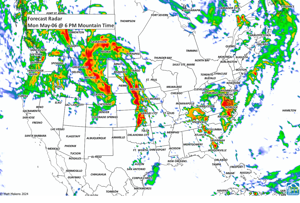
IMAGE 6
Here is a map showing the total precipitation this week. There is heavy rain/flooding for parts of the Central U.S. and very heavy moisture for the Northern High Plains from Montana into Alberta and Saskatchewan.

IMAGE 7

IMAGE 8
Next, we look at the total snowfall for the week, which is quite heavy for the time of year for parts of the mountains in the States and Canada.

IMAGE 9
Next, onto the heat that will cover the Southern U.S. and may lead to rapid onset of drought conditions, especially Central Florida.

IMAGE 10

IMAGE 11
Since this Weekly Weather Watch is your quick guide to the week ahead, you can stay up to date throughout the week as I track daily impacts via my social media channels:
Be well, and have a safe week! - Matt.
A prolonged and dangerous heat wave will dominate the weather story this week as much of the central and eastern United States experiences some of the hottest weather of the year. Heat index values above 100 degrees will become widespread, with some communities seeing readings between 105 and 115 degrees and little relief at night. At the same time, several rounds of severe thunderstorms are expected from the High Plains through the Upper Midwest and Northeast, bringing the threat of damaging winds, large hail, and localized flash flooding. Out West, cooler-than-normal temperatures will continue while dry conditions keep wildfire concerns elevated across parts of the Four Corners and Great Basin. Air quality is an issue across Alberta to Quebec due to wildfire smoke. Heavy precipitation is possible from far eastern Saskatchewan to far western Manitoba.