


Weekly Weather Watch: Monday, May 20th, 2024
There’s quite a lot of thunderstorm activity expected—‘tis the season, right?! In brief, we are watching out for daily chances for damaging thunderstorms to shift around the Central Plains to the Midwest this week and other areas of severe weather in Saskatchewan. Heavy rainfall is expected for much of the U.S. Record-high heat, and associated drought growth is expected for South Texas and parts of Florida.

Let’s collect the bullet points of what weather will be making headlines this week and what to look out for during next week.
Continued severe weather and excessive rainfall threats over the central U.S. into mid-week.
Tornadoes and damaging thunderstorms possible on the Canadian Prairies.
Cool conditions with periods of shower and storm chances from the Rockies to the Pacific Northwest.
Well above average, summer-like temperatures will start the week across much of the central/eastern U.S.
Moderate risk for excessive heat across southern Texas Sat-Mon, May 25-27.
Slight risk for excessive heat across portions of the Southern Plains, Sat-Wed, May 25-29.
Slight risk for excessive heat across portions of the Florida Peninsula, Sat-Tue, May 25-28.
Slight risk for heavy precipitation across portions of the Plains, Mississippi, Tennessee, and Ohio Valleys, Great Lakes, and Southeast, Sat-Mon, May 25-27.
Slight risk for high winds across parts of the Four Corners and central and southern High Plains, Sat-Mon, May 25-27.
Rapid onset drought risk across the southern Florida Peninsula and southern Texas.
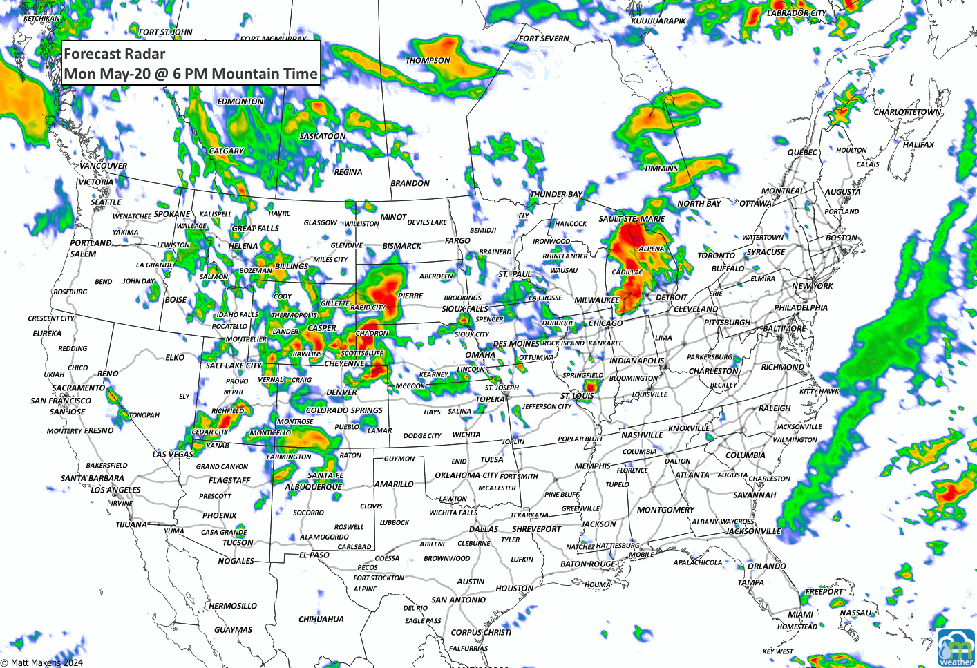
STORM ANIMATION GUIDES YOU AROUND THE ACTIVITY THIS WEEK:
DAILY SEVERE WEATHER OUTLOOK AREAS:


TOTAL MOISTURE DURING THE WEEK. Notice the bullseye in Osage Country, that’s more than 5” of water for some. Another band of precipitation from Nebraska to Ontario climbs to more than 2.5”.

LATE-SEASON SNOW. There’s a focus of snow on Wyoming and Montana this week. Some ranges here to pick up more than two feet.

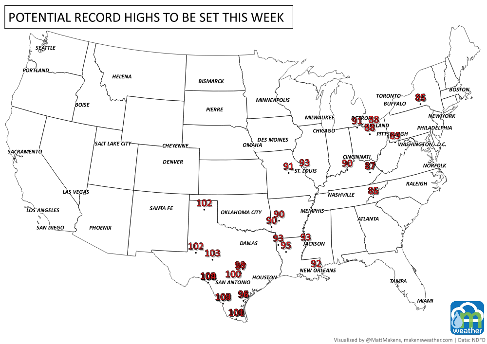
RECORD-SETTING TEMPERATURES POSSIBLE ACROSS THE SOUTH AND EAST.
With that, quite a busy week. Most of the focus is on the series of thunderstorms, their severity and high rainfall totals.
Be well, Matt.
A prolonged and dangerous heat wave will dominate the weather story this week as much of the central and eastern United States experiences some of the hottest weather of the year. Heat index values above 100 degrees will become widespread, with some communities seeing readings between 105 and 115 degrees and little relief at night. At the same time, several rounds of severe thunderstorms are expected from the High Plains through the Upper Midwest and Northeast, bringing the threat of damaging winds, large hail, and localized flash flooding. Out West, cooler-than-normal temperatures will continue while dry conditions keep wildfire concerns elevated across parts of the Four Corners and Great Basin. Air quality is an issue across Alberta to Quebec due to wildfire smoke. Heavy precipitation is possible from far eastern Saskatchewan to far western Manitoba.