Weekly Weather Watch: Monday, June 3rd, 2024
I hope you had a nice weekend; the weather was quite active across the Central U.S. and Oklahoma is still getting thunderstorm complexes this morning. Let’s look at what’s ahead this week as severe weather continues, as well as record-setting temperatures building throughout the week.
Heavy precipitation hits the Cascades & northern Rockies today and tomorrow over the Upper Midwest centered on Minnesota.
Heat increases through the week for the West, especially California’s Central Valley and Texas. Records are likely for many locations here.
Slight risk for heavy precipitation over the Northeast and Mid-Atlantic next week.
Slight risk for heavy precipitation over south-central states and Mississippi Valley next week
Rapid onset drought risk across parts of southern Texas.
Rapid onset drought risk over the central Florida Peninsula.
Here’s an image summarizing those threat areas:
This animation will show you the storm timeline for the week: NOTE, severe/damaging thunderstorms are possible each day for various regions. Please find your preferred social media channel to receive those updates as I post them each morning. Links to social sites
Of that storm activity, here are the estimated precipitation totals for the week. Osage Country has more heavy totals coming their way. Not a bad look for Colorado, Northern New Mexico and Western Kansas too. Northern parts of the Canadian Prairies will have more water on the way.
It was almost not worth running the snow map today, but parts of B.C. have snow to look forward to.
Perhaps one of the bigger headlines you’ll hear or see throughout the week will be the heat. Here is a summary of possible record-setting temperatures ahead through Sunday.
For Monthly Subscribers, your monthly outlook was delivered earlier. You can see how my discussion of the first two weeks of the month matches what you see in this Weekly Weather Watch before those mid-month possibilities in your updates.
Have a great week, -Matt

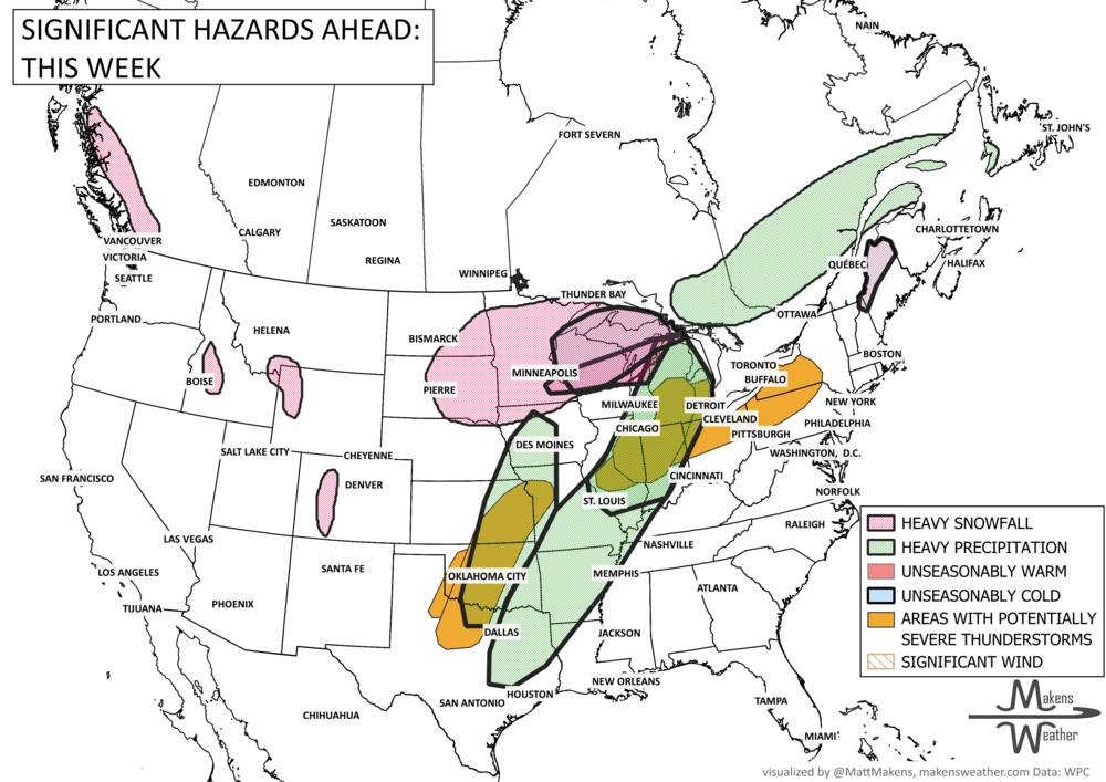
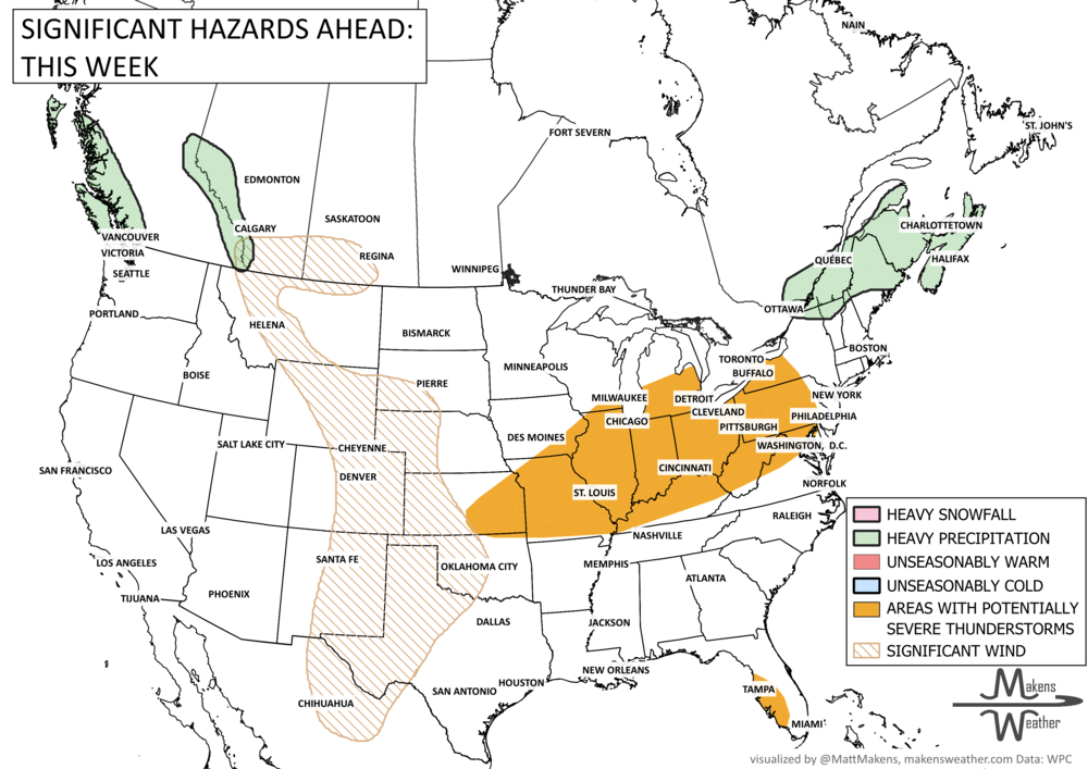
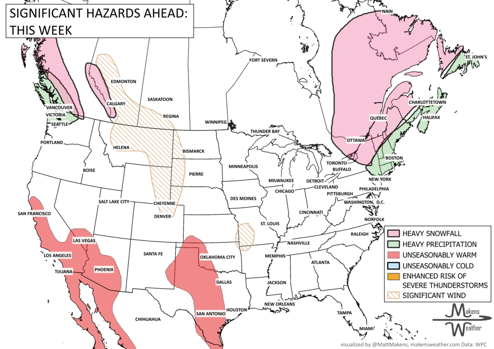
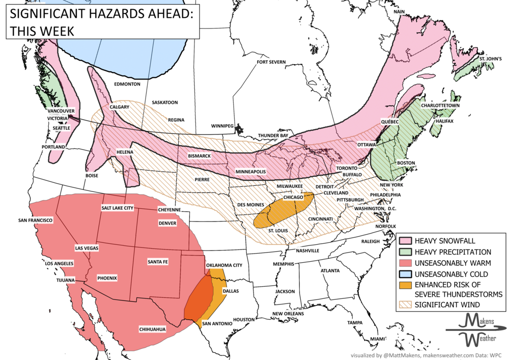
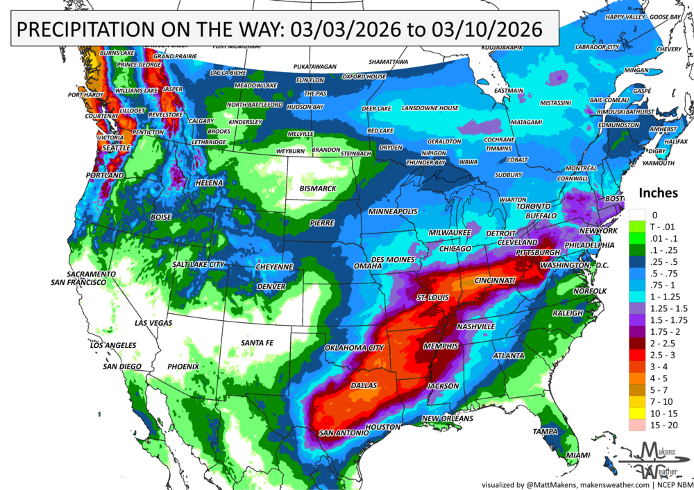


A drawn-out storm pattern will keep much of the country active through the first week of April. A slow-moving front stretching from the Great Lakes into the Plains will separate late-season snow and ice to the north from heavy rain and severe thunderstorms to the south. The setup brings the greatest impacts to parts of the Midwest, Ohio Valley, Southern Plains, Mississippi Valley, and eventually the East Coast, while the West sees mountain snow and then a warming trend heading into the weekend.