

Weekly Weather Watch: Monday, June 10th, 2024
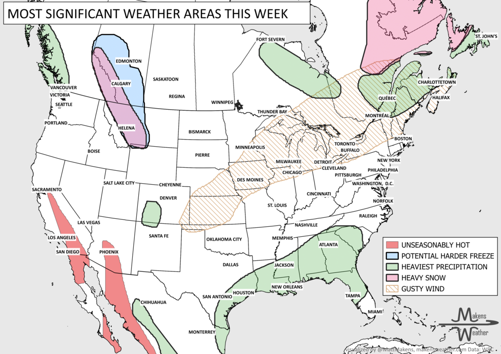
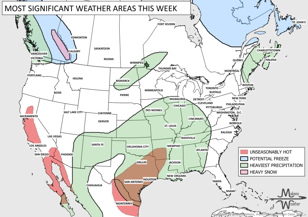
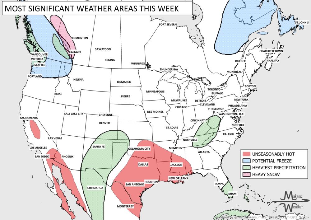
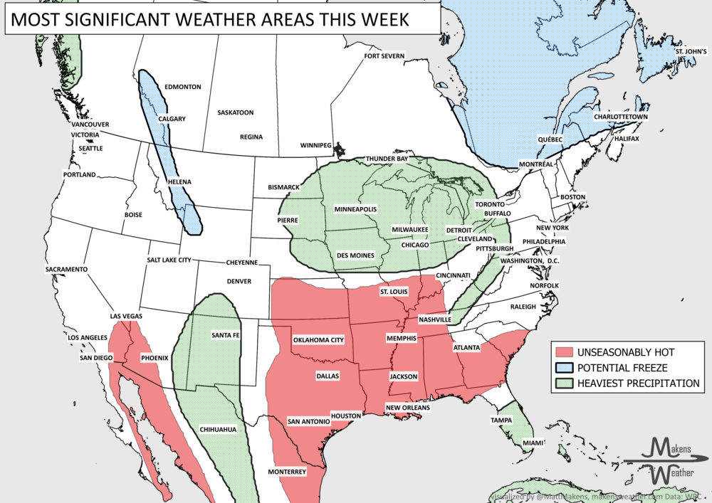
Your weekly briefing on the weather that will be making headlines includes heat and too much rain. Heat will focus on the West and Southwest, stretching to the Central Plains and then onto the Ohio Valley. Heavy rainfall stretched over several days will impact Florida. Here are some other items on your radar:
Strong wind events are possible across the Interior West and High Plains from Saturday through Monday.
Heavy precipitation is possible across the Midwest and Plains Saturday through Monday. Heavy moisture in parts of Western and Central Canada.
Heavy rainfall will be on and off across the Gulf Coast from Saturday through Wednesday.
A rapid increase in drought across parts of South Texas this week.
A damaging frost is possible in parts of Eastern Canada in the next few mornings.

ON THE RADAR: Here is the animation for the week. Note that there are daily risks for severe weather and I try to get those outlooks onto my social media channels each morning.
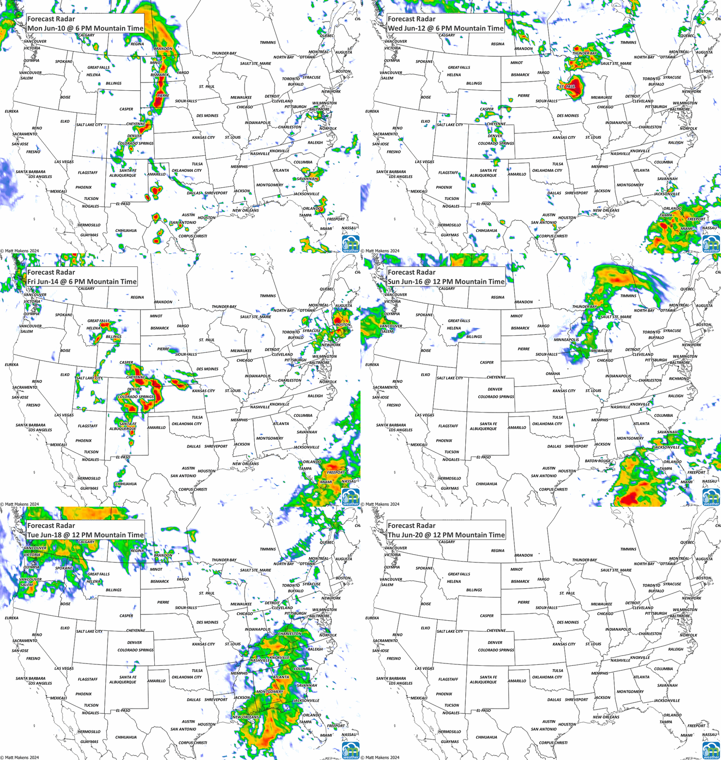
IN THE RAIN GAUGE: There is a bullseye of heavy rainfall over Florida. Also, some notable rainfall from Central Texas to Southwestern Colorado. The Central/Northern Plains to the Upper Midwest can catch more than 2.5” and several locations in Canada will have heavy precipitation - especially Central to Northern Alberta and Saskatchewan.


RECORD BOOKS: There are a number of potential record highs to be set this week; triple digits in Colorado, Arizona, and California.

Those are the big ticket items that will come across your news feeds this week. Until next week, be well. -Matt.
The weather pattern is about to make a pretty sharp turn across the country. California starts the week with unusual October heat, including highs well into the 90s and even lower 100s in the Central Valley. Meanwhile, much cooler fall air has reached the Great Lakes and Northeast. The Gulf Coast and Southeast stay unsettled, and there’s that record to watch: a tropical depression is likely to develop over the Gulf this week and could strengthen as it moves northeast. If it becomes a hurricane after the 8th, 2026 will have the latest-first hurricane in the Atlantic Basin record.