


Weekly Weather Watch: Tuesday, June 25th, 2024
Heat and excessive rainfall are some of the headlines from last week’s weather watch. In this week’s weather briefing, heat and excess moisture are expected. Here are some highlights of items you’ll soon see across your feeds. These weekly weather watches point out what’s ahead, give you the data, and do so without the hype. Monthly subscribers, your July outlook will be in your inbox next week.
THE PATTERN
For this week:
Heat spreads across the Central/Southern Plains to the Southeast.
Severe thunderstorms with flash flooding for the Upper Midwest.
Glimpses of the monsoon for the Southwest/Four Corners Region and Mexico.
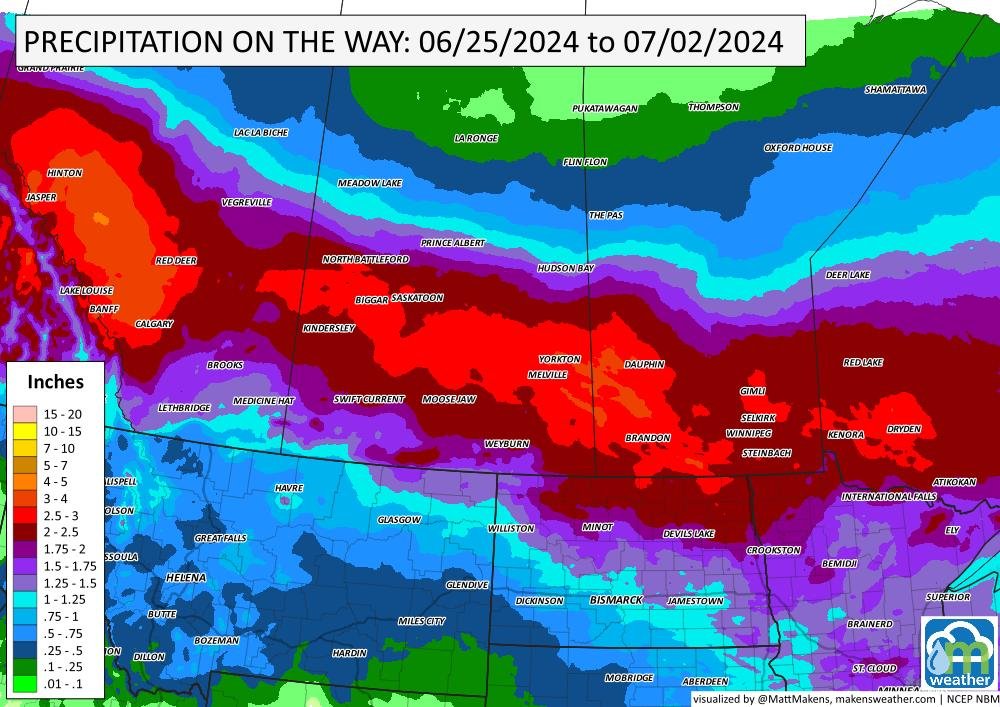
Heavy rainfall spreads across Canada.
No imminent tropical system for the Gulf of Mexico.
For next week:
Heat spreads throughout the Eastern U.S.
Heavy precipitation continues for the Southwest.

ON THE RADAR
Timing:

IN THE GAUGES
Total Precipitation this week: There’s a heavy amount of rain for Mexico, that’ll reach into the Southwestern U.S. as part of a monsoonal surge. Parts of corn country / Midwest receive enough rainfall for some flash flooding. Canada stays in the favored pattern for moisture, too.


THE MERCURY
Record heat this week: There are potentially new record highs across the States this week, here are the locations and the possible max temps.

ARE YOU CIRRUS
Simply, the term “heat wave” refers to a period of abnormally hot weather generally lasting more than two days. Heat waves can occur with or without high humidity and have the potential to cover a large area, exposing a large number of people to hazardous heat. The WMO defines this as five or more consecutive days when the daily max temperature surpasses the average max temperature by 9°F or more. (A previous version of this post included an erroneous definition, now replaced with this latest one.)
Have a great week. - Matt
A busy stretch of summer weather is underway. The greatest concern through midweek will be severe thunderstorms capable of damaging winds, large hail, isolated tornadoes, and flash flooding from the Dakotas into Minnesota and later the Upper Midwest. At the same time, dangerous heat continues across the Southeast, while a strengthening ridge will send temperatures soaring across the Northern Plains and Central U.S. heading into the weekend. Meanwhile, the Southwest monsoon will gradually become more active, bringing increasing rounds of afternoon and evening thunderstorms. In British Columbia and Quebec, smoke is causing or expected to cause poor air quality and reduced visibility.