


Weekly Weather Watch: Tuesday, July 2nd, 2024
The headlines include Hurricane Beryl, hot conditions for Southern Plains, Lower Mississippi and the West, and severe thunderstorms and flash flooding in the Midwest through midweek.
Monthly Members, your July weather outlook was delivered to you yesterday.
THE PATTERN:
For this week:
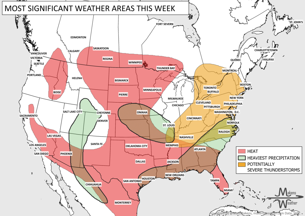
Abnormally hot weather for the West, South, and Southeast through the 8th. The West has a number of potential daily record highs to be set.
Hot weather also hits parts of Canada. From northern Alberta to Northern Manitoba.
Severe weather throughout the Central U.S. this week, including July 4th.
Heavy precipitation for South Texas, depending on the eventual track of Hurricane Beryl.
Heavy precipitation for parts of the Canadian Maritimes.
For next week:
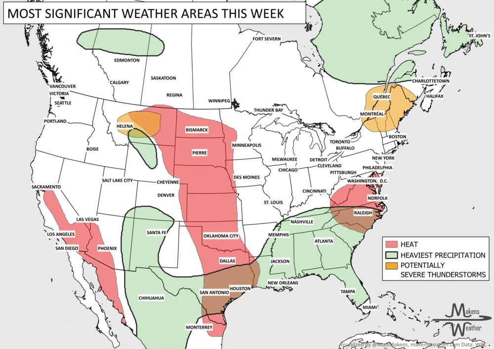
For the West, the hot weather continues through the 12th.
Keep an eye on Hurricane Beryl’s potential impact on Mexico, Texas, and the central Gulf Coast. Its track is far from locked in.

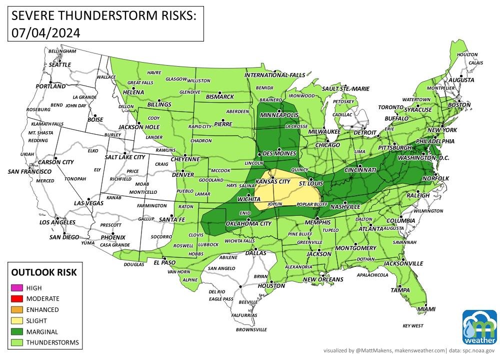
ON THE RADAR
The timing:

Potential severe weather areas:


IN THE GAUGES:
Total precipitation this week: Heavy rainfall continues to focus on the Midwest toward Great Lakes and into Ontario and Quebec. Moisture continues for parts of Mexico into the far southern Southwest. Notice heavy rainfall in pockets from Florida and along the Eastern Seaboard.


THE MERCURY:
Record heat this week: The West holds the highest potential to set several daily record highs.

TRACKING THE TROPICS
Hurricane Beryl’s track: remains favorable for entering the Gulf of Mexico; thereafter, it is too early to say if Mexico will be the landfall or if the storm will turn northward toward Texas and the Gulf Coast States. Use the National Hurricane Center’s information to keep up to date.

ARE YOU CIRRUS
“Hurricane Beryl is the strongest July Atlantic hurricane on record, breaking old record of 160 mph set by Emily (2005). Prior record for earliest calendar year Atlantic hurricane with 165 mph max winds is Allen (1980) on 5 August.” source: Philip Klotzbach, CSU.
Tropical Storm Bertha is one of several weather systems requiring attention this week. Bertha could bring tropical-storm conditions, storm surge and periods of heavy rain to portions of the Florida Panhandle and Alabama coast through Wednesday before tracking westward along the central and western Gulf Coast. Elsewhere, severe thunderstorms and flash flooding may affect a broad area from the Mid-South and Ohio Valley into the Mid-Atlantic and Northeast. Monsoon thunderstorms will continue across the Southwest and Rockies, while dangerous heat gradually expands from the Southern Plains and Southeast into the central Plains and Interior West.