


Weekly Weather Watch: Monday, December 22nd, 2025
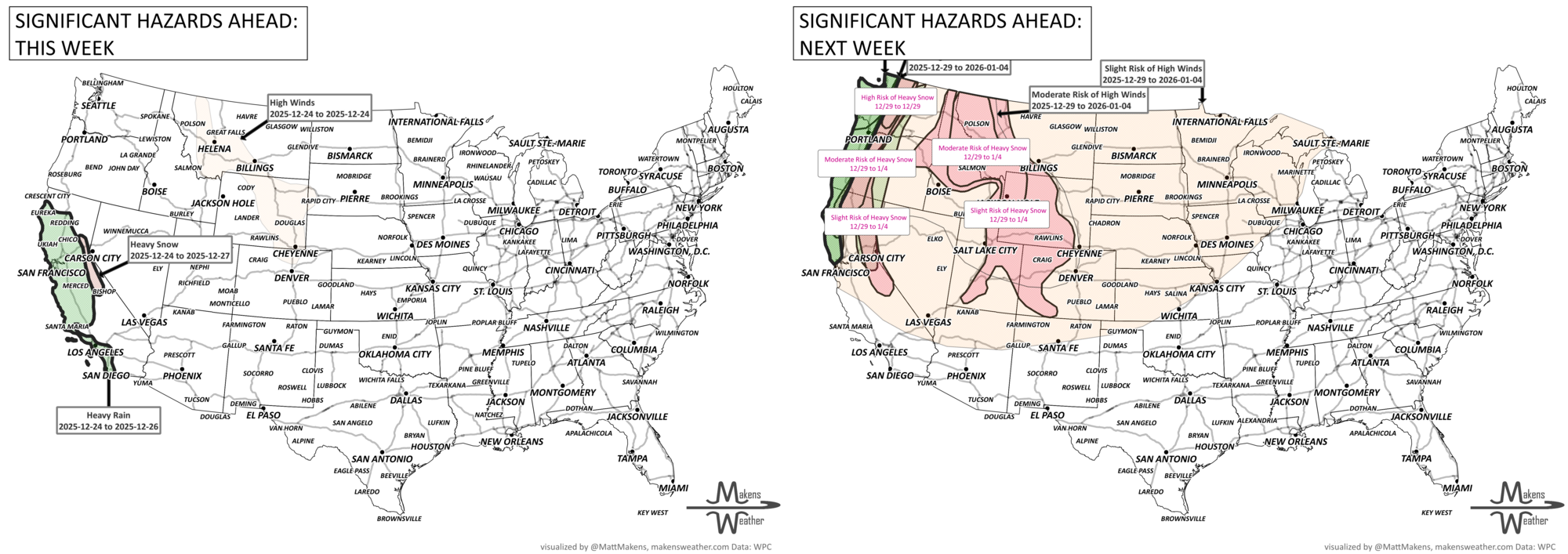
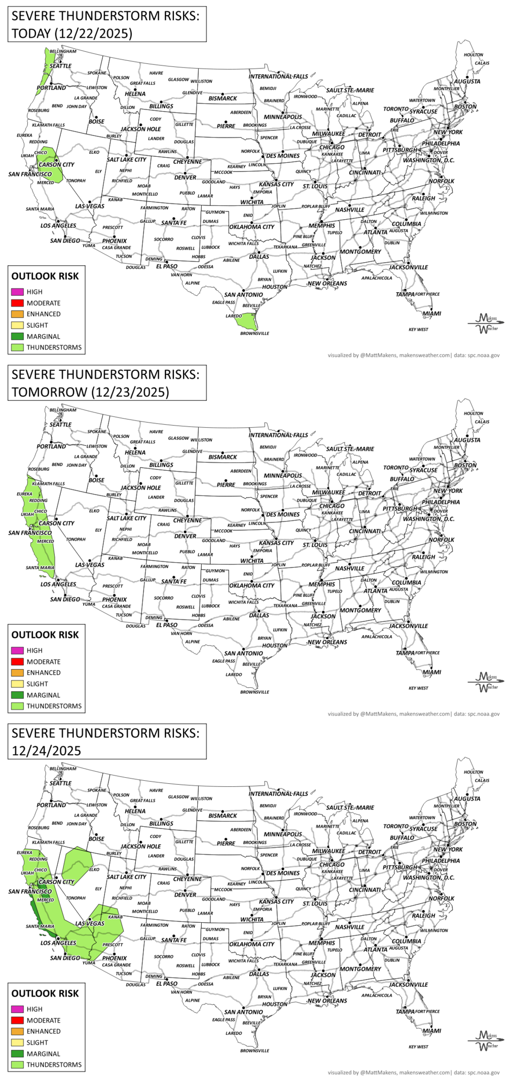
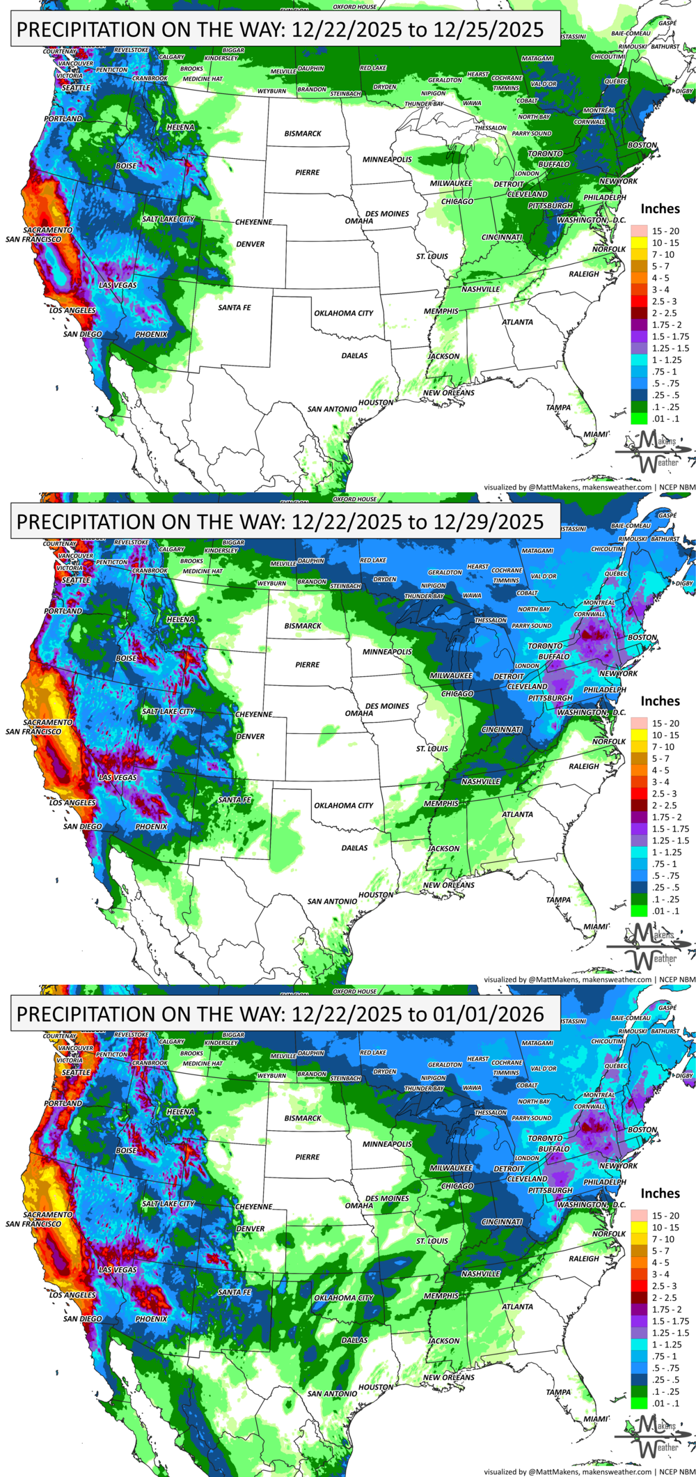
A powerful holiday-week storm pattern will bring impactful weather to several parts of the U.S. through the weekend. California will see another round of atmospheric river-fueled rain, with significant flooding in lower elevations and several feet of snow in the Sierra Nevada. Meanwhile, wintry precipitation could complicate travel across the Great Lakes, Mid-Atlantic, and New England, while the central Plains and parts of the South experience unseasonable warmth and fire weather conditions. Ongoing cold for much of Western and Central Canada, particularly Alberta.
Unlock the Makens Weather Advantage ☀️📊
Your membership includes:
✔️ Real-time dashboard with the latest weather observations and long-range projections
✔️ Monthly-lead forecasts to plan weeks ahead
✔️ Discounts on personalized consultations for ag, energy, or risk planning
All built for decision-makers who need weather insight, not just data.
🎯 Join now and put the forecast to work for you.
📈 The latest outlooks and conditions - track it 👉 Join Now to Access the Dashboard
HEADLINERS:
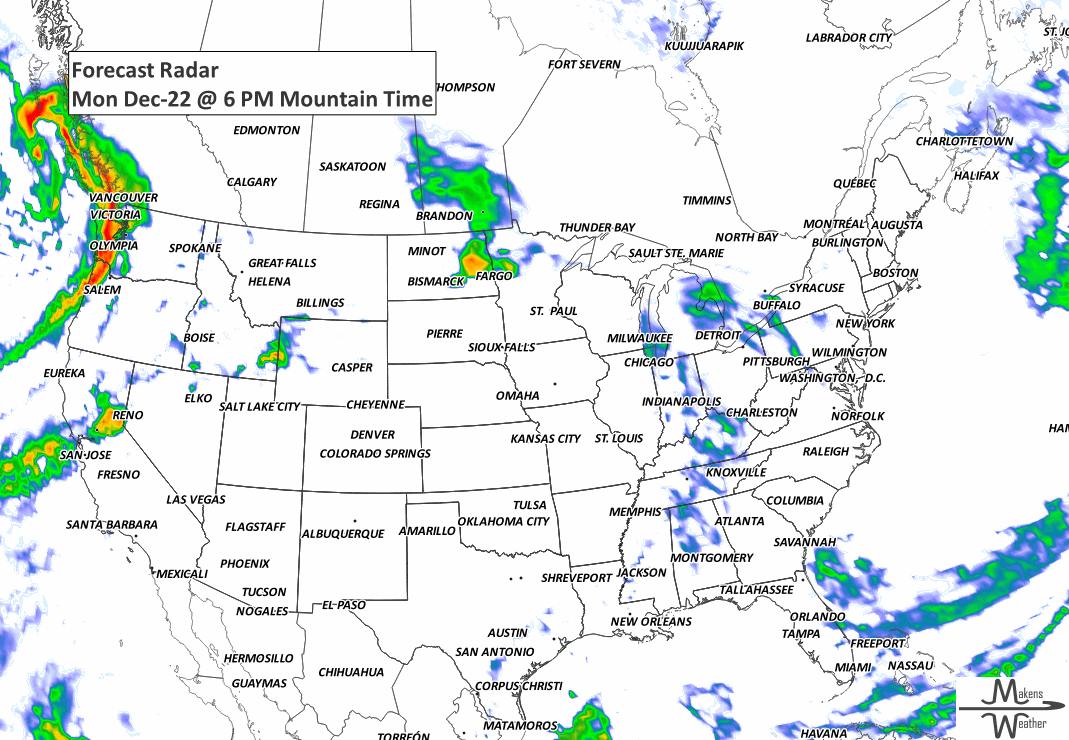
Monday (Dec 22):
Heavy rainfall and flood risk in Northern California.
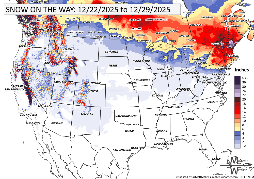
Heavy snow is possible in the Sierra Nevada.
Snow showers around the Great Lakes.
Significant cold/windchills in portions of British Columbia, Alberta, and Saskatchewan.
Tuesday (Dec 23):
Freezing rain/sleet potential in the Central Appalachians and Pennsylvania.
Snow spreads into Northern New England and Eastern New York.
Heavy rainfall expands into Southern California.
Cold continues in Canada.
Wednesday (Dec 24):
Flooding concerns continue in Southern California, especially near burn scars and urban areas.
Snow tapers in the Northeast, with lingering impacts for holiday travel.
Thursday–Friday (Dec 25–26):
Another atmospheric river targets Central and Southern California, with more flooding and heavy mountain snow.
Warmer-than-normal temperatures spread across the Plains, South, and East.
Saturday–Sunday (Dec 27–28):
Storms begin to shift eastward, and rainfall eases in the West.
Wintry mix and snow chances increase across the Upper Great Lakes and Northeast.
KEEP AN EYE TO THE SKY:
IN THE GAUGES:
GRAB A RULER:
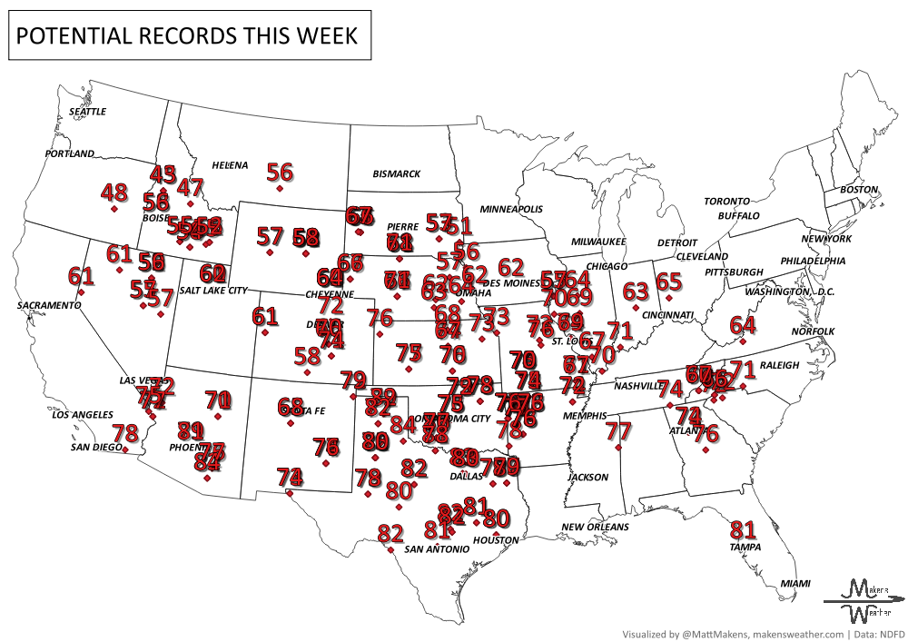
RECORDS MADE TO BE BROKEN:
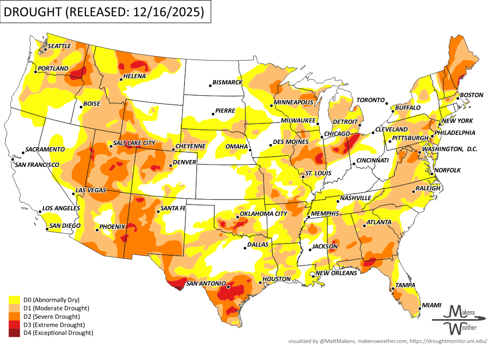
UN-DROUGHTABLY DRY:
This week’s weather brought some drought relief to the Pacific Northwest and northern Rockies thanks to multiple Pacific storms, though mountain snowpack is still below normal for mid-December. Meanwhile, much of the Midwest, Southern Plains, Ohio Valley, and parts of the East missed out on meaningful precipitation, leading to worsening drought in those areas. -U.S. Department of Agriculture
ARE YOU CIRRUS?!
Today in weather history:
1983 Temperatures plunged to -51 in Montana, while Waco, TX reported a record low of 12.
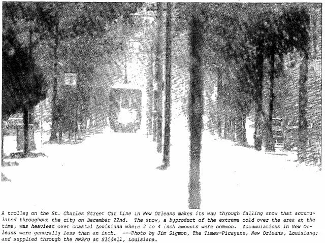
1989: The most significant cold spell of the century for the Deep South occurred from the 22 to the 26. New Orleans experienced 64 consecutive hours at or below 32 degrees Fahrenheit and a total of 81 out of 82 hours below freezing. A total of 15 hours was below 15 degrees with the lowest reading of 11 degrees on the morning of the 23rd. A low temperature of 8 degrees was recorded at Baton Rouge. Snow and sleet paralyzed transportation systems where as much as two to four inches of snow accumulated in Lafourche and Terrebonne Parishes. Snow and ice-covered the ground in New Orleans. The most significant impact was the breaking of water pipes in homes and businesses. Over 100 fires resulted in the New Orleans area within 24 hours due to a loss of water pressure and improperly utilized heating sources. Ice formed over shallow lakes and waterways where commercial fishing took heavy losses. Five weather-related deaths occurred in the service area during this rare Arctic outbreak.
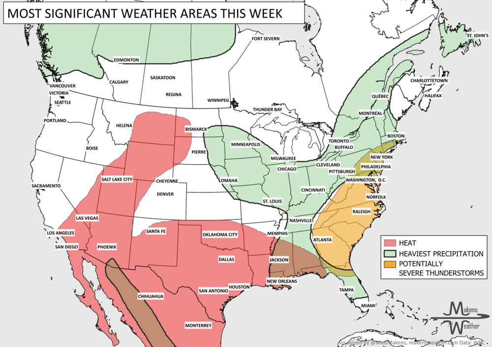
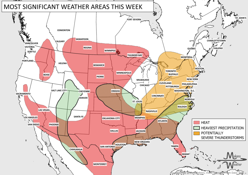
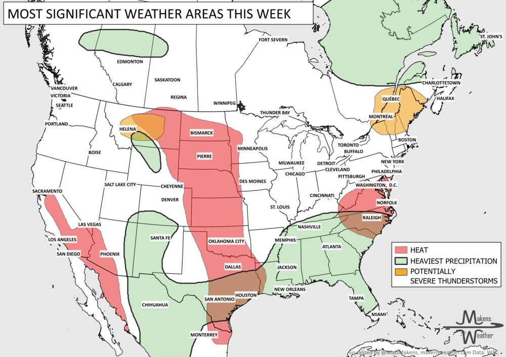
The weather pattern across the United States and Canada remains highly active this week, with two major stories dominating the forecast. Dangerous, long-lasting heat continues across much of the South before expanding into the western United States by the weekend. At the same time, repeated rounds of thunderstorms will bring the threat of flash flooding and severe weather from the Mid-Atlantic and Northeast to parts of the Midwest and Gulf Coast. Residents across these regions should stay weather-aware as heavy rain, damaging winds, and dangerous heat create multiple hazards over the coming week.