

Weekly Weather Watch: Monday, August 26th, 2024
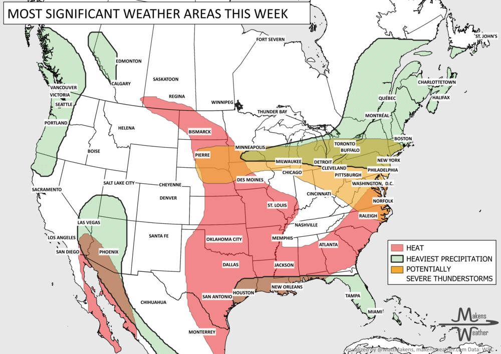
Your weekly weather brief is here. The weather headlines to appear on your feeds this week are: Heat is the biggest issue for the Central U.S. early this week, where a number of daily records are possible and high heat indices. Severe thunderstorms are also possible early this week as a cold front pushes through many regions to scour out the heat.
HEADLINERS:
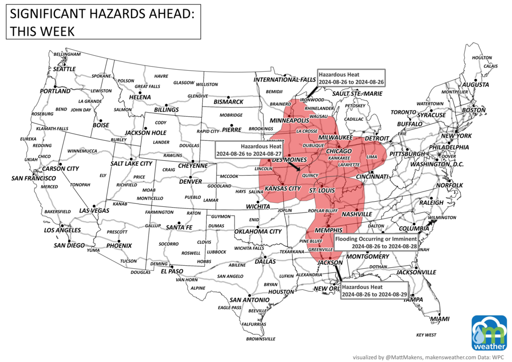
A couple of days of intense heat and humidity expected to impact the Midwest.
Severe storms and isolated flash flooding possible across the Northern Plains/Upper Midwest today and the Great Lakes on Tuesday.
Daily monsoonal thunderstorms shifting eastward into the southern Rockies/High Plains.
Slight risk of heavy precipitation for portions of southern Mainland Alaska, Sat-Mon, Aug 31-Sep 2.
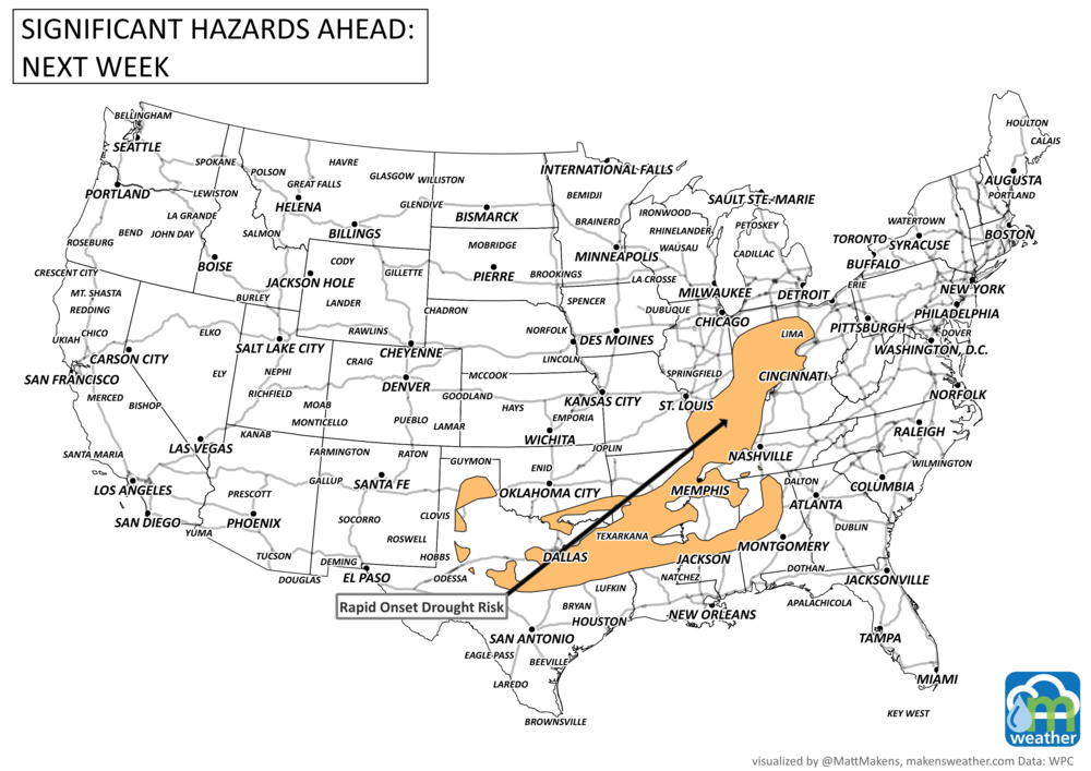
Risk for rapid onset drought for portions of the Southern Plains, and the Ohio, Tennessee, and Lower and Middle Mississippi Valley.
Heavy precipitation for parts of BC but air quality issues throughout much of Canada due to wildfire activity.
List contributions from Environment Canada and WPC.
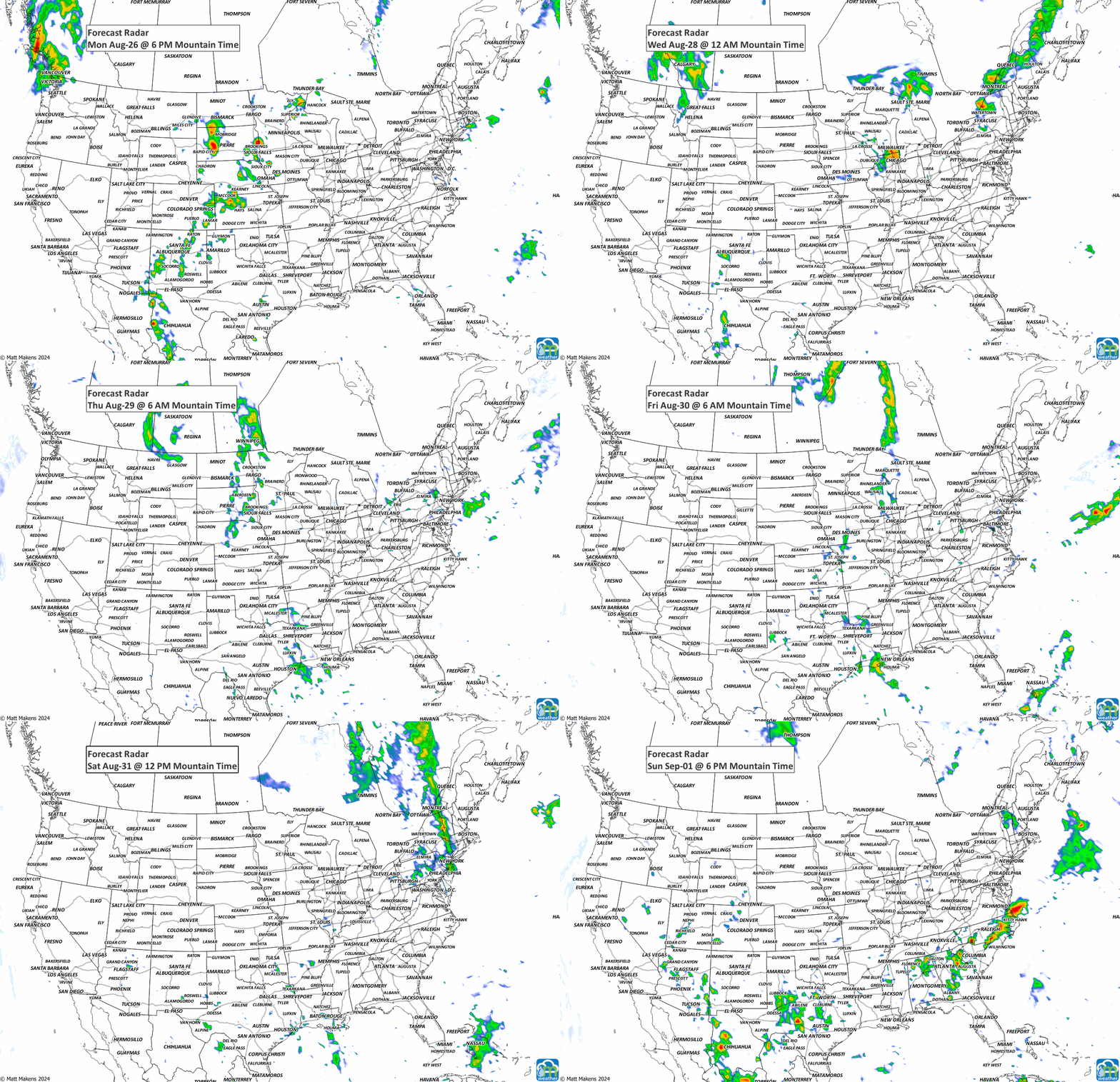
ON THE RADAR:
Animation of the storm segments expected this week, followed by severe weather risks the next three days.

IN THE GAUGES:
Rainfall expected through the week highlights another push of the Southwestern Monsoon for Mexico and New Mexico. With the cold front moving across Canada and the Upper Midwest, rainfall will be higher here, especially over Minnesota and Wisconsin.

RECORDS MADE TO BE BROKEN:

TROPICAL TIDINGS:
Nothing to note at this time…
ARE YOU CIRRUS?!
Abilene, Texas recorded its hottest day Wednesday 8/21 with 113°F; this is the hottest temperature on their record since 1885. The previous record was set August 2023 at 111°F.
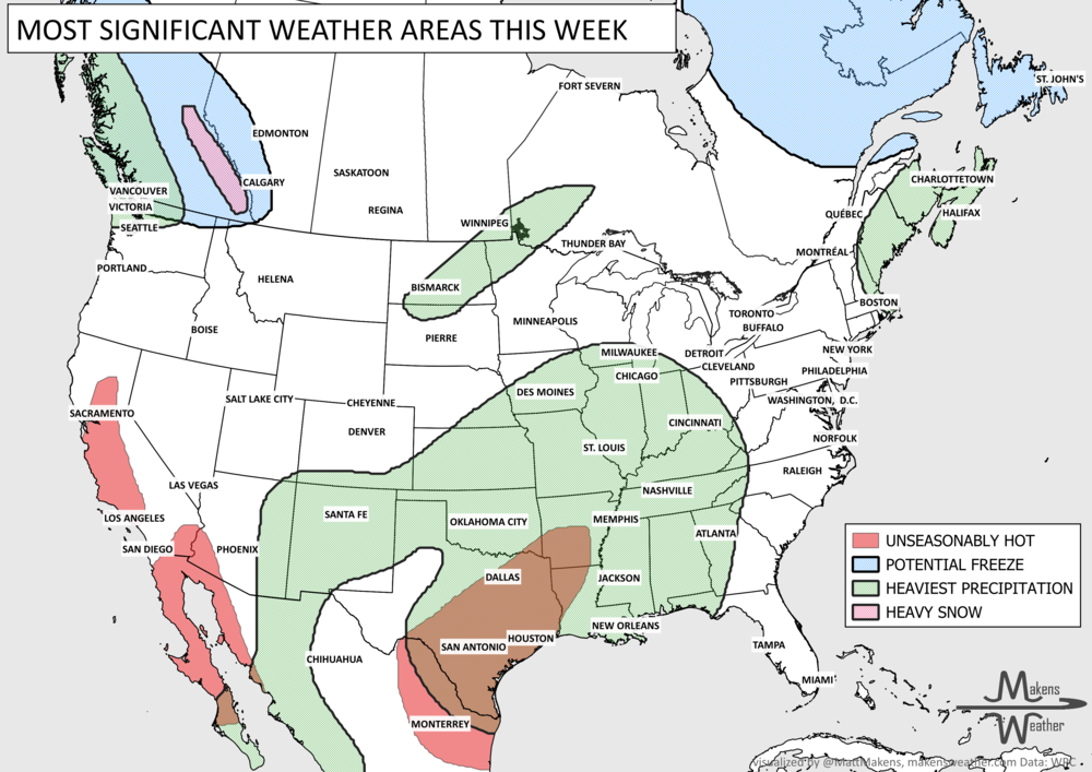
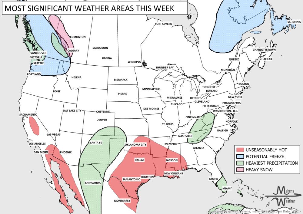
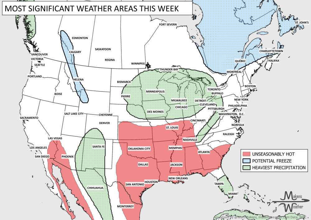
Pacific tropical moisture will drive one of the bigger weather stories this week as it gets pulled north into a slow-moving storm over the Southwest. New Mexico and western Texas face the greatest flash-flood threat early in the week, before heavy rain expands across the Southern Plains, Central Plains and Midwest. Some areas could pick up 3 to 6 inches of rain, with locally higher totals. The wet pattern won’t end quickly either, with the threat gradually shifting east toward the Mississippi and Tennessee Valleys later this week and into the weekend. Meanwhile, the Nor’easter affecting New England is winding down, while late-season heat hangs on across southern Texas and eventually builds across parts of the West.