

Weekly Weather Watch: Tuesday, August 6th, 2024
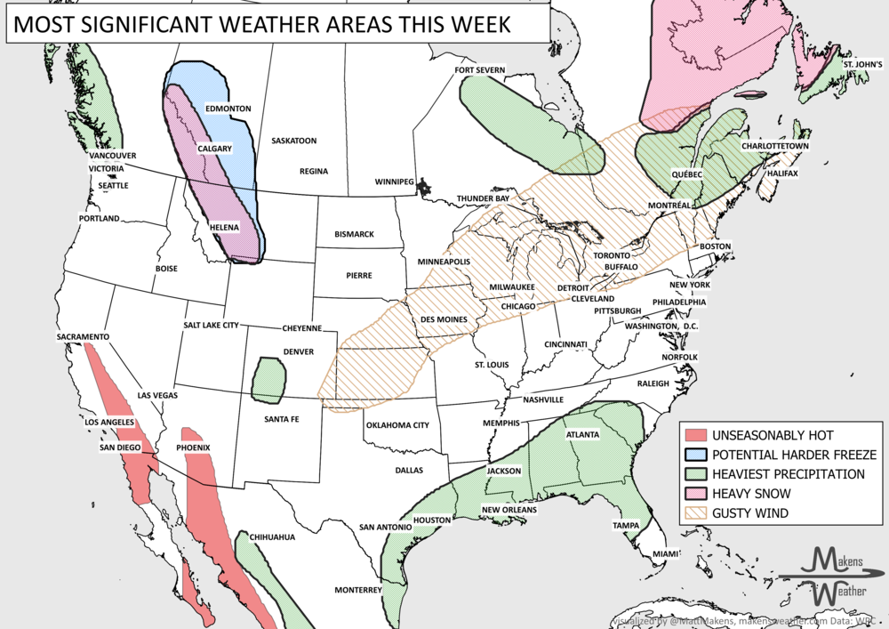
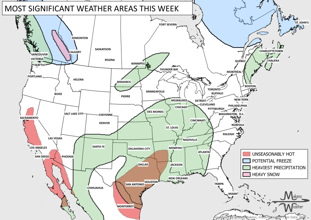
A former hurricane, Debby, continues to track along the East Coast of the U.S. and will deliver a lot of rainfall up the seaboard. Meanwhile, we have some heavy rainfall focused on Colorado and extending into portions of nearby states.
HEADLINERS:
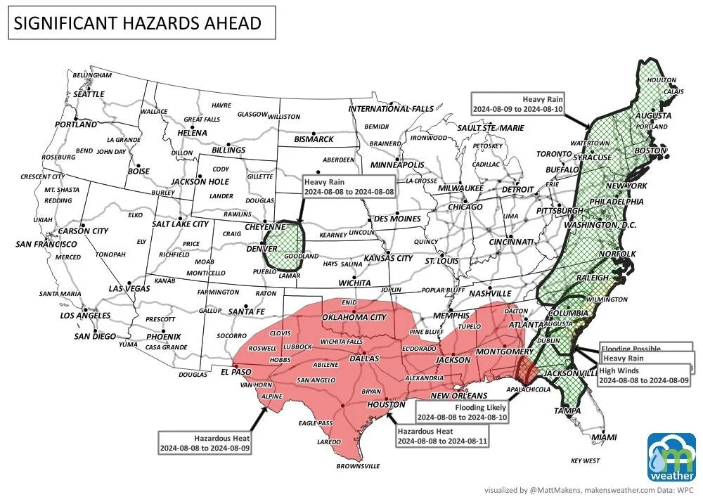
This week:
Tropical Storm Debby is expected to cause potentially catastrophic flash and urban flooding, a life-threatening storm surge, and strong winds across portions of north Florida and the Southeast.
Today, portions of the Northern High Plains, Midwest, Lower Great Lakes, Northeast, and Mid-Atlantic are potentially affected by excessive rainfall and severe thunderstorms.
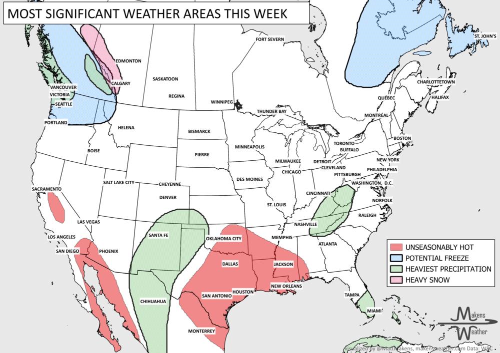
Excessive heat warnings are in effect over parts of Central/Southeastern California and the Southwest, and heat advisories are in effect over parts of the Lower Mississippi Valley.
Much of Canada faces poor air quality due to the ongoing wildfires.
Parts of Ontario and Quebec may see some heavy rainfall.
The Canadian Rockies to western Prairies will have heavy rainfall areas, plus the Maritimes may see what’s left of Hurricane Debby, resulting in wind and heavy rainfall.
In the next two weeks:
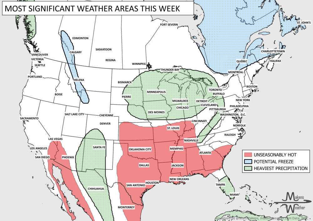
There is a slight risk of excessive heat across much of the central and southern Plains and Lower Mississippi Valley from Tuesday through Monday, August 13-19, 2024.
Flooding is possible over much of the Atlantic Coastal Plain and Piedmont and portions of New England.
Rapid onset drought is possible over part of the southern Plains.
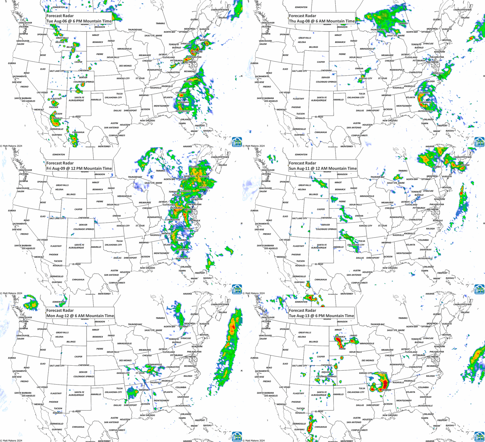
ON THE RADAR:
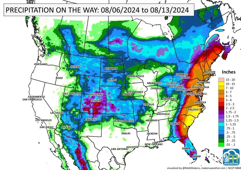
IN THE GAUGES:
Big-time rainfall expected along the East Coast from Debby. Meanwhile, other areas of heavy rainfall will be along the Rockies from Canada to Mexico. For Colorado and surroundings, a cold front combines with monsoonal moisture to produce hefty totals here.


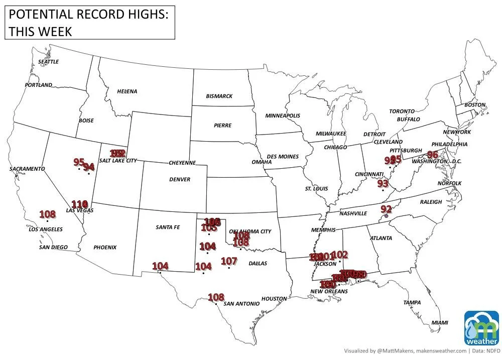
RECORDS MADE TO BE BROKEN:
There is a bit of record heat to go around this week. Here are potential location of such heat.
TROPICAL TIDINGS:
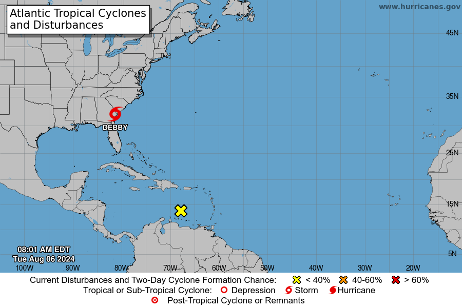
Debby will continue impacting the eastern seaboard toward the Canadian Maritimes this week. Another area of interest for possible development is in the Caribbean indicated by the yellow “X.”
ARE YOU CIRRUS:
Hurricane Debby made landfall in Florida with max winds of 80 mph; the 4th hurricane to make landfall in Florida in August since 2000 (Charley ‘04, Katrina ‘05, and Idalia ‘23).
Also:
The weather pattern is about to make a pretty sharp turn across the country. California starts the week with unusual October heat, including highs well into the 90s and even lower 100s in the Central Valley. Meanwhile, much cooler fall air has reached the Great Lakes and Northeast. The Gulf Coast and Southeast stay unsettled, and there’s that record to watch: a tropical depression is likely to develop over the Gulf this week and could strengthen as it moves northeast. If it becomes a hurricane after the 8th, 2026 will have the latest-first hurricane in the Atlantic Basin record.