


Weekly Weather Watch: Monday, July 29th, 2024
As we draw to a close on July, you can guess where August is headed… a hot and smoky start for the majority of us. In this week’s weather brief, be on the watch for wildfire smoke, record-setting temperatures, a couple areas of super heavy rainfall, in part along a cold front that’ll drive across the northern states this week and may also increase risks of severe thunderstorms. Let’s get to it.
HEADLINERS:
Flash flooding is possible in the Ohio/Tennessee Valleys and central/southern Appalachians early this week.
Scattered severe thunderstorms and heavy rain are forecast across portions of the Northern Plains and Midwest.
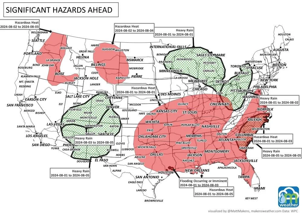
Dangerous mid-summer heat wave to expand across the Central U.S. and Southeast.
Heat, and smoke the biggest issue across Canada, although a few areas of severe weather are also expected - especially northern Alberta and Saskatchewan today and tomorrow.
There is a high risk of excessive heat for parts of the northern intermountain, northern Great Basin, Rockies, and northern and central high plains from Saturday to Monday, August 3-5.
There is a moderate risk of excessive heat for parts of California, the Pacific Northwest, the Great Basin, the Rockies, and the Great Plains from Saturday through Friday, August 3-9.
Moderate risk of excessive heat for the Northeast, eastern Great Lakes, Central Appalachians, and Mid-Atlantic region, Sat-Wed, Aug 3-7.
There is a slight risk of excessive heat for much of the CONUS, except for parts of the Southern Plains, Lower Mississippi and Tennessee Valleys, Southern Appalachians, and Southeast, Sat-Fri, Aug 3-9.
There is a slight risk of heavy precipitation for parts of the Desert Southwest, Sat-Wed, Aug 3-7.
There is a slight risk of heavy precipitation for parts of the Southeast and Lower Mississippi Valley, Sat-Tue, Aug 3-6.
Slight risk of high winds for much of the western CONUS and High Plains, Sat-Wed, Aug 3-7
There is a slight risk of high winds for parts of the Southeast and Lower Mississippi Valley, Sat-Wed, Aug 3-7.
Rapid Onset Drought risk for much of the Great Plains and into western Missouri.
-Source: WPC
ON THE RADAR:
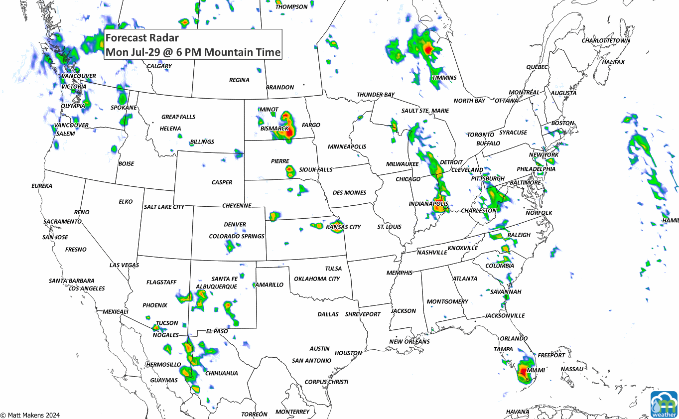
There will be increased chances for damaging/severe thunderstorms this week. For example, Monday and Tuesday’s outlooks are as follows.


IN THE GAUGES:
The Canadian Prairies and the Central to Southern Plains are mostly dry this week. There is a bit of monsoonal flow to produce rainfall in Mexico into the Four Corners Region, a bit of moisture for the Northern Rockies, but most of the water is along/east of the Mississippi River.


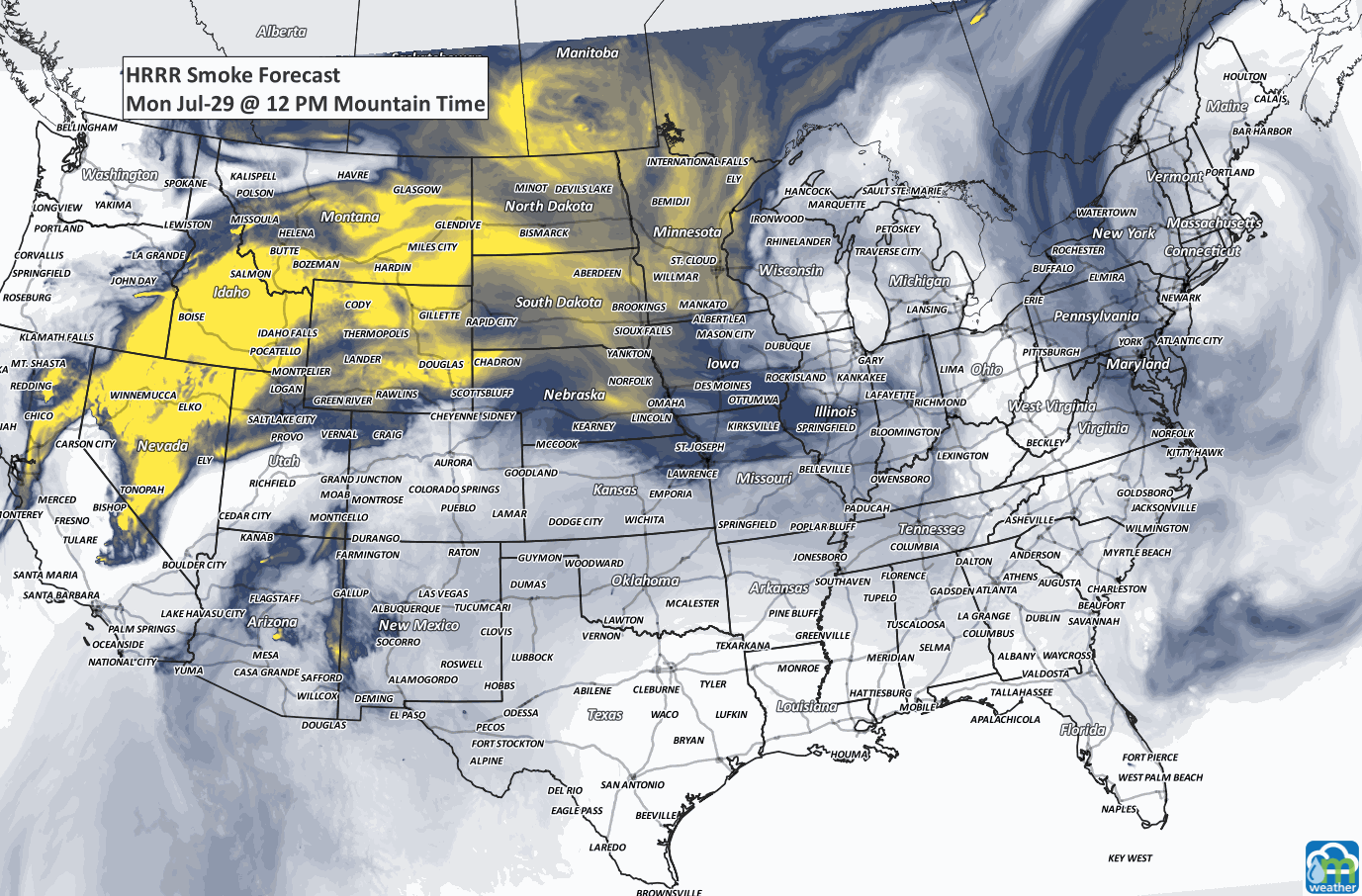
SMOKY BANDIT:
RECORDS MADE TO BE BROKEN:

TROPICAL TIDINGS:
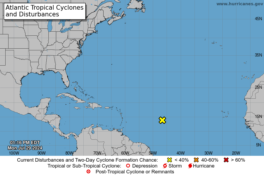
There’s a disturbance in the Atlantic that is capable of developing into a tropical system later this week. The probability for such development between now and Wednesday is quite low, however.
ARE YOU CIRRUS:
Notable July 28th events…
1945 A B-25 bomber crashed into the 79th floor of the Empire State Building due to fog, killing 14 people and causing $1 million in damage
1997 Fort Collins, Colorado was hit by a flood that killed five people and led to the creation of CoCoRaHS, a network of volunteers who monitor rainfall
A busy stretch of summer weather is underway. The greatest concern through midweek will be severe thunderstorms capable of damaging winds, large hail, isolated tornadoes, and flash flooding from the Dakotas into Minnesota and later the Upper Midwest. At the same time, dangerous heat continues across the Southeast, while a strengthening ridge will send temperatures soaring across the Northern Plains and Central U.S. heading into the weekend. Meanwhile, the Southwest monsoon will gradually become more active, bringing increasing rounds of afternoon and evening thunderstorms. In British Columbia and Quebec, smoke is causing or expected to cause poor air quality and reduced visibility.