


Weekly Weather Watch: Tuesday, June 10th, 2025
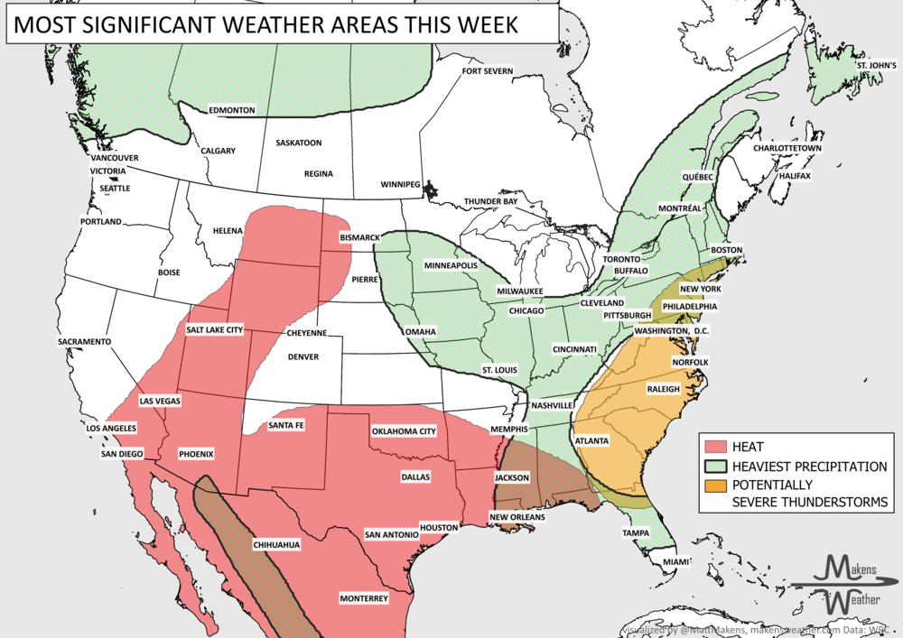
A stalled frontal boundary from the Southern Plains to the Southeast is triggering rounds of heavy rain and strong to severe thunderstorms, especially across Texas and Oklahoma, where flash flooding is a growing concern through Friday. Meanwhile, the Pacific Northwest and Desert Southwest are facing a dangerous heat wave, with highs soaring into the 100s and heat risks reaching major to extreme levels. Breezy, dry conditions in central Washington are also heightening fire weather concerns. Looking ahead to the weekend, widespread showers and storms are expected to expand into the Ohio Valley and Northeast, with continued threats of flash flooding in areas with already saturated soils.
HEADLINERS:

Heavy to excessive rainfall in Texas and Oklahoma through Friday
Severe thunderstorms, including hail and wind, for west Texas
Record heat in the Pacific Northwest easing slightly midweek
Extreme heat (near 120°F) in Death Valley and Desert Southwest
Critical fire weather in central Washington today
Moderate to heavy rainfall likely in the Upper Midwest and Great Lakes
Expanding flood risk from the Gulf Coast to the Northeast by weekend
Heat Risk categories reaching major across the Southwest into next week.
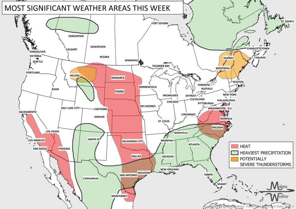
Smoke from wildfire activity in northern B.C. and northern Alberta is causing poor air quality conditions through much of southern Saskatchewan.
Severe thunderstorms hitting parts of eastern Canada, including Quebec.

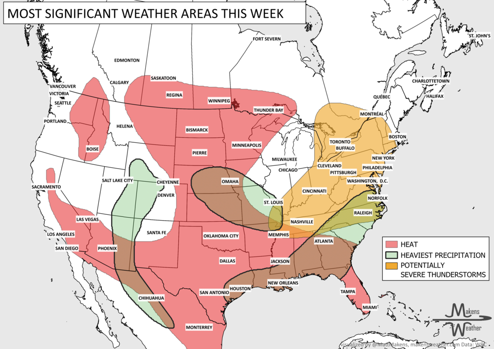
Heavy rain potential mid to late week (June 18–22) from the Central and Southern Plains to the Upper Mississippi Valley
Flooding risk returns to southern Texas from Wednesday through Friday (June 18–20)
Extreme heat building in the Desert Southwest on Wednesday, with triple-digit highs likely
Dangerous heat expands across the Central Plains, Midwest, and Ohio Valley from Wednesday through Saturday (June 18–21)
Heat lingers across the southern Great Lakes and northern Ohio Valley through the end of the week (June 19–21)
Strong winds possible across parts of the Southern Plains throughout the period (June 18–24)
Gusty coastal winds expected from Medford, OR to Point Conception, CA from midweek into early next week (June 18–24)
ON THE RADAR:

KEEP AN EYE TO THE SKY:

IN THE GAUGES:

RECORDS MADE TO BE BROKEN:

ARE YOU CIRRUS?!
1991 Two-day total rainfall topped 30 inches in the western India city of Bombay. This was the heaviest rainfall in four decades.
1953 An F4 tornado hit Worcester, MA causing 94 fatalities. The tornado touched down in Petersham, traveled through Worcester, and on to Southborough. Debris was carried eastward and fell in the Boston area. About 4000 houses and buildings were destroyed, totaling more than $52 million in damages.
The weather pattern across the United States and Canada remains highly active this week, with two major stories dominating the forecast. Dangerous, long-lasting heat continues across much of the South before expanding into the western United States by the weekend. At the same time, repeated rounds of thunderstorms will bring the threat of flash flooding and severe weather from the Mid-Atlantic and Northeast to parts of the Midwest and Gulf Coast. Residents across these regions should stay weather-aware as heavy rain, damaging winds, and dangerous heat create multiple hazards over the coming week.