

A pair of storm systems will bring unsettled weather through midweek, with severe thunderstorms and flash flooding possible in the southern High Plains, Ohio Valley, and parts of the Northeast, including the New York City area. Heavy snow may fall in the higher Rockies, while a slow-moving front lingers over the Southeast, supporting daily heavy rain chances. Temperatures will stay cooler than normal across the southern Plains and Northeast, but much of the West will heat up as the week progresses, with highs reaching into the 100s in the Desert Southwest. Heavy snow and rain for parts of Canada, mostly the mountainous west and high plains of Alberta, and heavy rainfall for parts of the Maritimes.
Read More
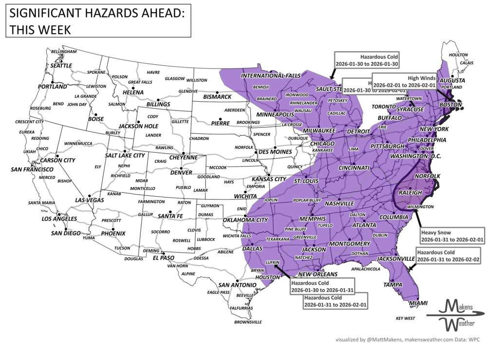
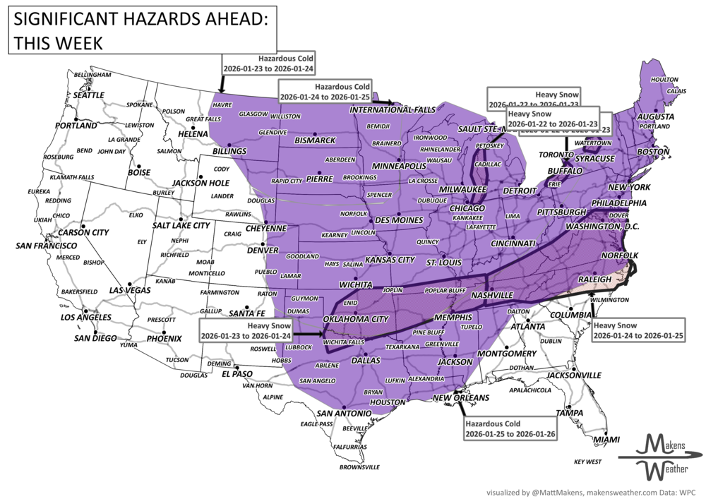
January is closing out with no shortage of winter weather. Frigid temperatures will dominate the eastern U.S. for the rest of the week as another round of arctic air spills southward starting Friday. The cold could break more records as far south as Florida. Meanwhile, forecasters are closely tracking a potentially significant East Coast winter storm this weekend that could bring heavy snow, strong winds, and coastal flooding from the Carolinas to New England. Out West, a soggy pattern continues in the Pacific Northwest, with rounds of rain and mountain snow.