


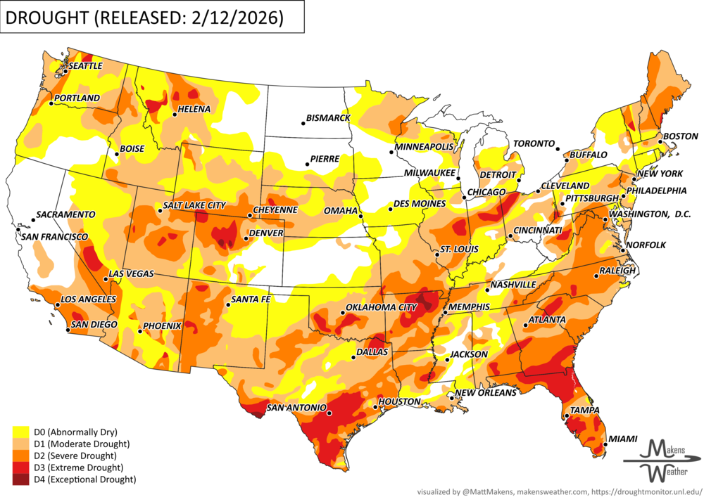
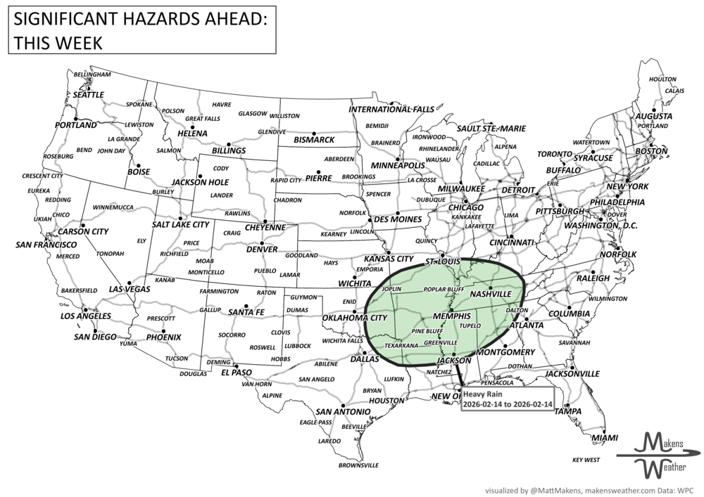

A dynamic weather pattern will dominate the U.S. this week. Scattered showers and lake-effect thunderstorms will linger across the Great Lakes, while breezy, cooler air spreads into the Northeast. The Southern Plains face a growing flood risk by Friday as heavy rain and storms roll in from Oklahoma to Louisiana. Meanwhile, Tropical Storm Melissa has formed in the Caribbean, with potential impacts for Haiti and Jamaica by late week—though the track remains highly uncertain. Out West, a shift toward colder weather will bring rain to the Pacific Northwest and snow to the Rockies by the weekend. And in southern Texas, unseasonable heat continues with record highs and heightened fire weather concerns. Across Canada, areas of strong wind for the West along with heavy precitation from British Columbia to the mountainous areas of Alberta. Pockets of heavy moisture will hit sections of Ontario and Quebec.
Read More
An active weather pattern is unfolding across much of the United States this week. Severe thunderstorms and flooding rains will develop from the Plains into the Midwest, while late-season snow and icy conditions affect parts of the Great Lakes and northern New England. Meanwhile, the Pacific Northwest faces heavy rain and mountain snow, and unusually warm spring temperatures continue across much of the East and Southwest.
Several storm systems will move across the country through mid-week and into the weekend, bringing a mix of severe storms, winter weather, heavy rain, and record-setting warmth depending on location.