


Weekly Weather Watch: Wednesday, December 4th, 2024
A strong cold front will sweep across the Great Lakes today and into the Northeastern US and Canadian Maritimes on Thursday. Expect intense bursts of heavy snowfall and gusty winds. Remaining behind this front is freezing rain and heavy snowfall in parts of Canada. Here are other items to keep track of in this week’s Weather Watch.
Also, Members, you should have received your monthly forecast on the 1st. That subscriber content can be accessed here: December Outlook
HEADLINERS:
Arctic cold will spread across the Northeast and Eastern US.
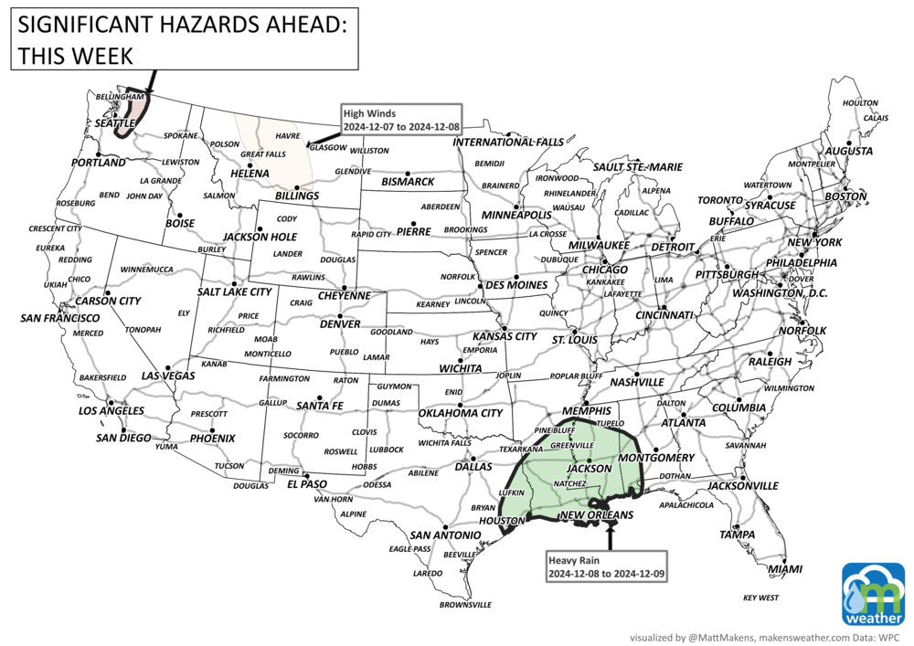
Heavy rainfall from the west-central Gulf Coast to the Appalachians this weekend to early next week.
Slight risk of much below normal temperatures across portions of the Southern Plains and Lower Mississippi Valley, Thu, Dec 12.
Slight risk of heavy precipitation across portions of the Northeast, Thu, Dec 12.
Slight risk of heavy precipitation across portions of the Pacific Northwest and the northern half of California, Thu-Mon, Dec 12-16.
Slight risk of heavy snow across portions of the Interior Northeast, Thu, Dec 12.
Slight risk of heavy snow across portions of the Cascades, Klamath, and Sierra Nevadas, Thu-Mon, Dec 12-16.
Slight risk of heavy snow across portions of the Northern and Central Rockies, Thu-Mon, Dec 12-16.
Slight risk of high winds across portions of the Great Lakes and Northeast, Thu, Dec 12.
Slight risk of high winds across much of the northwestern quadrant of the CONUS extending into the Northern and Central Plains, Thu-Mon, Dec 12-16.

ON THE RADAR:
IN THE GAUGES:

GRAB A RULER:

RECORDS MADE TO BE BROKEN:

ARE YOU CIRRUS?!
On this date in weather history
1902 Brutally cold temperatures of -42.7 did not deter firefighters in Dawson, Yukon from attacking a fire at the Empire Hotel. Despite intense heat caused by the fire, many firefighters' nosetips were frozen and fire hoses flowing at full pressure were frozen in 2 hours.
A prolonged and dangerous heat wave will dominate the weather story this week as much of the central and eastern United States experiences some of the hottest weather of the year. Heat index values above 100 degrees will become widespread, with some communities seeing readings between 105 and 115 degrees and little relief at night. At the same time, several rounds of severe thunderstorms are expected from the High Plains through the Upper Midwest and Northeast, bringing the threat of damaging winds, large hail, and localized flash flooding. Out West, cooler-than-normal temperatures will continue while dry conditions keep wildfire concerns elevated across parts of the Four Corners and Great Basin. Air quality is an issue across Alberta to Quebec due to wildfire smoke. Heavy precipitation is possible from far eastern Saskatchewan to far western Manitoba.