Weekly Weather Watch: Monday, February 5th, 2024
Here’s your weekly weather briefing on the weather headlines coming to you through next weekend.
You have probably heard of all the flooding in California, heavy precipitation will continue there as the Atmospheric River events ebb and flow.
A strong system is expected to develop this week, spreading more heavy snowfall to the Rocky Mountains and then onto parts of the Northern Plains.
Much warmer than “normal” temperatures will continue across the Northern Plains and Midwest until that system arrives later this week.
Significant rain will continue over the South, too.
For Canada, heavy precipitation for Coastal B.C. and parts of the mountains, but the most widespread moisture will continue across the East, especially the Maritimes. For the Prairies, some snow is coming your way.
For Alaska, several Pacific storm systems move toward the Gulf, bringing coastal rain and snow to the southern mountains.
For Hawaii, high pressure north of you will play with the trades and may bring a few showers to the windward side of the mountains, but overall, it will be a drier airmass.
Let’s look at the animation, showing you when precipitation may hit your area.
From that, let’s turn to total water, with incredible totals for Southern California, Arizona, the Rockies, and areas of the South. All those red areas are over two inches, with probable totals of three to ten inches for parts of California.
That previous map is of total precipitation, including frozen precipitation for many. Let’s look at snowfall totals now.
Parts of the Sierras and Rockies will receive several feet of snowfall during the next ten days. It’s worth zooming into the North to see that snowfield possible across Montana and North Dakota. Similar totals will spread into the Canadian Prairies (SK primarily).
Temperatures may remain a concern for some industries, specifically agriculture and energy. There are hints of a cold snap beyond this period. If this impacts your operations, make sure to reach out to us or our partnership companies, which you may be a client of, to get that timeline and magnitude.
Have a great week! -Matt PS: We had a wonderful time in Orlando for CattleCon24 with dozens of great discussions. If we met, thank you for stopping by to say hello, and I look forward to connecting again in the future.

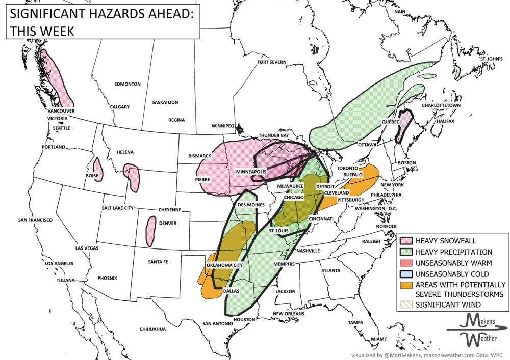
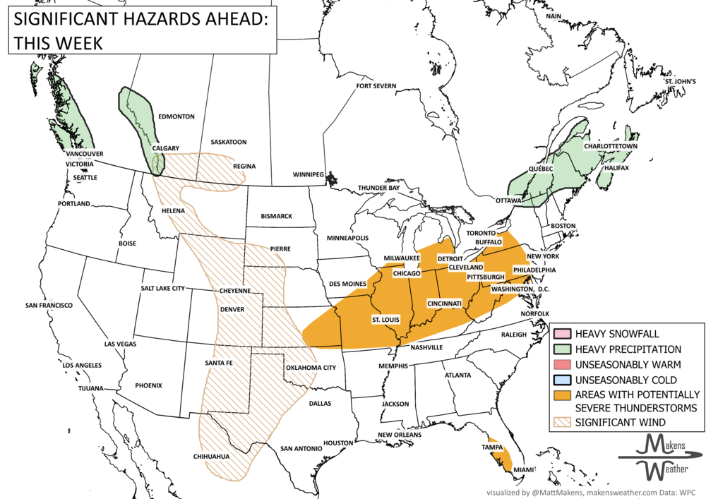
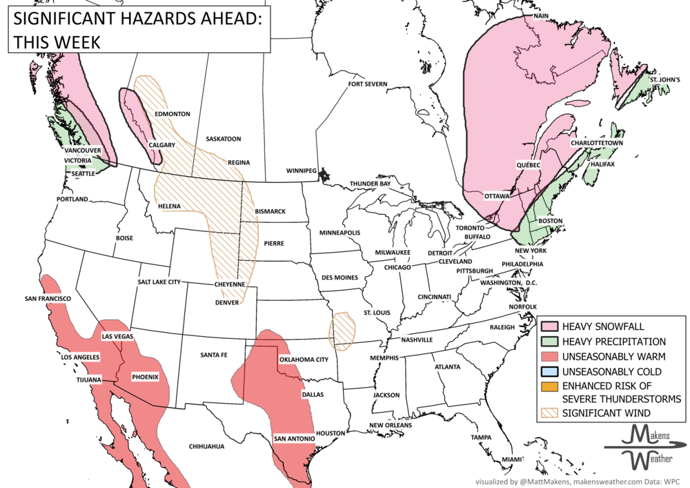
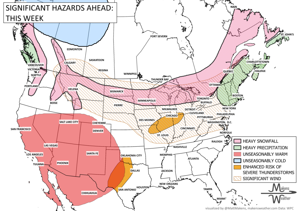
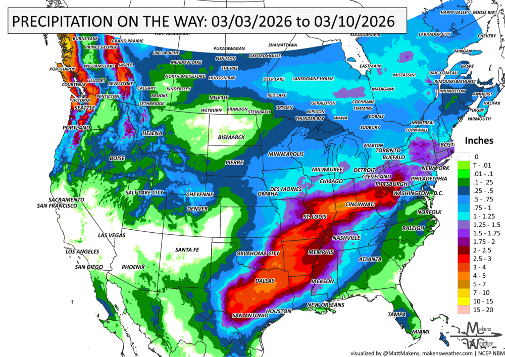


A drawn-out storm pattern will keep much of the country active through the first week of April. A slow-moving front stretching from the Great Lakes into the Plains will separate late-season snow and ice to the north from heavy rain and severe thunderstorms to the south. The setup brings the greatest impacts to parts of the Midwest, Ohio Valley, Southern Plains, Mississippi Valley, and eventually the East Coast, while the West sees mountain snow and then a warming trend heading into the weekend.