Weekly Weather Watch: Monday, July 15th, 2024
Heat and heavy rainfall fill the headlines that you will be hearing this week. Before I break those down, MONTHLY MEMBERS, I posted a mid-month update to your most recent discussion, click here to access.
THE PATTERN
Here are the big-ticket items for the next two weeks (note that at the moment, there are no suspect areas in the hurricane regions).
This week:
Heatwave and wildfire threats to build over much of the West this week and into next week.
Air quality and heat are an issue across much of Western Canada for BC and AB. Eastern Canada has heat to deal with for the Maritimes.
Heavy rainfall threat for the Four Corners States and South-Central Rockies/High Plains and also the South/Southeast and southern Mid-Atlantic.
Chances for damaging thunderstorms as severe weather focuses on parts of the Plains, Midwest, and East today and tomorrow.
Next week:
High risk of excessive heat across portions of the Great Basin, Northern Rockies, and Northern High Plains, Sat-Mon, Jul 20-22.
Moderate risk of excessive heat across portions of the interior Pacific Northwest, Great Basin, California, Desert Southwest, Rockies, and Northern and Central High Plains, Sat-Wed, Jul 20-24.
Slight risk of excessive heat across much of the western CONUS and High Plains, Sat-Fri, Jul 20-26.
Moderate risk of heavy precipitation across southeastern Virginia and the Carolinas, Sat-Sun, Jul 20-21.
Slight risk of heavy precipitation across portions of the southern Mid-Atlantic, southern Appalachians, Southeast, and Tennessee Valley, Sat-Tue, Jul 20-23.
Slight risk of periods of heavy precipitation for portions of the Southwest and Central and Southern Rockies, Sat-Fri, Jul 20-26.
Slight risk of episodic high winds for portions of California and the Pacific Northwest, Sat-Mon, Jul 20-22.
Rapid Onset Drought risk for portions of the Ohio, Tennessee, and Lower Mississippi Valleys, and Northern Plains.
-List compiled from WPC data/text
ON THE RADAR
POTENTIAL SEVERE WEATHER AREAS:
IN THE GAUGES
Total precipitation this week: Heavy rainfall will focus on two primary regions, the Four Corners/Southwest and the Southeastern Coast. Another dry week on tap for much of the West, Northwest, and Canadian Prairies - eastern Canada to cash in on more moisture. For New Mexico and Colorado, some areas of 3+ inches are on the way this week, valuable rainfall continues from this area toward the east to give the Plains a drink. The Southeast will have areas of more than six inches of rainfall.
MERCURY RISING
A look at the potential daily record highs to be set this week. Denver broke a 146-year-old record over the weekend. Weather5280 has that and the outlook for Colorado. Click here to access.
ARE YOU CIRRUS?
Rare for this part of Colorado, a landspout was recorded just west of Castle Rock - an area that has many bluffs/mesas in the foothills. Not a total stranger to tornadoes - there have been a few, but it sure isn’t common for a landspout here. This post discusses what a landspout is versus dust devils and tornadoes.

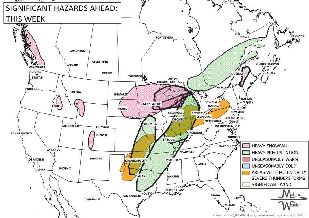
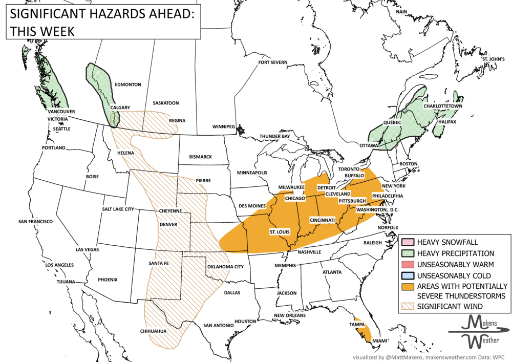
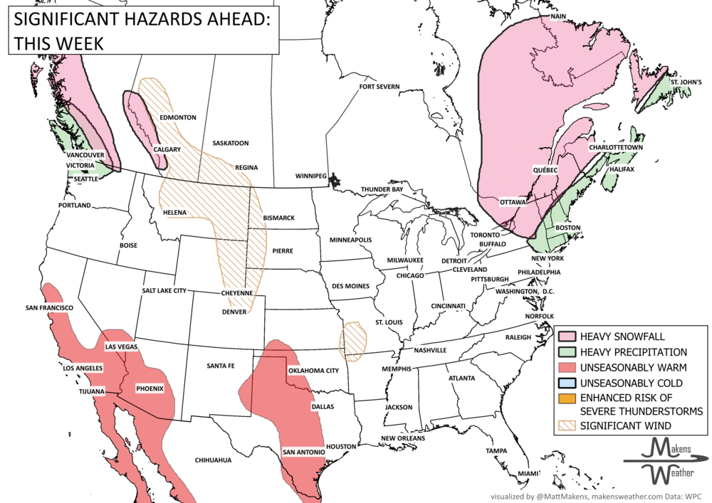
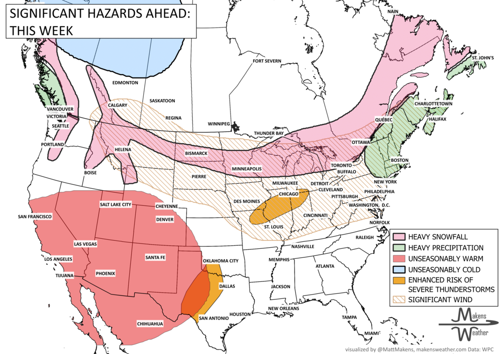
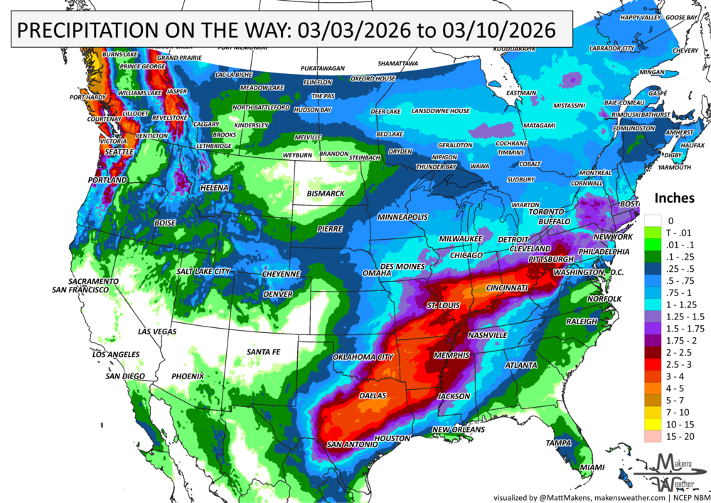


A drawn-out storm pattern will keep much of the country active through the first week of April. A slow-moving front stretching from the Great Lakes into the Plains will separate late-season snow and ice to the north from heavy rain and severe thunderstorms to the south. The setup brings the greatest impacts to parts of the Midwest, Ohio Valley, Southern Plains, Mississippi Valley, and eventually the East Coast, while the West sees mountain snow and then a warming trend heading into the weekend.