

Weekly Weather Watch: Monday, July 22nd, 2024
We are trending hotter and drier across much of the county… This week, headlines revolve around potential records to be set for the Northern Rockies and Northwest, as well as heavy rainfall for the Four Corners and South Texas regions. Here are the items that’ll cross your news feeds from the weather department this week.
A quick shoutout to all those involved with and who attended this year’s OCA meetings in Oklahoma - I know my message wasn’t what you wanted to hear. Still, you are prepared for your drought growth, and as discussed, I’ll keep you posted on the evolution of the pattern’s strength throughout the months ahead. Thank you to Farm Data Services for sponsoring the weather outlook again this year.
HEADLINERS:
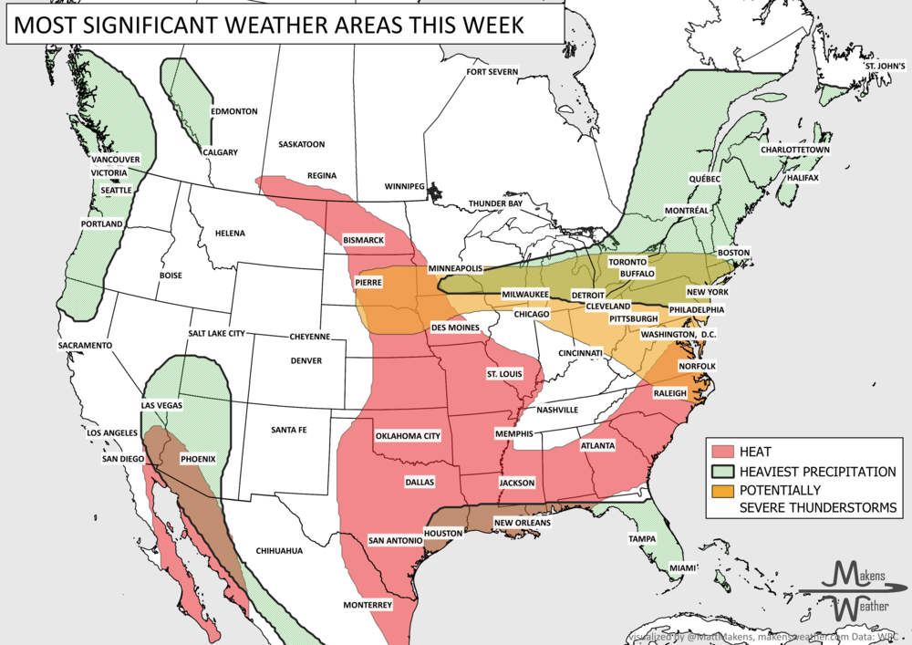
Heat and air quality issues expand to cover parts of B.C., and most all of Alberta and Saskatchewan.
Heat shifts toward the Northern Rockies/Northern High Plains.
Thunderstorms with heavy rainfall are expected in the Four Corners region and from the western Gulf Coast into parts of the East.
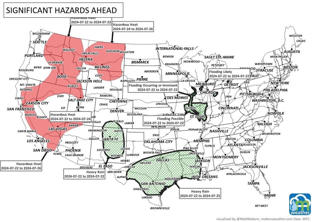
Topics identified by WPC that we will likely discuss in next week’s Weekly Weather Watch:
Moderate risk of excessive heat for parts of the Northern Plains and Upper Mississippi Valley, Sat-Sun, Jul 27-28.
Moderate risk of excessive heat for parts of the northern Great Lakes and the Northeast, Sun-Tue, Jul 28-30.
Slight risk of excessive heat for parts of the Northern Rockies, Northern and Central Plains, Upper Mississippi Valley, Great Lakes, Ohio Valley, Mid-Atlantic, and the Northeast, Sat-Fri, Jul 27-Aug 2.
Slight risk of episodic high winds for much of the western CONUS, Sat-Mon, Jul 27-29.
Rapid Onset Drought risk for portions of the Northern and Central Plains.
ON THE RADAR:

IN THE GAUGES:


RECORDS MADE TO BE BROKEN

ARE YOU CIRRUS?
July 22, in weather history
1918 A lightning bolt struck 504 sheep dead in their tracks at the Wasatch National Forest in Utah. Sheep often herd together in storms, so the shock from the lightning bolt was passed from one animal to another.
2003 It was the hottest night in history for a city known for its sizzling temperatures as the mercury in Phoenix, AZ managed to fall to only 96 degrees.
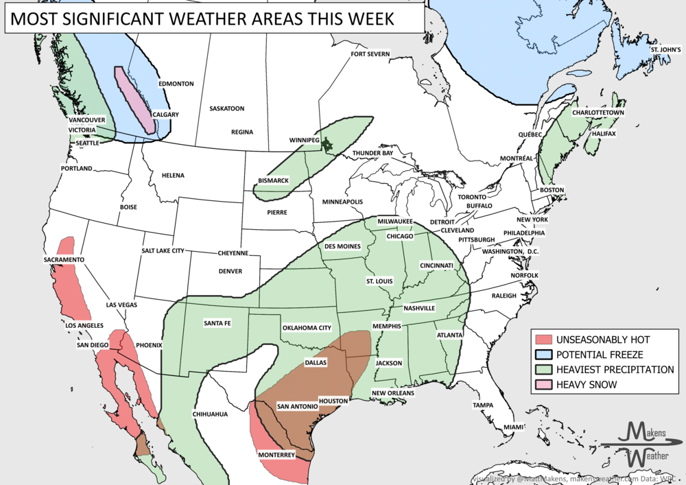
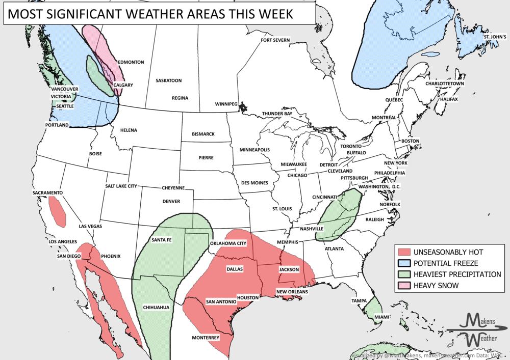
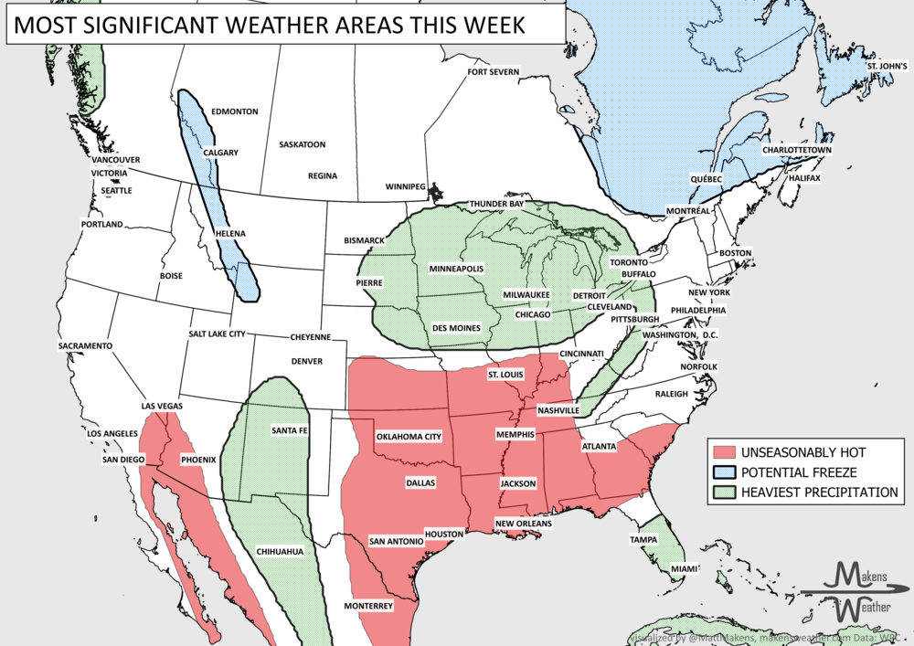
Pacific tropical moisture will drive one of the bigger weather stories this week as it gets pulled north into a slow-moving storm over the Southwest. New Mexico and western Texas face the greatest flash-flood threat early in the week, before heavy rain expands across the Southern Plains, Central Plains and Midwest. Some areas could pick up 3 to 6 inches of rain, with locally higher totals. The wet pattern won’t end quickly either, with the threat gradually shifting east toward the Mississippi and Tennessee Valleys later this week and into the weekend. Meanwhile, the Nor’easter affecting New England is winding down, while late-season heat hangs on across southern Texas and eventually builds across parts of the West.