




Weekly Weather Watch: Tuesday, September 10th, 2024
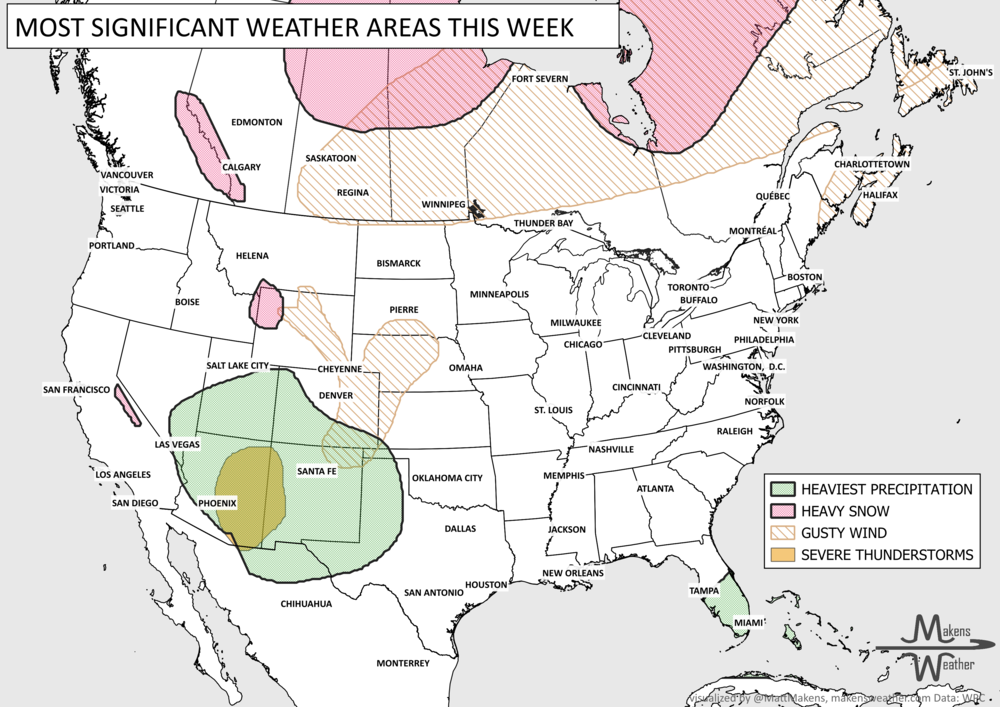
Tropical Cyclone Francine will hit the Gulf Coast, spreading dangerous storm surge, wind, and flooding across the Delta Region. That is the primary headline in this week’s weather brief. The others will include moisture spreading across the Pacific Northwest and Northern Rockies, air quality issues related to wildfires in Western to Central Canada, and a frost to form in New Brunswick.
HEADLINERS:

Hazards for this week:
Now through the 12th, hurricane force wind and storm surge possible across the Southern Delta.
The 11th through the 15th, heavy rainfall associated with a tropical cyclone will spread inland from the Gulf Coast to the Tennessee Valley.
Frost will spread across parts of New Brunswick Wednesday morning.
Heavy precipitation to fall on the Northern Rockies Thursday.
Hazards for next week:
There is a slight risk of heavy precipitation for portions of the coastal Mid-Atlantic and Southeast, Tue-Fri, Sep 17-20.
There is a slight risk of high winds for portions of the Mid-Atlantic and Southeast coasts Tue-Fri, Sep 17-20.
There is a slight risk of heavy precipitation for portions of the Northern Plains and Upper Mississippi Valley, Tue-Fri, Sep 17-20.
Slight risk for episodes of high winds for a large portion of the Southern and Central Rockies and Central and Northern Plains, Tue-Thu, Sep 17-19.
ON THE RADAR:

IN THE GAUGES:

TROPICAL TIDINGS:
KEY MESSAGES:
1. There is a danger of life-threatening storm surge for portions of the Upper Texas and Louisiana coastlines where a Storm Surge Warning is in effect. Residents in the warning area should follow advice, including evacuation orders, given by local officials.
2. Damaging and life-threatening hurricane-force winds are expected in portions of southern Louisiana on Wednesday, where a Hurricane Warning is in effect. Preparations to protect life and property should be completed by tonight since tropical storm conditions are expected to begin within this area early Wednesday.
3. Francine is expected to bring heavy rainfall and the risk of considerable flash flooding for much of Louisiana and Mississippi through Thursday. Flash and urban flooding is probable across portions of northeast Mexico and far southern Texas into early Wednesday and the Mid-South Wednesday night into Friday morning.

ARE YOU CIRRUS?!
On this day in weather history:
2003 A Florida couple won $21 million when they bought the winning lottery ticket while shopping for a surge protector after lightning had struck their TV set.
1976 Tropical Storm Kathleen hit San Diego, CA causing widespread flooding and producing 72 mph wind gusts. It is one of the few tropical systems to hit that area.
A nor'easter will continue to cause problems along the Mid-Atlantic coast through midweek, with coastal flooding, beach erosion and dangerous marine conditions. Meanwhile, a storm moving into the West will pull unusually high amounts of moisture into the Southwest and Four Corners, increasing the risk of flash flooding Wednesday and Thursday. That storm will eventually spread rain and thunderstorms into the Plains this weekend, with some locally heavy rainfall possible. Snow is also likely in the higher elevations of the Sierra Nevada and Rockies. Temperatures will run cooler than normal across much of the West, while the Central U.S. stays unusually warm for late October. Another Pacific system will bring precipitation into the Northwest this weekend, and parts of Florida could see repeated rounds of heavy rain.