


Weekly Weather Watch: Tuesday, September 17th, 2024
There is an enhanced risk of severe thunderstorms is forecast across the high plains Tuesday, wind gusts up to 70mph and large hail are possible. Heavy rainfall continues along the East Coast from the tropical cyclone through mid-week. We are looking at heavy rainfall in the Central Plains and chance for tropical cyclone development in the Atlantic Basin. Plus, where is the snowfall. That’s all covered in this Weekly Weather Watch.
HEADLINERS:

ON THE RADAR:
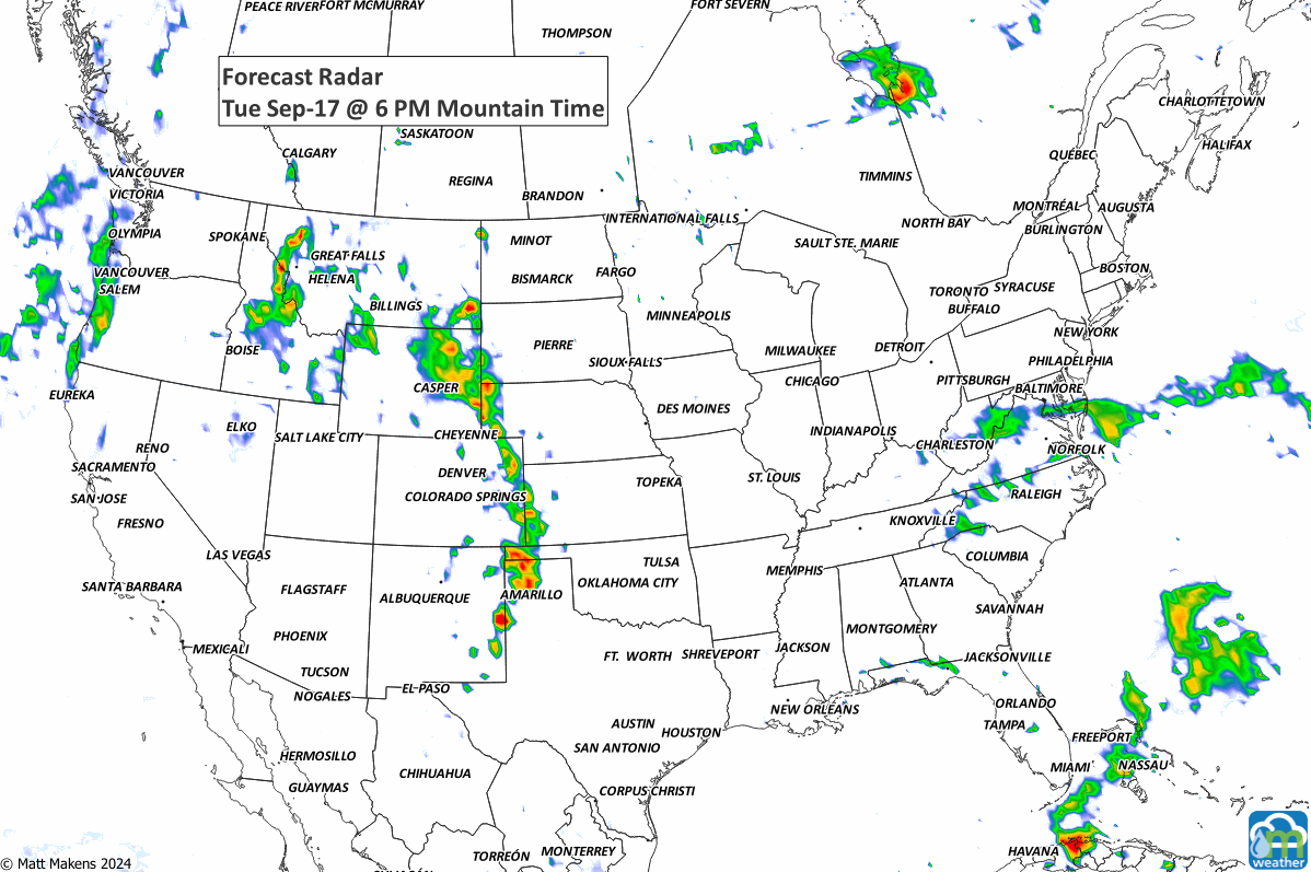
SEVERE WEATHER AREAS:

IN THE GAUGES:
Rainfall will favor the Northern Rockies and the Central to Northern Plains this week. Check out the 10-day totals!
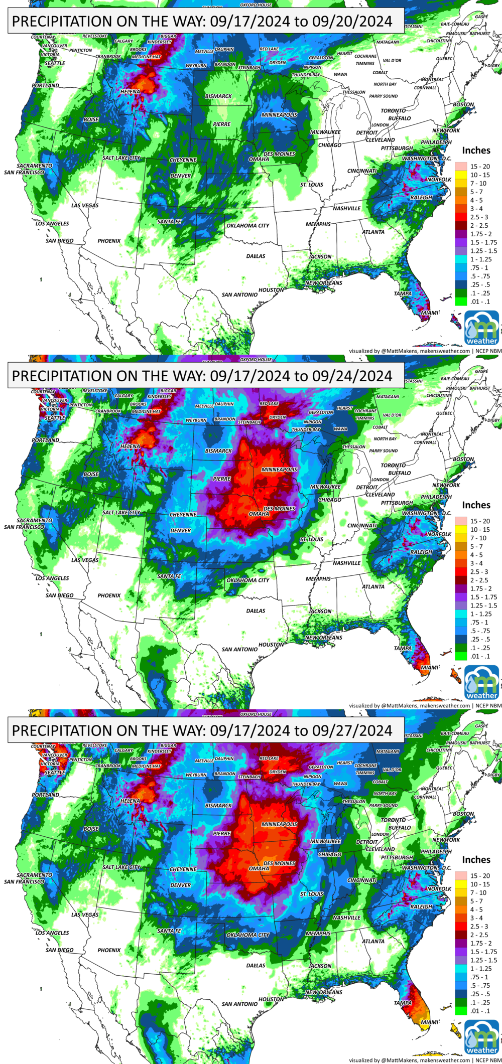
GRAB A RULER:

TROPICAL TIDINGS:
For the North Atlantic...Caribbean Sea and the Gulf of Mexico:
The National Hurricane Center has issued the final advisory on the remnants of Gordon, located over the central tropical Atlantic Ocean.1. Central Subtropical Atlantic (Remnants of Gordon) Disorganized showers and thunderstorms over the central tropical Atlantic are associated with the remnants of Gordon. This disturbance is forecast to interact with a non-tropical low to its north while moving north-northeastward at 5 to 10 mph during the next couple of days. Environmental conditions could become more conducive for redevelopment later this week, and a tropical depression or storm could form by this weekend while the system moves slowly northward over the central subtropical Atlantic. * Formation chance through 48 hours...low...20 percent. * Formation chance through 7 days...medium...40 percent. -NOAA’s NHC

RECORDS MADE TO BE BROKEN:
A handful of daily high temperature records are possible in the Upper Midwest through Ontario, as well as in Texas. A couple of daily record low temperatures are possible in the West.

ARE YOU CIRRUS?
On this day in weather history:
2004 Flooding and mudslides killed more than 3,000 people in Haiti in Hurricane Jeanne.
1932 A tropical storm struck Annapolis Valley in the Maritimes, destroying 300,000 barrels of apples in Nova Scotia.
A prolonged and dangerous heat wave will dominate the weather story this week as much of the central and eastern United States experiences some of the hottest weather of the year. Heat index values above 100 degrees will become widespread, with some communities seeing readings between 105 and 115 degrees and little relief at night. At the same time, several rounds of severe thunderstorms are expected from the High Plains through the Upper Midwest and Northeast, bringing the threat of damaging winds, large hail, and localized flash flooding. Out West, cooler-than-normal temperatures will continue while dry conditions keep wildfire concerns elevated across parts of the Four Corners and Great Basin. Air quality is an issue across Alberta to Quebec due to wildfire smoke. Heavy precipitation is possible from far eastern Saskatchewan to far western Manitoba.