


Weekly Weather Watch: Tuesday, September 24th, 2024
Watching a probable major hurricane approaching the Gulf Coast with most significant impact coming to Florida. The impact from heavy rainfall will continue through next week for the Southeast. Elsewhere, milder temperatures for the week.
HEADLINERS:
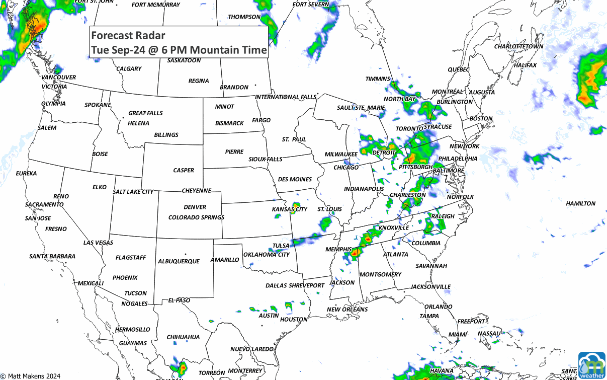
ON THE RADAR:
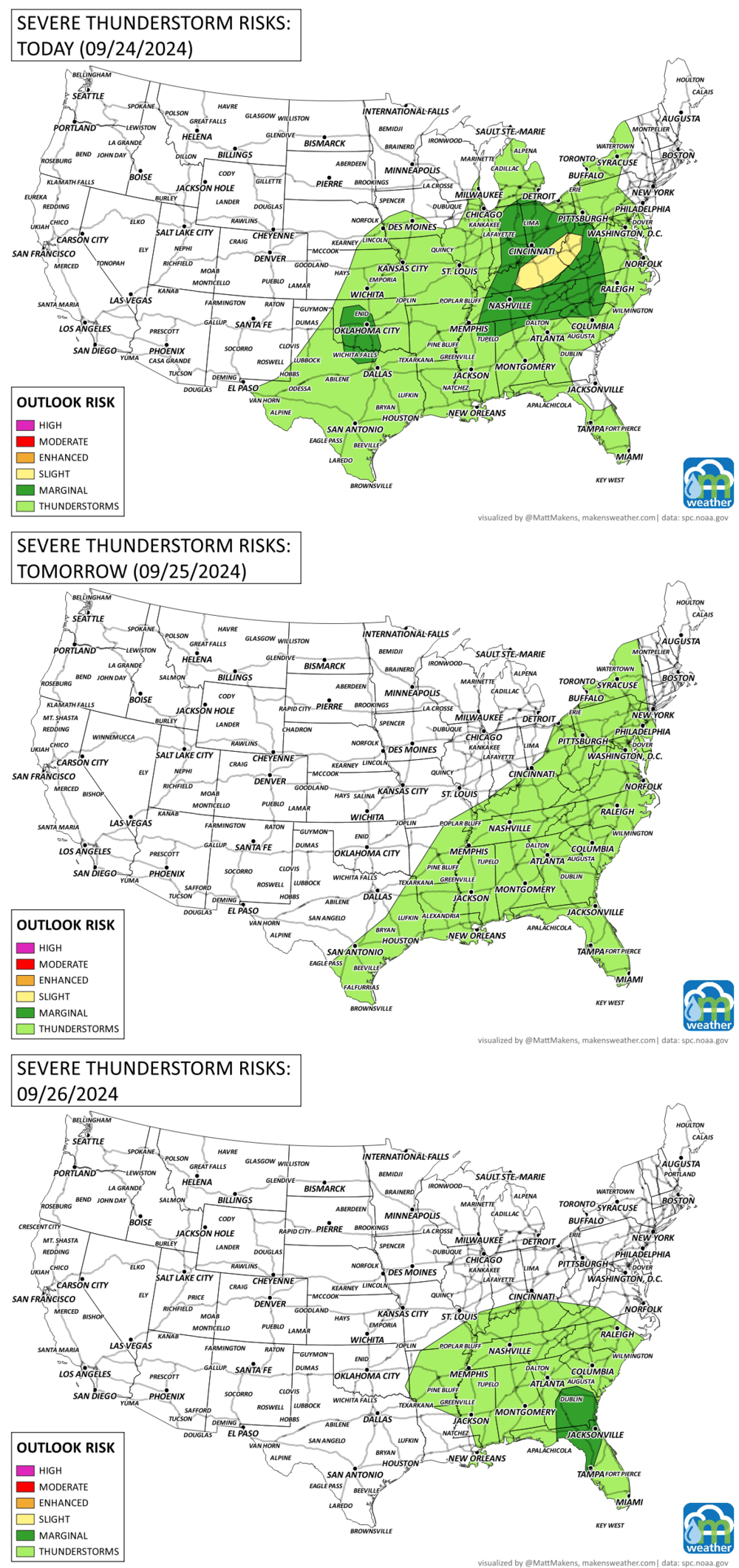
SEVERE WEATHER AREAS:
IN THE GAUGES:
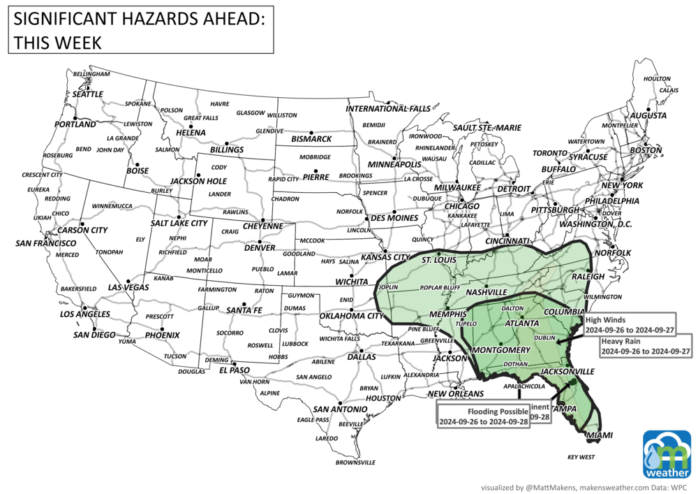
Significant risk of flooding for the Southeast, additional moisture for the Northwest, and very little moisture for the Southwest to the Northern Plains.

GRAB A RULER:
There is very little snowfall in the States, but Canada has some heavier snowfall ahead.

TROPICAL TIDINGS:

KEY MESSAGES:

1. Helene is forecast to intensify and be near hurricane strength
when it reaches the far northwestern Caribbean Sea early Wednesday.
Tropical storm conditions are expected over portions of western
Cuba and the northeastern coast of the Yucatan Peninsula with
hurricane conditions possible.

2. Helene is expected to rapidly intensify over the eastern
Gulf of Mexico and be a major hurricane when it approaches the
northeastern Gulf Coast on Thursday.  The risk of impacts from
life-threatening storm surge and damaging hurricane-force winds
continues to increase along the coast of the Florida Panhandle and
the Florida west coast.  Hurricane and Storm Surge Watches are in
effect for much of that area and residents in those areas should
follow advice given by local officials.

3. Helene will bring heavy rain to portions of the western
Caribbean, which will cause considerable flooding and mudslides
across western Cuba.  Heavy rainfall will likely result in locally
considerable flash and urban flooding across portions of Florida,
with isolated flash and urban flooding possible across the
Southeast, Southern Appalachians, and the Tennessee Valley
Wednesday through Friday. Minor to isolated moderate river flooding
will be possible.
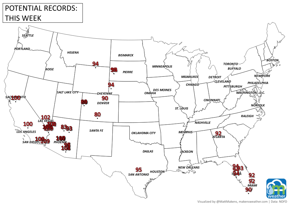
RECORDS MADE TO BE BROKEN:
ARE YOU CIRRUS?
On this day in weather history:
1926 At Riverside Ranger Station in Yellowstone National Park, the temperature dropped to -9 degrees F, making this the lowest recorded temperature in the United States in September.
1985 The national media dubbed Hurricane Gloria the "Killer Storm of the Century". This nickname turned the entire East Coast into panic.
1939 A tropical storm called "El Cordonazo" ("the lash" or "whip") made landfall between Los Angeles and San Diego. It was the only time in the 20th Century that the center of a tropical storm made landfall on the California coast (at Long Beach).
1988 The earliest frost of record hit the southern states of South Carolina, Georgia and northern Florida.
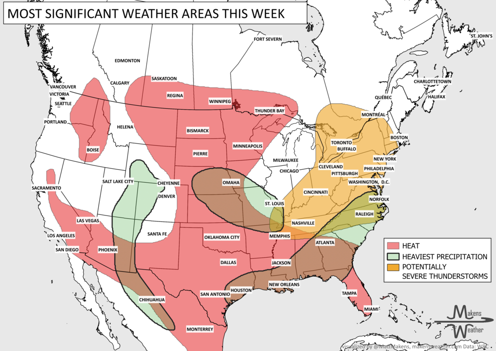
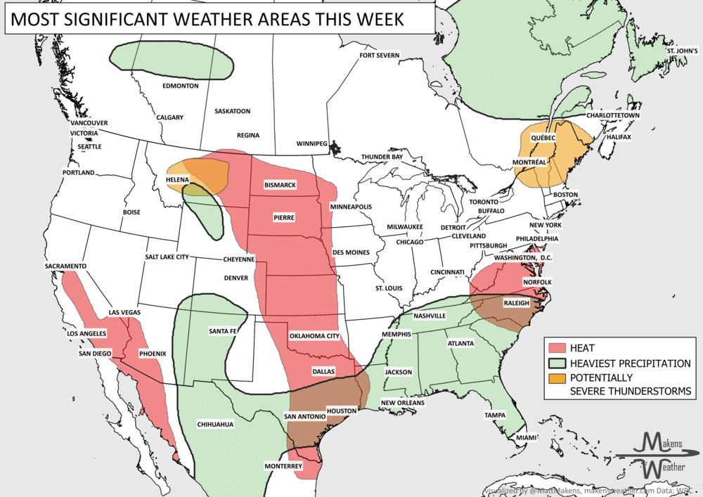
Tropical Storm Bertha is one of several weather systems requiring attention this week. Bertha could bring tropical-storm conditions, storm surge and periods of heavy rain to portions of the Florida Panhandle and Alabama coast through Wednesday before tracking westward along the central and western Gulf Coast. Elsewhere, severe thunderstorms and flash flooding may affect a broad area from the Mid-South and Ohio Valley into the Mid-Atlantic and Northeast. Monsoon thunderstorms will continue across the Southwest and Rockies, while dangerous heat gradually expands from the Southern Plains and Southeast into the central Plains and Interior West.