


Weekly Weather Watch: Tuesday, January 13th, 2026
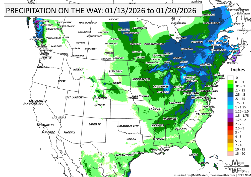
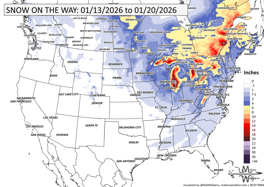
Much of the Lower 48 and Western Canada is kicking off the week with unseasonably warm weather, but a midweek storm system will flip the pattern, ushering in colder air and a round of wintry weather from Central to Eastern Canada, the Upper Midwest into the Great Lakes and Appalachians. While major snow looks limited, areas downwind of the Great Lakes could see more persistent lake-effect snow as the pattern turns colder.
Unlock the Makens Weather Advantage ☀️📊
Your membership includes:
✔️ Real-time dashboard with the latest weather observations and long-range projections
✔️ Monthly-lead forecasts to plan weeks ahead
✔️ Discounts on personalized consultations for ag, energy, or risk planning
All built for decision-makers who need weather insight, not just data.
🎯 Join now and put the forecast to work for you.
📈 The latest outlooks and conditions - track it 👉 Join Now to Access the Dashboard
HEADLINERS:
Weekly Timeline Snapshot
Tuesday (Jan 13): Unseasonably warm with highs 25–30°F above average across much of the Plains, Ohio Valley, and Mid-Atlantic.
Wednesday (Jan 14): A cold front drops south and east, bringing rain and a wintry mix to the Great Lakes and central Appalachians. Gusty winds on the leeside of the Rockies from Alberta and Saskatchewan to Colorado and Kansas
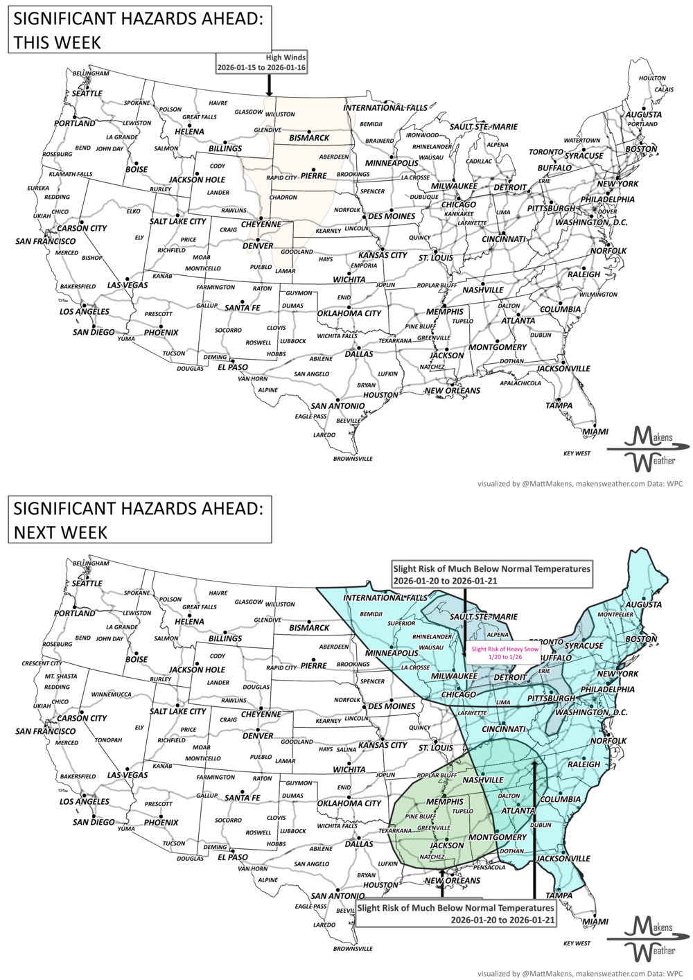
Thursday (Jan 15): Cooler air settles in; light snow likely across parts of the Northeast and Ohio Valley. Gusty wind continues on the leeside of the Rockies on the High Plains.
Friday (Jan 16): Very windy in the Canadian Prairies/Northern/Central Plains; gusts up to 70 mph possible.
Weekend (Jan 17–18): Lake-effect snow lingers near Lakes Michigan and Erie.
Early Next Week (Jan 19–20): Chilly for the eastern half of the continent, mild and dry for much of the West.
IN THE GAUGES:
GRAB A RULER:
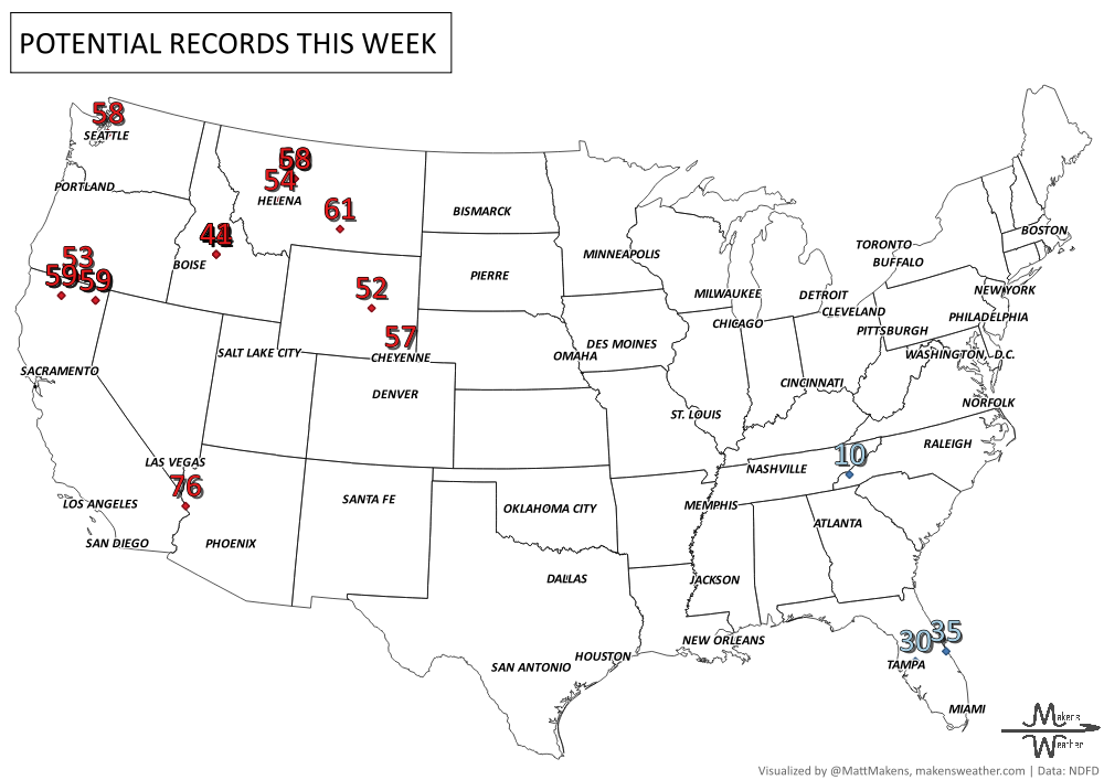
RECORDS MADE TO BE BROKEN:
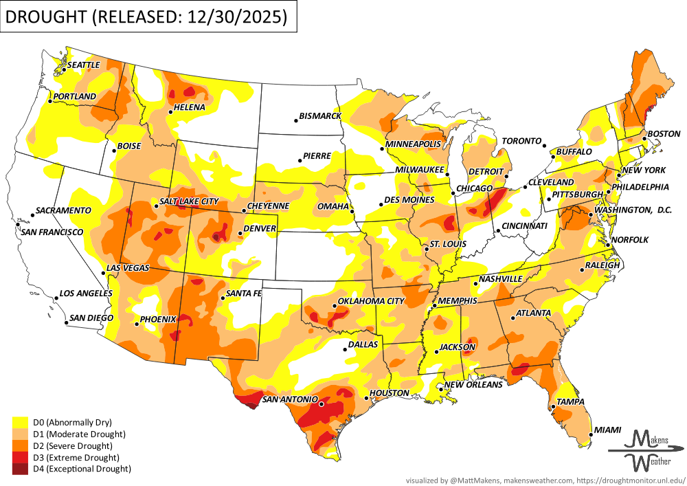
UN-DROUGHTABLY DRY:
The past week saw a sharp divide in U.S. weather patterns. Much of the West, especially the Northern Rockies, experienced unseasonably warm conditions, up to 20°F above normal, favoring rain over snow and continuing a slow start to the snow season. Meanwhile, the Florida Peninsula and parts of the Northeast and Upper Midwest saw colder-than-normal temperatures, with some areas running 10–15°F below average. Precipitation was heaviest in the West, particularly California, where some areas saw more than double their normal weekly totals. -U.S. Department of Agriculture
ARE YOU CIRRUS?!
Today in weather history:
1862: Known as the Great Flood of 1862, a series of storms from December 1861 to January 1862 produced the largest flood in the recorded history of Oregon, Nevada, and California. Estimated property damage in California alone was $10 million in 1862 dollars. More than 200,000 head of cattle lost their lives. The State of California went bankrupt, and the economy evolved from ranching to farm-based.
1950: One of the worst winter months on record for Seattle, Washington, and the surrounding areas. By the end of the month, Seattle measured 57.2 inches of snow, the most snowfall in any month since records began in 1894. The normal January snowfall is 1.4 inches. On this day, a crippling blizzard produced 40 to 50 mph winds and an astounding 20 inches.
A drawn-out storm pattern will keep much of the country active through the first week of April. A slow-moving front stretching from the Great Lakes into the Plains will separate late-season snow and ice to the north from heavy rain and severe thunderstorms to the south. The setup brings the greatest impacts to parts of the Midwest, Ohio Valley, Southern Plains, Mississippi Valley, and eventually the East Coast, while the West sees mountain snow and then a warming trend heading into the weekend.